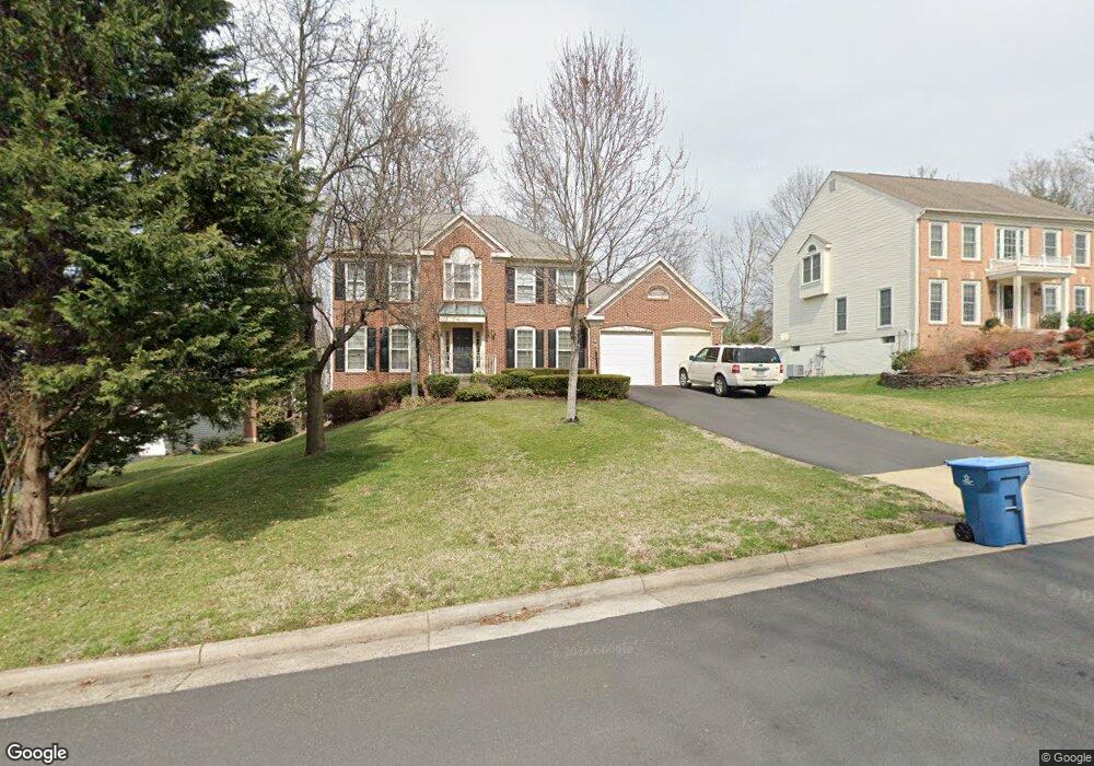
6644 Rockland Dr Clifton, VA 20124
Estimated Value: $894,000 - $968,000
4
Beds
4
Baths
2,484
Sq Ft
$374/Sq Ft
Est. Value
About This Home
This home is located at 6644 Rockland Dr, Clifton, VA 20124 and is currently estimated at $930,057, approximately $374 per square foot. 6644 Rockland Dr is a home located in Fairfax County with nearby schools including Union Mill Elementary School, Liberty Middle School, and Centreville High School.
Ownership History
Date
Name
Owned For
Owner Type
Purchase Details
Closed on
Aug 7, 2002
Sold by
Elliott Patrick
Bought by
Pietruszka Steven
Current Estimated Value
Home Financials for this Owner
Home Financials are based on the most recent Mortgage that was taken out on this home.
Original Mortgage
$359,900
Outstanding Balance
$152,618
Interest Rate
6.58%
Estimated Equity
$777,439
Purchase Details
Closed on
Jun 25, 1998
Bought by
Elliott Patrick
Home Financials for this Owner
Home Financials are based on the most recent Mortgage that was taken out on this home.
Original Mortgage
$282,000
Interest Rate
7.09%
Create a Home Valuation Report for This Property
The Home Valuation Report is an in-depth analysis detailing your home's value as well as a comparison with similar homes in the area
Home Values in the Area
Average Home Value in this Area
Purchase History
| Date | Buyer | Sale Price | Title Company |
|---|---|---|---|
| Pietruszka Steven | $449,900 | -- | |
| Elliott Patrick | $297,000 | -- |
Source: Public Records
Mortgage History
| Date | Status | Borrower | Loan Amount |
|---|---|---|---|
| Open | Pietruszka Steven | $359,900 | |
| Previous Owner | Elliott Patrick | $282,000 |
Source: Public Records
Tax History
| Year | Tax Paid | Tax Assessment Tax Assessment Total Assessment is a certain percentage of the fair market value that is determined by local assessors to be the total taxable value of land and additions on the property. | Land | Improvement |
|---|---|---|---|---|
| 2025 | $9,349 | $863,710 | $300,000 | $563,710 |
| 2024 | $9,349 | $806,960 | $280,000 | $526,960 |
| 2023 | $9,244 | $819,140 | $280,000 | $539,140 |
| 2022 | $8,392 | $733,880 | $250,000 | $483,880 |
| 2021 | $7,580 | $645,920 | $220,000 | $425,920 |
| 2020 | $7,399 | $625,150 | $210,000 | $415,150 |
| 2019 | $7,092 | $599,260 | $210,000 | $389,260 |
| 2018 | $6,857 | $596,260 | $207,000 | $389,260 |
| 2017 | $6,788 | $584,630 | $203,000 | $381,630 |
| 2016 | $6,640 | $573,150 | $199,000 | $374,150 |
Source: Public Records
Map
Nearby Homes
- 13949 Springstone Dr
- 14216 Hartwood Ct
- 14125 Honey Hill Ct
- 6713 Briarcroft St
- 6311 Betsy Ross Ct
- 13215 Twin Lakes Dr
- 14300 Montverd Ct
- 6789 Stone Maple Terrace
- 14024 Winding Ridge Ln
- 13803 Fount Beattie Ct
- 14317 Flomation Ct
- 14334 Stonewater Ct
- 13406 Compton Rd
- 6112B Hoskins Hollow Cir
- 7017 Union Mill Rd
- 6105A Hoskins Hollow Cir
- 5936 Spruce Run Ct
- 7003 Centreville Rd
- 14408 Tracy Schar Ln
- 13572 Jasper Ln
- 6646 Rockland Dr
- 6642 Rockland Dr
- 13855 Stonebrook Ct
- 6640 Rockland Dr
- 6648 Rockland Dr
- 13857 Stonebrook Ct
- 6643 Rockland Dr
- 13853 Stonebrook Ct
- 6645 Rockland Dr
- 6681 Stonebrook Dr
- 6641 Rockland Dr
- 6683 Stonebrook Dr
- 13859 Stonebrook Ct
- 6647 Rockland Dr
- 6638 Rockland Dr
- 6639 Rockland Dr
- 6650 Rockland Dr
- 13851 Stonebrook Ct
- 6685 Stonebrook Dr
- 6649 Rockland Dr
Your Personal Tour Guide
Ask me questions while you tour the home.