Estimated Value: $314,181 - $338,000
3
Beds
2
Baths
1,508
Sq Ft
$218/Sq Ft
Est. Value
About This Home
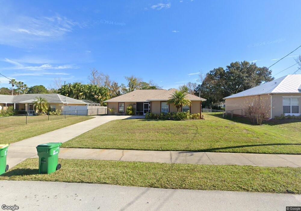
This home is located at 6645 Addie Ave, Cocoa, FL 32927 and is currently estimated at $328,545, approximately $217 per square foot. 6645 Addie Ave is a home located in Brevard County with nearby schools including Enterprise Elementary School, Space Coast Junior/Senior High School, and East Atlantic Prep of Brevard County.
Ownership History
Date
Name
Owned For
Owner Type
Purchase Details
Closed on
Jan 13, 2022
Sold by
Cooper George B and Cooper Christine M
Bought by
Cooper Family Trust
Current Estimated Value
Purchase Details
Closed on
Aug 9, 2012
Sold by
Cooper George Blair and Cooper Christine M
Bought by
Cooper George B and Cooper Christine M
Home Financials for this Owner
Home Financials are based on the most recent Mortgage that was taken out on this home.
Original Mortgage
$160,800
Interest Rate
3.65%
Purchase Details
Closed on
Mar 16, 2005
Sold by
Smith Staton Darla and Smith Staton Darla K
Bought by
Cooper George Blair
Home Financials for this Owner
Home Financials are based on the most recent Mortgage that was taken out on this home.
Original Mortgage
$47,200
Interest Rate
5.6%
Purchase Details
Closed on
Oct 25, 2002
Sold by
Foy Kenneth Hugh
Bought by
Smith Staton Darla
Create a Home Valuation Report for This Property
The Home Valuation Report is an in-depth analysis detailing your home's value as well as a comparison with similar homes in the area
Home Values in the Area
Average Home Value in this Area
Purchase History
| Date | Buyer | Sale Price | Title Company |
|---|---|---|---|
| Cooper Family Trust | -- | None Listed On Document | |
| Cooper George B | -- | Fidelity National Title Of F | |
| Cooper George Blair | $59,000 | Fidelity Natl Title Ins Co | |
| Smith Staton Darla | $6,500 | -- |
Source: Public Records
Mortgage History
| Date | Status | Borrower | Loan Amount |
|---|---|---|---|
| Previous Owner | Cooper George B | $160,800 | |
| Previous Owner | Cooper George Blair | $47,200 |
Source: Public Records
Tax History Compared to Growth
Tax History
| Year | Tax Paid | Tax Assessment Tax Assessment Total Assessment is a certain percentage of the fair market value that is determined by local assessors to be the total taxable value of land and additions on the property. | Land | Improvement |
|---|---|---|---|---|
| 2025 | $1,375 | $99,750 | -- | -- |
| 2024 | $1,338 | $96,940 | -- | -- |
| 2023 | $1,338 | $94,120 | $0 | $0 |
| 2022 | $1,246 | $91,380 | $0 | $0 |
| 2021 | $1,241 | $88,720 | $0 | $0 |
| 2020 | $1,177 | $87,500 | $0 | $0 |
| 2019 | $1,112 | $85,540 | $0 | $0 |
| 2018 | $1,103 | $83,950 | $0 | $0 |
| 2017 | $1,093 | $82,230 | $0 | $0 |
| 2016 | $1,091 | $80,540 | $18,000 | $62,540 |
| 2015 | $1,100 | $79,990 | $15,000 | $64,990 |
| 2014 | $1,100 | $79,360 | $11,000 | $68,360 |
Source: Public Records
Map
Nearby Homes
- 6665 Addie Ave
- 6105 Banyan St
- 6545 Addie Ave
- 6115 Allmont St
- 23-35-21-JX-B-2 Aruin St
- 6365 Homestead Ave
- 6295 Banyan St
- 5715 Fairbridge St
- 6643 Emil Ave
- 4650 N Highway 1 Hwy
- 5575 Curtis Blvd
- 6581 Bancroft Ave
- 5915 Akers St
- 6309 Alleghany Ave
- 6615 Dock Ave
- 6010 Fay Blvd
- 5720 Flint Rd
- 6530 Bethel St
- 6198 Dees Rd
- 6481 Muller Ave
- 6655 Addie Ave
- 6635 Addie Ave
- 6630 Homestead Ave
- 6625 Addie Ave
- 6640 Addie Ave
- 6630 Addie Ave
- 6650 Homestead Ave
- 6610 Homestead Ave
- 6620 Addie Ave
- 6615 Addie Ave
- 6650 Addie Ave
- 6600 Homestead Ave
- 6610 Addie Ave
- 6635 Homestead Ave
- 6625 Homestead Ave
- 6605 Addie Ave
- 6615 Homestead Ave
- 6590 Homestead Ave
- 6600 Addie Ave
- 6635 Duncan Ave