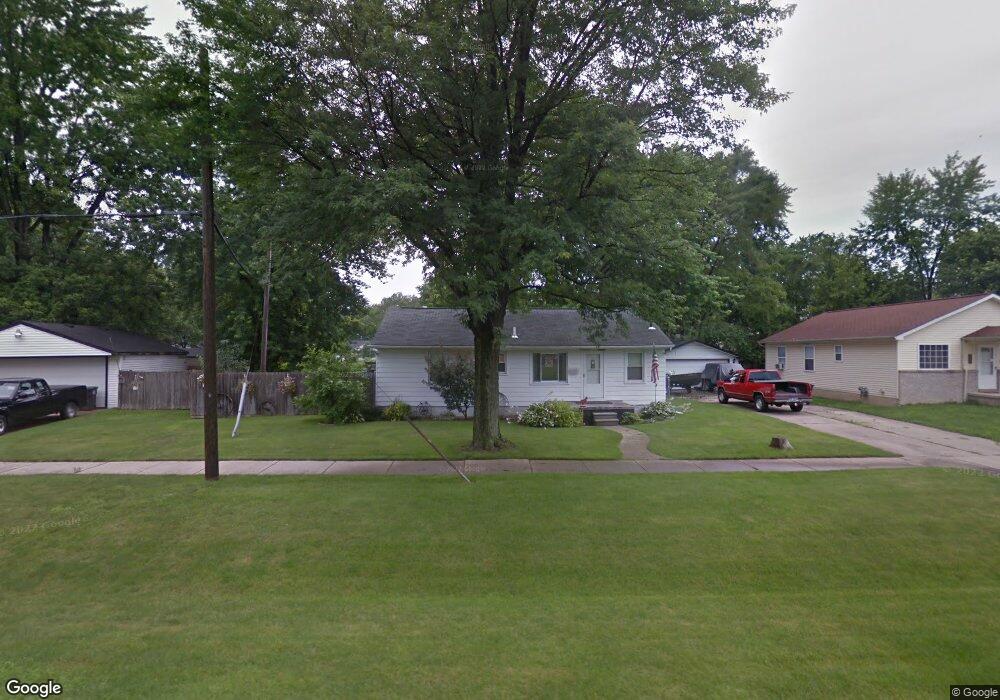
6648 Merrick St Taylor, MI 48180
Estimated Value: $156,000 - $197,031
Studio
--
Bath
1,092
Sq Ft
$162/Sq Ft
Est. Value
About This Home
This home is located at 6648 Merrick St, Taylor, MI 48180 and is currently estimated at $176,508, approximately $161 per square foot. 6648 Merrick St is a home located in Wayne County with nearby schools including Lemasters Elementary School, Taylor Parks Elementary School, and Robert J. West Middle School.
Ownership History
Date
Name
Owned For
Owner Type
Purchase Details
Closed on
Jul 30, 2007
Sold by
Jeffrey Gregory H
Bought by
Jeffrey Gregory H
Current Estimated Value
Home Financials for this Owner
Home Financials are based on the most recent Mortgage that was taken out on this home.
Original Mortgage
$116,000
Outstanding Balance
$73,857
Interest Rate
6.77%
Mortgage Type
New Conventional
Estimated Equity
$102,651
Purchase Details
Closed on
Dec 13, 2000
Sold by
Northam Bonnie L
Bought by
Jeffrey Gregory H
Create a Home Valuation Report for This Property
The Home Valuation Report is an in-depth analysis detailing your home's value as well as a comparison with similar homes in the area
Home Values in the Area
Average Home Value in this Area
Purchase History
| Date | Buyer | Sale Price | Title Company |
|---|---|---|---|
| Jeffrey Gregory H | -- | Title Source Inc | |
| Jeffrey Gregory H | $88,000 | -- |
Source: Public Records
Mortgage History
| Date | Status | Borrower | Loan Amount |
|---|---|---|---|
| Open | Jeffrey Gregory H | $116,000 |
Source: Public Records
Tax History Compared to Growth
Tax History
| Year | Tax Paid | Tax Assessment Tax Assessment Total Assessment is a certain percentage of the fair market value that is determined by local assessors to be the total taxable value of land and additions on the property. | Land | Improvement |
|---|---|---|---|---|
| 2025 | $2,102 | $101,500 | $0 | $0 |
| 2024 | $2,035 | $89,400 | $0 | $0 |
| 2023 | $2,405 | $75,700 | $0 | $0 |
| 2022 | $1,886 | $63,900 | $0 | $0 |
| 2021 | $2,056 | $60,200 | $0 | $0 |
| 2020 | $2,035 | $51,900 | $0 | $0 |
| 2019 | $203,717 | $44,300 | $0 | $0 |
| 2018 | $1,619 | $38,100 | $0 | $0 |
| 2017 | $833 | $37,600 | $0 | $0 |
| 2016 | $1,974 | $36,600 | $0 | $0 |
| 2015 | $3,860 | $38,600 | $0 | $0 |
| 2013 | $3,830 | $39,700 | $0 | $0 |
| 2012 | $1,649 | $39,000 | $13,900 | $25,100 |
Source: Public Records
Map
Nearby Homes
- 6731 Harding St
- 6485 Huron St
- 7235 Mortenview Dr
- 20233 Pinecrest St
- 6764 Jackson St
- 7254 Mayfair St
- 7267 William St
- 7120 Jackson St
- 7571 William St
- 7580 Mayfair St
- 6056 Clippert St
- 7882 Campbell St
- 6731 Robinson Ave
- 5873 Merrick St
- 7713 Jackson St
- 7866 Dudley St
- 7854 Jackson St
- 7866 Katherine St
- 7210 Buckingham Ave
- 5725 Polk St
- 6632 Merrick St
- 6624 Merrick St
- 6639 Harding St
- 6631 Harding St
- 20908 Pinecrest St
- 6623 Harding St
- 20916 Pinecrest St
- 6647 Harding St
- 20924 Pinecrest St
- 20948 Pinecrest St
- 6638 Harding St
- 6646 Harding St
- 6630 Harding St
- 6654 Harding St
- 6622 Harding St
- 6662 Harding St
- 21022 Pinecrest St
- 21030 Pinecrest St
- 20751 Pinecrest St
- 6720 Merrick St