Estimated Value: $222,000 - $314,000
--
Bed
--
Bath
--
Sq Ft
0.83
Acres
About This Home
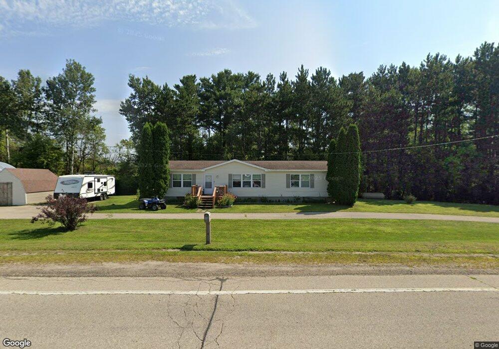
This home is located at 6648 Us Highway 12, Tomah, WI 54660 and is currently estimated at $273,700. 6648 Us Highway 12 is a home located in Monroe County with nearby schools including Tomah High School.
Ownership History
Date
Name
Owned For
Owner Type
Purchase Details
Closed on
May 1, 2013
Sold by
Fannie Mae
Bought by
Swanson Carl E and Swanson Elsie E
Current Estimated Value
Purchase Details
Closed on
Apr 30, 2013
Sold by
Jensen Nancy A
Bought by
Federal National Mortgage Association
Purchase Details
Closed on
Jan 10, 2013
Sold by
Jensen Nancy A
Bought by
Federal National Mortgage Association
Purchase Details
Closed on
May 6, 2011
Sold by
John D John D
Bought by
Jensen Nancy
Create a Home Valuation Report for This Property
The Home Valuation Report is an in-depth analysis detailing your home's value as well as a comparison with similar homes in the area
Home Values in the Area
Average Home Value in this Area
Purchase History
| Date | Buyer | Sale Price | Title Company |
|---|---|---|---|
| Swanson Carl E | -- | -- | |
| Federal National Mortgage Association | -- | Gray & Associates Llp | |
| Federal National Mortgage Association | -- | Commerce Title Company | |
| Jensen Nancy | -- | -- |
Source: Public Records
Tax History Compared to Growth
Tax History
| Year | Tax Paid | Tax Assessment Tax Assessment Total Assessment is a certain percentage of the fair market value that is determined by local assessors to be the total taxable value of land and additions on the property. | Land | Improvement |
|---|---|---|---|---|
| 2024 | $1,606 | $139,300 | $20,800 | $118,500 |
| 2023 | $1,540 | $139,300 | $20,800 | $118,500 |
| 2022 | $1,608 | $139,300 | $20,800 | $118,500 |
| 2021 | $1,278 | $90,400 | $13,700 | $76,700 |
| 2020 | $1,341 | $90,400 | $13,700 | $76,700 |
| 2019 | $1,313 | $90,400 | $13,700 | $76,700 |
| 2018 | $1,362 | $90,400 | $13,700 | $76,700 |
| 2017 | $1,510 | $90,400 | $13,700 | $76,700 |
| 2016 | $1,469 | $90,400 | $13,700 | $76,700 |
| 2015 | $1,711 | $90,400 | $13,700 | $76,700 |
| 2014 | $1,465 | $90,400 | $13,700 | $76,700 |
| 2011 | $1,987 | $106,200 | $15,300 | $90,900 |
Source: Public Records
Map
Nearby Homes
- 24486 Destiny Ave
- 7324 County Highway O
- Lot 8 Sunset Trace
- Lot 9 Sunset Trace
- Lot 2 Sunset Trace
- 7672 Division Rd
- Lot 7 Blackberry Ave
- 4130 US Highway 12
- 20397 Charcoal Ave
- Lt0 Interstate 94
- 23033 Elgin Ave
- 9481 Elkland Rd
- 24691 Embay Ave
- 26073 County Highway G
- 3861 County Highway O
- 135 Cindy Ln
- 20342 Blackhawk Ave
- 157 Yogi Bear Ln
- 600 Oakwood St
- 627 Sandy Beach Ct
- 6648 Hwy 12
- 6534 County Highway M
- 7139 Ellsworth Rd
- 6391 Us Highway 12
- 6391 Us Highway 12
- 6709 County Highway M
- 7133 Ellsworth Rd
- 7237 Ellsworth Rd
- 7237 Ellsworth Rd
- 23270 County Highway Oo
- 23350 County Highway Oo
- 7015 County Highway M
- 0 Clay & Hwy12 Unit 3891235
- 0 Clay Ave Unit 1528999
- 0 Clay Ave Unit 1599293
- 22989 Clovercrest Ave
- 22988 Clovercrest Ave
- 23675 Destiny Ave
- 23952 Destiny Ave
- 7405 Ellsworth Rd