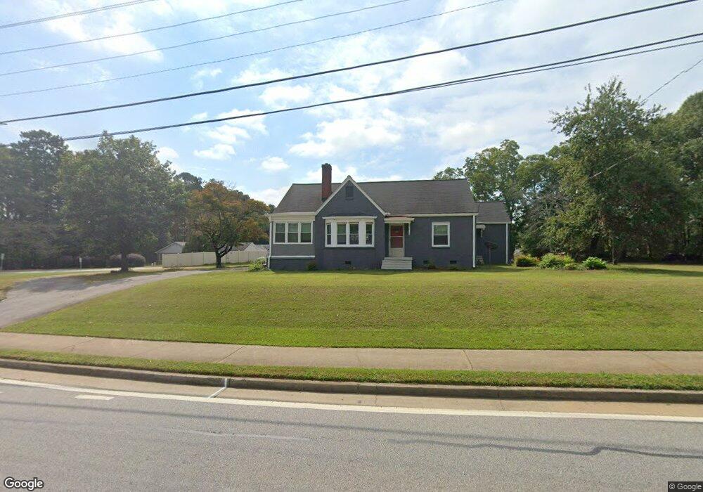
665 Lanier Ave E Fayetteville, GA 30214
Estimated Value: $294,000 - $431,000
4
Beds
2
Baths
2,058
Sq Ft
$168/Sq Ft
Est. Value
About This Home
This home is located at 665 Lanier Ave E, Fayetteville, GA 30214 and is currently estimated at $344,956, approximately $167 per square foot. 665 Lanier Ave E is a home located in Fayette County with nearby schools including Spring Hill Elementary School, Bennett's Mill Middle School, and Fayette County High School.
Ownership History
Date
Name
Owned For
Owner Type
Purchase Details
Closed on
Oct 7, 2016
Sold by
Mcelroy Clark H
Bought by
Montes Luis
Current Estimated Value
Home Financials for this Owner
Home Financials are based on the most recent Mortgage that was taken out on this home.
Original Mortgage
$133,950
Outstanding Balance
$107,318
Interest Rate
3.44%
Mortgage Type
New Conventional
Estimated Equity
$237,638
Purchase Details
Closed on
Dec 28, 2007
Sold by
Mcelroy Clark H
Bought by
Windham Janet M and Mcelroy Clark
Create a Home Valuation Report for This Property
The Home Valuation Report is an in-depth analysis detailing your home's value as well as a comparison with similar homes in the area
Home Values in the Area
Average Home Value in this Area
Purchase History
| Date | Buyer | Sale Price | Title Company |
|---|---|---|---|
| Montes Luis | $141,000 | -- | |
| Windham Janet M | -- | -- |
Source: Public Records
Mortgage History
| Date | Status | Borrower | Loan Amount |
|---|---|---|---|
| Open | Montes Luis | $133,950 |
Source: Public Records
Tax History Compared to Growth
Tax History
| Year | Tax Paid | Tax Assessment Tax Assessment Total Assessment is a certain percentage of the fair market value that is determined by local assessors to be the total taxable value of land and additions on the property. | Land | Improvement |
|---|---|---|---|---|
| 2024 | $3,390 | $114,056 | $27,360 | $86,696 |
| 2023 | $3,390 | $103,080 | $27,360 | $75,720 |
| 2022 | $3,013 | $99,160 | $27,360 | $71,800 |
| 2021 | $2,557 | $83,080 | $27,360 | $55,720 |
| 2020 | $2,357 | $76,240 | $27,360 | $48,880 |
| 2019 | $2,294 | $73,480 | $27,360 | $46,120 |
| 2018 | $2,167 | $68,672 | $25,992 | $42,680 |
| 2017 | $1,685 | $56,364 | $23,524 | $32,840 |
| 2016 | $1,918 | $62,752 | $25,992 | $36,760 |
| 2015 | $1,840 | $59,152 | $25,992 | $33,160 |
| 2014 | $1,757 | $55,432 | $25,992 | $29,440 |
| 2013 | -- | $54,872 | $0 | $0 |
Source: Public Records
Map
Nearby Homes
- 310 Autumn Glen Cir
- 210 Rosewood Dr
- 115 Cloverwood Dr
- 210 Pecan Ridge Dr Unit 2
- 500 Circle Dr
- 225 Buckeye Ln Unit 2
- 150 Reese St
- 140 Reese St
- 130 Reese St
- 250 Mimosa Dr
- 865 Virginia Highlands
- The Mildred Plan at Mitchell Estates
- The Bradford Plan at Mitchell Estates
- 115 Linda Way
- 482 N Jeff Davis Dr Unit 5
- 12 Intown Place
- 498 N Jeff Davis Dr
- 42 Intown Place
- 37 Intown Place
- 135 Rabbits Run
- 645 E Lanier Ave
- 645 Lanier Ave E
- 125 Garden Ct
- 100 Wilbanks Dr
- 650 Lanier Ave E
- 110 Wilbanks Dr
- 135 Garden Ct
- 120 Wilbanks Dr
- 145 Garden Ct
- 130 Wilbanks Dr Unit 4
- 130 Wilbanks Dr
- 155 Garden Ct
- 140 Wilbanks Dr
- 100 Garden Ct
- 110 Garden Ct
- 165 Garden Ct
- 120 Garden Ct
- 130 Garden Ct
- 140 Garden Ct
- 175 Garden Ct