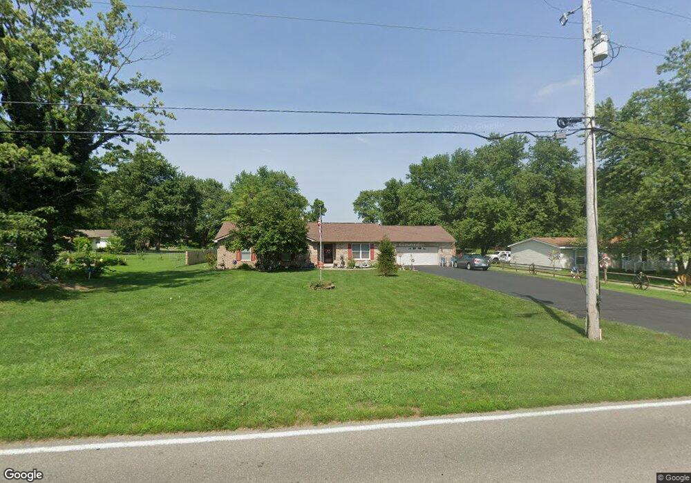
665 S Old Us Highway 31 Franklin, IN 46131
Estimated Value: $335,000 - $405,000
2
Beds
2
Baths
1,945
Sq Ft
$191/Sq Ft
Est. Value
About This Home
This home is located at 665 S Old Us Highway 31, Franklin, IN 46131 and is currently estimated at $370,823, approximately $190 per square foot. 665 S Old Us Highway 31 is a home located in Johnson County with nearby schools including Needham Elementary School, Franklin Community Middle School, and Custer Baker Intermediate School.
Ownership History
Date
Name
Owned For
Owner Type
Purchase Details
Closed on
May 4, 2015
Sold by
Miller Jodi F
Bought by
Rutherford Alfred D and Rutherford Melody K
Current Estimated Value
Home Financials for this Owner
Home Financials are based on the most recent Mortgage that was taken out on this home.
Original Mortgage
$133,089
Interest Rate
3.62%
Mortgage Type
FHA
Purchase Details
Closed on
Oct 28, 2009
Sold by
Miller Jodi
Bought by
Rutherford Alfred D and Rutherford Melody K
Create a Home Valuation Report for This Property
The Home Valuation Report is an in-depth analysis detailing your home's value as well as a comparison with similar homes in the area
Home Values in the Area
Average Home Value in this Area
Purchase History
| Date | Buyer | Sale Price | Title Company |
|---|---|---|---|
| Rutherford Alfred D | -- | None Available | |
| Rutherford Alfred D | $124,000 | None Available |
Source: Public Records
Mortgage History
| Date | Status | Borrower | Loan Amount |
|---|---|---|---|
| Previous Owner | Rutherford Alfred D | $133,089 |
Source: Public Records
Tax History Compared to Growth
Tax History
| Year | Tax Paid | Tax Assessment Tax Assessment Total Assessment is a certain percentage of the fair market value that is determined by local assessors to be the total taxable value of land and additions on the property. | Land | Improvement |
|---|---|---|---|---|
| 2025 | $2,740 | $354,800 | $37,600 | $317,200 |
| 2024 | $2,740 | $302,100 | $37,600 | $264,500 |
| 2023 | $2,724 | $302,100 | $37,600 | $264,500 |
| 2022 | $3,167 | $302,100 | $37,600 | $264,500 |
| 2021 | $2,410 | $235,000 | $32,700 | $202,300 |
| 2020 | $1,923 | $198,500 | $28,700 | $169,800 |
| 2019 | $1,801 | $196,500 | $28,700 | $167,800 |
| 2018 | $1,525 | $185,200 | $28,700 | $156,500 |
| 2017 | $1,488 | $182,800 | $28,700 | $154,100 |
| 2016 | $1,828 | $177,300 | $28,700 | $148,600 |
| 2014 | -- | $176,200 | $28,700 | $147,500 |
| 2013 | -- | $177,600 | $28,700 | $148,900 |
Source: Public Records
Map
Nearby Homes
- 1532 Williamsburg Ln
- 1175 S Old Us Highway 31
- 3151 E 150 S
- 6516 N U S Highway 31
- 1121 E Adams Dr
- 1130 E Adams Dr
- 1110 Hillview Dr
- 178 S Water St Unit F
- 76 E Wayne St Unit B
- 863 S 450 E
- 252 S Main St
- 150 E Madison St
- 147 E King St
- 1850 Longest Dr
- 0 W 900 Hwy Unit 202537998
- 298 N Water St
- 348 Ohio St
- 698 Yandes St
- 750 Hurricane St
- 351 Cincinnati St
- 677 S Old Us Highway 31
- 649 S Old Us Highway 31
- 645 S Old Us Highway 31
- 1095 Wilson Way
- 691 S Old Us Highway 31
- 643 S Old Us Highway 31
- 790 S Old Us Highway 31
- 1087 Wilson Way
- 1098 Wilson Way
- 694 S Old Us Highway 31
- 1094 Wilson Way
- 707 S Old Us Highway 31
- 639 S Old Us Highway 31
- 1059 Overlook Cir
- 1090 Wilson Way
- 1073 Overlook Cir
- 635 S Old Us Highway 31
- 1080 Wilson Way
- 1035 Overlook Cir
- 1050 Wilson Way