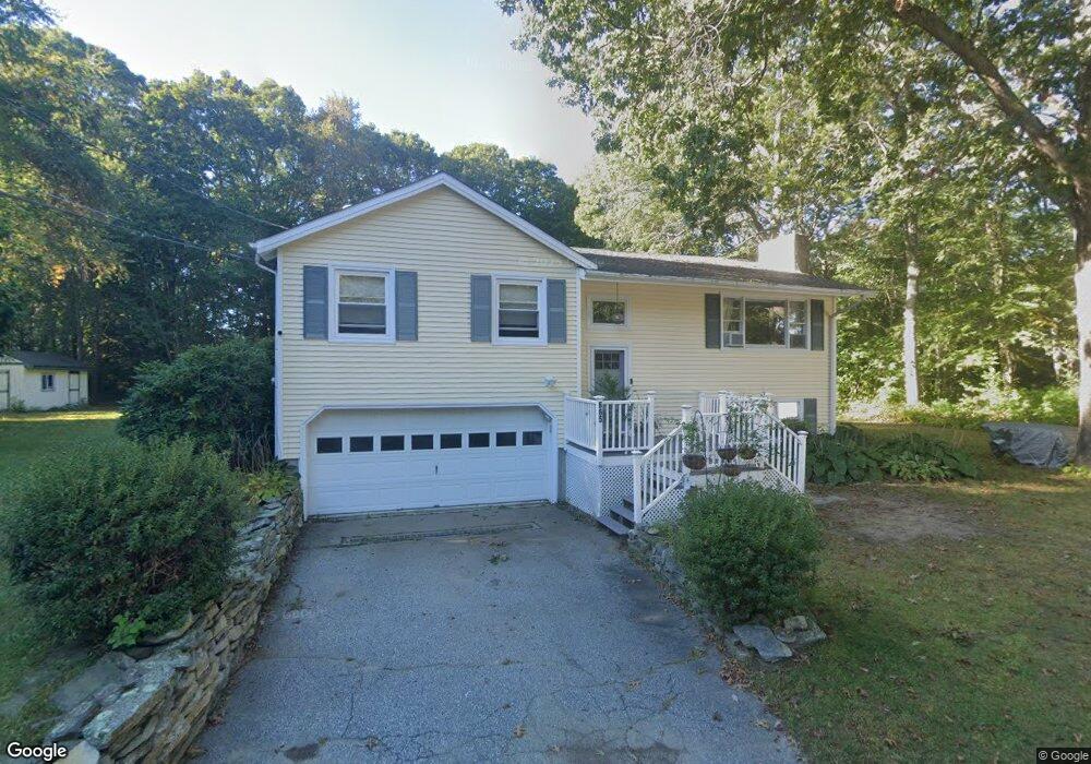
665 Shennecossett Rd Groton, CT 06340
Estimated Value: $401,000 - $464,000
2
Beds
2
Baths
1,787
Sq Ft
$244/Sq Ft
Est. Value
About This Home
This home is located at 665 Shennecossett Rd, Groton, CT 06340 and is currently estimated at $436,878, approximately $244 per square foot. 665 Shennecossett Rd is a home located in New London County with nearby schools including Catherine Kolnaski STEAM Magnet School, Groton Middle School, and Robert E. Fitch High School.
Ownership History
Date
Name
Owned For
Owner Type
Purchase Details
Closed on
Aug 31, 2000
Sold by
Sawyer Bonnie M
Bought by
Martin Kelly A
Current Estimated Value
Create a Home Valuation Report for This Property
The Home Valuation Report is an in-depth analysis detailing your home's value as well as a comparison with similar homes in the area
Home Values in the Area
Average Home Value in this Area
Purchase History
| Date | Buyer | Sale Price | Title Company |
|---|---|---|---|
| Martin Kelly A | $129,900 | -- |
Source: Public Records
Mortgage History
| Date | Status | Borrower | Loan Amount |
|---|---|---|---|
| Closed | Martin Kelly A | $2,000 | |
| Closed | Martin Kelly A | $35,000 | |
| Closed | Martin Kelly A | $116,000 |
Source: Public Records
Tax History Compared to Growth
Tax History
| Year | Tax Paid | Tax Assessment Tax Assessment Total Assessment is a certain percentage of the fair market value that is determined by local assessors to be the total taxable value of land and additions on the property. | Land | Improvement |
|---|---|---|---|---|
| 2025 | $5,517 | $190,820 | $90,419 | $100,401 |
| 2024 | $5,131 | $190,820 | $90,419 | $100,401 |
| 2023 | $4,923 | $190,820 | $47,390 | $143,430 |
| 2022 | $4,761 | $190,820 | $47,390 | $143,430 |
| 2021 | $4,759 | $157,150 | $58,520 | $98,630 |
| 2020 | $4,622 | $157,150 | $58,520 | $98,630 |
| 2019 | $4,474 | $157,150 | $58,520 | $98,630 |
| 2018 | $4,518 | $157,150 | $58,520 | $98,630 |
| 2017 | $4,534 | $157,150 | $58,520 | $98,630 |
| 2016 | $4,267 | $157,080 | $61,600 | $95,480 |
| 2015 | $4,213 | $157,080 | $61,600 | $95,480 |
| 2014 | $3,919 | $157,080 | $61,600 | $95,480 |
Source: Public Records
Map
Nearby Homes
- 760 Shennecossett Rd
- 520 Shennecossett Rd Unit J
- 88 Eastwood Rd
- 26 Bakers Cove Ln
- 53 Westwood Dr
- 895 Shennecossett Rd
- 222 Tyler Ave
- 49 Bayberry Ln
- 90 Jupiter Point Rd
- 119 High Rock Rd
- 42 A St
- 63 Johl Dr
- 42 Godfrey St
- 51 Warner St
- 172 D St
- 174 D St
- 55 Virginia Ave Unit C
- 41 Joe Ave
- 74 Twin Hills Dr
- 43 George Ave Unit B
- 663 Shennecossett Rd
- 683 Shennecossett Rd
- 661 Shennecossett Rd
- 673 Shennecossett Rd
- 340 Plant St
- 342 Plant St
- 358 Plant St
- 372 Plant St
- 551 Shennecossett Rd
- 6 Eastwood Rd
- 5 Eastwood Rd
- 634 Shennecossett Rd
- 16 Eastwood Rd
- 597 Shennecossett Rd
- 624 Shennecossett Rd
- 17 Eastwood Rd
- 303 Plant St
- 577 Shennecossett Rd
- 14 Birch Ln
- 295 Plant St