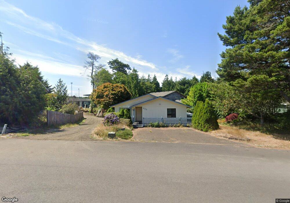
665 SW Green Dr Waldport, OR 97394
Estimated Value: $418,000 - $470,000
3
Beds
2
Baths
2,000
Sq Ft
$220/Sq Ft
Est. Value
About This Home
This home is located at 665 SW Green Dr, Waldport, OR 97394 and is currently estimated at $439,786, approximately $219 per square foot. 665 SW Green Dr is a home located in Lincoln County with nearby schools including Crestview Heights School, Waldport High and Middle School, and Angell JCC.
Ownership History
Date
Name
Owned For
Owner Type
Purchase Details
Closed on
Mar 16, 2023
Sold by
Jam Lady Trust
Bought by
Grech Larry
Current Estimated Value
Home Financials for this Owner
Home Financials are based on the most recent Mortgage that was taken out on this home.
Original Mortgage
$75,000
Interest Rate
6.32%
Mortgage Type
New Conventional
Purchase Details
Closed on
Jul 31, 2019
Sold by
Phillips Sherry P
Bought by
Phillips Sherry and Jam Lady Trust
Create a Home Valuation Report for This Property
The Home Valuation Report is an in-depth analysis detailing your home's value as well as a comparison with similar homes in the area
Home Values in the Area
Average Home Value in this Area
Purchase History
| Date | Buyer | Sale Price | Title Company |
|---|---|---|---|
| Grech Larry | $85,000 | Western Title | |
| Phillips Sherry | -- | None Available |
Source: Public Records
Mortgage History
| Date | Status | Borrower | Loan Amount |
|---|---|---|---|
| Closed | Grech Larry | $75,000 |
Source: Public Records
Tax History Compared to Growth
Tax History
| Year | Tax Paid | Tax Assessment Tax Assessment Total Assessment is a certain percentage of the fair market value that is determined by local assessors to be the total taxable value of land and additions on the property. | Land | Improvement |
|---|---|---|---|---|
| 2024 | $3,380 | $202,870 | -- | -- |
| 2023 | $3,281 | $196,970 | $0 | $0 |
| 2022 | $3,169 | $191,240 | $0 | $0 |
| 2021 | $3,089 | $185,670 | $0 | $0 |
| 2020 | $3,028 | $180,270 | $0 | $0 |
| 2019 | $2,914 | $175,020 | $0 | $0 |
| 2018 | $2,860 | $169,930 | $0 | $0 |
| 2017 | $2,768 | $164,990 | $0 | $0 |
| 2016 | $2,700 | $160,190 | $0 | $0 |
| 2015 | $2,287 | $155,530 | $0 | $0 |
| 2014 | $2,224 | $151,000 | $0 | $0 |
| 2013 | -- | $141,710 | $0 | $0 |
Source: Public Records
Map
Nearby Homes
- 2220 SW Green Ln
- 415 SW Range Dr
- 125 SW Range Dr Unit 2
- 1590 SW Fairway Dr
- 1155 SW Sailfish Loop
- 1345 SW Fairway Dr
- 1445 S Crestline Dr
- 165 SE Rose St
- 700 Blk SW Kelsie Ln
- 125 SE Salmon St
- 960 SW Dolores Dr
- 1200 Blk Sw Norwood Drive Tl0120
- 1200 Blk Norwood Dr Tl012
- 1115 SW Whitecap Dr
- 925 SW Dolores Dr
- 600 SW Pacific Coast Hwy
- TL 300 SW Dolores Dr
- 3531 SW Fernwood Ln
- 0 SW Seawoods Terrace Unit TL 601 187755044
- TL 601 SW Seawoods Terrace
- 725 SW Green Dr
- 645 SW Green Dr
- 600 SW Green Dr
- 745 SW Green Dr
- 655 SW Green Dr
- 2525 SW Fairway Cir
- 2540 SW Fairway Cir
- 785 SW Green Dr
- 1436 SW Green Dr
- 2495 SW Fairway Cir
- Lot 6 SW Green Dr
- Lot 1 SW Green Dr
- Lot 4 SW Green Dr
- Lot 2 SW Green Dr
- Lot 3 SW Green Dr
- Lot 5 SW Green Dr
- 740 SW Green Dr
- 625 SW Green Dr
- 0 SW Green Dr
- Lot 28 SW Green Dr