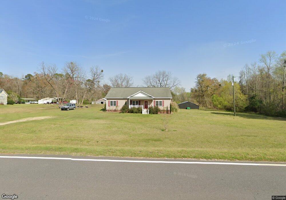
665 Us Highway 221 S Adrian, GA 31002
Estimated Value: $246,000 - $285,000
3
Beds
3
Baths
2,479
Sq Ft
$107/Sq Ft
Est. Value
About This Home
This home is located at 665 Us Highway 221 S, Adrian, GA 31002 and is currently estimated at $264,153, approximately $106 per square foot. 665 Us Highway 221 S is a home located in Emanuel County with nearby schools including Swainsboro High School.
Ownership History
Date
Name
Owned For
Owner Type
Purchase Details
Closed on
Aug 12, 2016
Sold by
Spivey St Bk
Bought by
Fleming Larry P
Current Estimated Value
Home Financials for this Owner
Home Financials are based on the most recent Mortgage that was taken out on this home.
Original Mortgage
$124,699
Outstanding Balance
$99,140
Interest Rate
3.37%
Mortgage Type
FHA
Estimated Equity
$165,013
Purchase Details
Closed on
Mar 18, 2011
Sold by
Ggmls Llc
Bought by
Denison Vincent
Create a Home Valuation Report for This Property
The Home Valuation Report is an in-depth analysis detailing your home's value as well as a comparison with similar homes in the area
Home Values in the Area
Average Home Value in this Area
Purchase History
| Date | Buyer | Sale Price | Title Company |
|---|---|---|---|
| Fleming Larry P | $127,000 | -- | |
| Denison Vincent | $155,000 | -- |
Source: Public Records
Mortgage History
| Date | Status | Borrower | Loan Amount |
|---|---|---|---|
| Open | Fleming Larry P | $124,699 |
Source: Public Records
Tax History Compared to Growth
Tax History
| Year | Tax Paid | Tax Assessment Tax Assessment Total Assessment is a certain percentage of the fair market value that is determined by local assessors to be the total taxable value of land and additions on the property. | Land | Improvement |
|---|---|---|---|---|
| 2024 | $2,250 | $80,821 | $1,510 | $79,311 |
| 2023 | $1,391 | $67,706 | $1,187 | $66,519 |
| 2022 | $1,631 | $61,060 | $1,187 | $59,873 |
| 2021 | $1,473 | $54,229 | $1,079 | $53,150 |
| 2020 | $1,643 | $57,265 | $2,417 | $54,848 |
| 2019 | $1,627 | $57,037 | $2,417 | $54,620 |
| 2018 | $1,641 | $57,037 | $2,417 | $54,620 |
| 2017 | $1,648 | $57,157 | $2,417 | $54,740 |
| 2016 | $1,660 | $57,583 | $2,417 | $55,166 |
| 2015 | -- | $57,583 | $2,417 | $55,166 |
| 2014 | -- | $56,648 | $2,417 | $54,230 |
| 2013 | -- | $55,320 | $2,414 | $52,906 |
Source: Public Records
Map
Nearby Homes
- 0 Old Wilson Rd
- Old Wilson Rd
- 0000 Hwy 171
- 0 Highway 56 S Unit 10646183
- S Highway 56
- 223 Kersey Rd
- 374 Union Chapel Rd
- 87 Georgia Ave
- 150 Kemp Rd
- 444 Halls Bridge Rd
- 0 Walden Way Unit 10601502
- 2618 Georgia 86
- 600 Alton Lawson Rd
- 400 Alton Lawson Rd
- 503 Alton Lawson Rd
- 0 Alton Lawson Rd
- 546 Alton Lawson Rd
- 0 Trinity Church Rd
- 14936 Ga Highway 86
- 26 Ben Blvd
- 665 Us Highway 221 S
- 665 U S 221
- 203 Keas Old Mill Pond Rd
- 207 Keas Old Mill Pond Rd
- 106 Horton St
- 112 Horton St
- 307 Norristown Main St
- 117 Horton St
- 116 Horton St
- 502 Johnson St
- RT 1 Route 1
- U S Highway 221 S
- 311 Johnson St
- 509 Norristown Main St
- 503 Norristown Main St
- 211 Horton St
- 208 Horton St
- 726 Us Highway 221 S
- 744 Us Highway 221 S
- 748 Us Highway 221 S