Estimated Value: $248,000 - $288,000
3
Beds
2
Baths
1,208
Sq Ft
$224/Sq Ft
Est. Value
About This Home
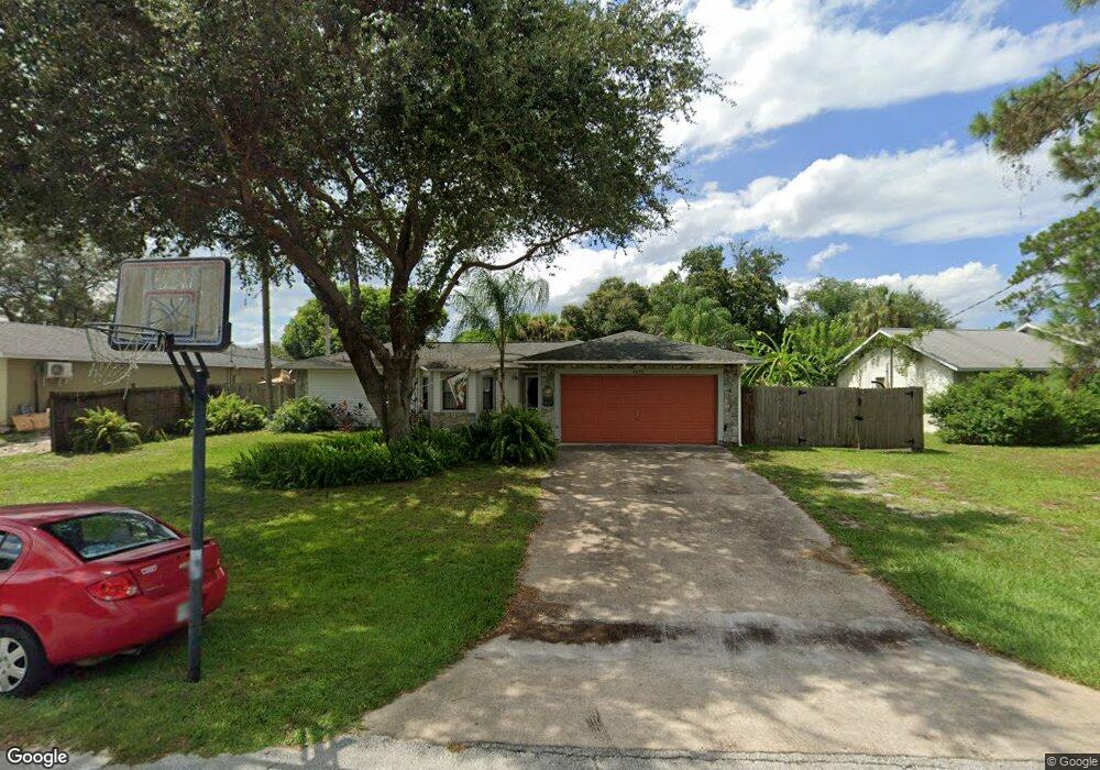
This home is located at 6650 Cecil Rd, Cocoa, FL 32927 and is currently estimated at $270,887, approximately $224 per square foot. 6650 Cecil Rd is a home located in Brevard County with nearby schools including Enterprise Elementary School, Space Coast Junior/Senior High School, and Sculptor Charter School.
Ownership History
Date
Name
Owned For
Owner Type
Purchase Details
Closed on
Sep 11, 2009
Sold by
Wachovia Bank National Association
Bought by
Houten Brent A and Houten Beth A
Current Estimated Value
Home Financials for this Owner
Home Financials are based on the most recent Mortgage that was taken out on this home.
Original Mortgage
$87,068
Outstanding Balance
$56,710
Interest Rate
5.11%
Estimated Equity
$214,177
Purchase Details
Closed on
Oct 28, 2008
Sold by
Senko Alan M and Case #05 2007 Ca 029905 Xxxx X
Bought by
Wachovia Bank National Association
Purchase Details
Closed on
Jul 8, 1994
Sold by
Wray Jay David and Wray Jean
Bought by
Moore Nancy E
Home Financials for this Owner
Home Financials are based on the most recent Mortgage that was taken out on this home.
Original Mortgage
$84,956
Interest Rate
8.52%
Create a Home Valuation Report for This Property
The Home Valuation Report is an in-depth analysis detailing your home's value as well as a comparison with similar homes in the area
Home Values in the Area
Average Home Value in this Area
Purchase History
| Date | Buyer | Sale Price | Title Company |
|---|---|---|---|
| Houten Brent A | $88,675 | Attorney | |
| Wachovia Bank National Association | -- | None Available | |
| Moore Nancy E | $85,000 | -- |
Source: Public Records
Mortgage History
| Date | Status | Borrower | Loan Amount |
|---|---|---|---|
| Open | Houten Brent A | $87,068 | |
| Previous Owner | Moore Nancy E | $84,956 |
Source: Public Records
Tax History
| Year | Tax Paid | Tax Assessment Tax Assessment Total Assessment is a certain percentage of the fair market value that is determined by local assessors to be the total taxable value of land and additions on the property. | Land | Improvement |
|---|---|---|---|---|
| 2025 | $1,246 | $94,120 | -- | -- |
| 2024 | $1,211 | $91,470 | -- | -- |
| 2023 | $1,211 | $88,810 | $0 | $0 |
| 2022 | $1,125 | $86,230 | $0 | $0 |
| 2021 | $1,118 | $83,720 | $0 | $0 |
| 2020 | $1,066 | $82,570 | $0 | $0 |
| 2019 | $1,000 | $80,720 | $0 | $0 |
| 2018 | $992 | $79,220 | $0 | $0 |
| 2017 | $982 | $77,600 | $0 | $0 |
| 2016 | $979 | $76,010 | $18,000 | $58,010 |
| 2015 | $986 | $75,490 | $15,000 | $60,490 |
| 2014 | $986 | $74,900 | $11,000 | $63,900 |
Source: Public Records
Map
Nearby Homes
- 6760 Cairo Rd
- 6815 Bryant Rd
- 00 Unknown
- 6615 Dock Ave
- 6450 Ember Ave
- 5095 Hogan Place
- 6620 Grissom Pkwy
- 6581 Bancroft Ave
- 0000 Grissom Pkwy
- 7065 Hundred Acre Dr
- 5555 Brandon St
- 6481 La Brea Ave
- 5155 Mayflower St
- 6438 Hudson Rd
- 6375 Cable Ave
- 6990 Bryant Rd
- 5165 Patricia St
- 5220 Holden Rd
- 5080 Mayflower St
- 4852 Alfred St
Your Personal Tour Guide
Ask me questions while you tour the home.