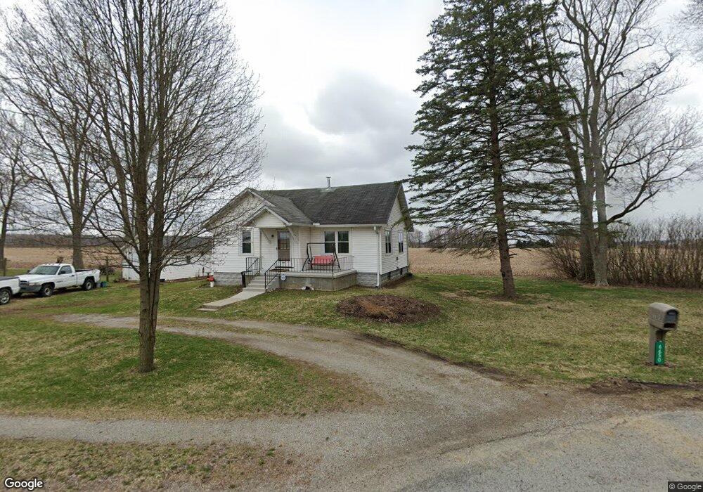
6650 River Rd Springfield, OH 45502
Estimated Value: $160,531 - $294,000
2
Beds
1
Bath
904
Sq Ft
$228/Sq Ft
Est. Value
About This Home
This home is located at 6650 River Rd, Springfield, OH 45502 and is currently estimated at $205,883, approximately $227 per square foot. 6650 River Rd is a home located in Clark County with nearby schools including Northwestern Elementary School and Northwestern Junior/Senior High School.
Ownership History
Date
Name
Owned For
Owner Type
Purchase Details
Closed on
Apr 18, 1990
Sold by
Neher Robert Lee
Bought by
Neher Margaret L
Current Estimated Value
Purchase Details
Closed on
Jan 1, 1980
Create a Home Valuation Report for This Property
The Home Valuation Report is an in-depth analysis detailing your home's value as well as a comparison with similar homes in the area
Home Values in the Area
Average Home Value in this Area
Purchase History
| Date | Buyer | Sale Price | Title Company |
|---|---|---|---|
| Neher Margaret L | $35,000 | -- | |
| -- | $20,000 | -- |
Source: Public Records
Tax History Compared to Growth
Tax History
| Year | Tax Paid | Tax Assessment Tax Assessment Total Assessment is a certain percentage of the fair market value that is determined by local assessors to be the total taxable value of land and additions on the property. | Land | Improvement |
|---|---|---|---|---|
| 2024 | $1,278 | $37,160 | $12,600 | $24,560 |
| 2023 | $1,278 | $37,160 | $12,600 | $24,560 |
| 2022 | $1,333 | $37,160 | $12,600 | $24,560 |
| 2021 | $1,043 | $28,500 | $9,620 | $18,880 |
| 2020 | $1,053 | $28,500 | $9,620 | $18,880 |
| 2019 | $1,043 | $28,500 | $9,620 | $18,880 |
| 2018 | $818 | $23,970 | $8,750 | $15,220 |
| 2017 | $818 | $23,969 | $8,747 | $15,222 |
| 2016 | $802 | $23,969 | $8,747 | $15,222 |
| 2015 | $786 | $23,678 | $8,747 | $14,931 |
| 2014 | $786 | $23,678 | $8,747 | $14,931 |
| 2013 | $780 | $23,678 | $8,747 | $14,931 |
Source: Public Records
Map
Nearby Homes
- 30 Center St
- 5646 Springfield-Urbana Pike Unit Lot 88
- 5646 Springfield-Urbana Pike Unit Lot 122
- 5646 Springfield-Urbana Pike Unit Lot 61
- 5646 Springfield-Urbana Pike Unit Lot 127
- 5646 Springfield-Urbana Pike Unit Lot 72
- 1470 Oldham Dr Unit 12
- Pendleton Plan at Liberty Place
- Holcombe Plan at Liberty Place
- Newcastle Plan at Liberty Place
- Chatham Plan at Liberty Place
- 593 Hiser Ave
- 0 W Dallas Rd
- 30 E Dallas Rd
- 5249 Taywell Dr
- 4514 Dowden St
- 794 Donnelly Ave
- 880 Brendle Trace Unit 28
- 916 Sawmill Ct
- 5127 Stoneridge Dr
- 6647 River Rd
- 6623 River Rd
- 6693 River Rd
- 6791 River Rd
- 6976 River Rd
- 1076 W County Line Rd
- 1098 W County Line Rd
- 910 W County Line Rd
- 1138 W County Line Rd
- 5841 Cedar Creek Rd
- 5791 Cedar Creek Rd
- 654 W County Line Rd
- 624 W County Line Rd
- 1218 W County Line Rd
- 604 W County Line Rd
- 1461 W County Line Rd
- 559 W County Line Rd
- 580 W County Line Rd
- 5628 Cedar Creek Rd
- 547 W County Line Rd