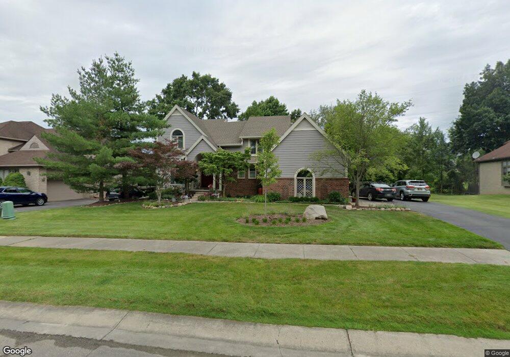
6650 Torybrooke Cir West Bloomfield, MI 48323
Estimated Value: $501,879 - $693,000
--
Bed
4
Baths
2,884
Sq Ft
$207/Sq Ft
Est. Value
About This Home
This home is located at 6650 Torybrooke Cir, West Bloomfield, MI 48323 and is currently estimated at $596,220, approximately $206 per square foot. 6650 Torybrooke Cir is a home located in Oakland County with nearby schools including Walled Lake Central High School, Brookfield Academy - West Bloomfield, and The Susan And Rabbi Harold Loss Ecc.
Ownership History
Date
Name
Owned For
Owner Type
Purchase Details
Closed on
Aug 23, 2021
Sold by
Rothman Andrew R and Rivard Rothman Diane
Bought by
Rothman Andrew R and Rivard Rothman Diane
Current Estimated Value
Home Financials for this Owner
Home Financials are based on the most recent Mortgage that was taken out on this home.
Original Mortgage
$225,000
Interest Rate
2.16%
Create a Home Valuation Report for This Property
The Home Valuation Report is an in-depth analysis detailing your home's value as well as a comparison with similar homes in the area
Home Values in the Area
Average Home Value in this Area
Purchase History
| Date | Buyer | Sale Price | Title Company |
|---|---|---|---|
| Rothman Andrew R | -- | None Available |
Source: Public Records
Mortgage History
| Date | Status | Borrower | Loan Amount |
|---|---|---|---|
| Closed | Rothman Andrew R | $225,000 |
Source: Public Records
Tax History Compared to Growth
Tax History
| Year | Tax Paid | Tax Assessment Tax Assessment Total Assessment is a certain percentage of the fair market value that is determined by local assessors to be the total taxable value of land and additions on the property. | Land | Improvement |
|---|---|---|---|---|
| 2024 | $3,888 | $239,210 | $0 | $0 |
| 2022 | $3,666 | $207,080 | $16,830 | $190,250 |
| 2021 | $5,901 | $200,310 | $0 | $0 |
| 2020 | $3,542 | $199,660 | $16,830 | $182,830 |
| 2018 | $5,922 | $182,290 | $16,580 | $165,710 |
| 2015 | -- | $181,670 | $0 | $0 |
| 2014 | -- | $164,650 | $0 | $0 |
| 2011 | -- | $154,010 | $0 | $0 |
Source: Public Records
Map
Nearby Homes
- 7065 Deerwood Trail Unit 27
- 5570 Wildrose Ave
- 0000 Blue Jay Way
- VL Leytonstone Blvd
- 6606 Leytonstone Blvd
- 6433 Walnut Lake Rd
- 7230 Walnut Lake Rd
- 6980 Hambro St
- 7220 Essex Dr
- 5512 Essex Ct
- 5994 Glen Eagles Dr
- 4540 Rolling Pine Ct
- 4442 Borland St
- 7400 Tall Timbers
- 5375 Trail Vista Dr Unit 1
- 5679 Branford Dr
- 5367 Trail Vista Dr Unit 3
- 5357 Trail Vista Dr Unit 6
- 7555 Windgate Cir
- 7359 Woodlore Dr
- 6658 Torybrooke Cir
- 6642 Torybrooke Cir
- 6666 Torybrooke Cir Unit Bldg-Unit
- 6666 Torybrooke Cir
- 6625 Torybrooke Cir
- 6681 Torybrooke Cir
- 6634 Torybrooke Cir
- 5071 Pheasant Cove
- 6674 Torybrooke Cir
- 6617 Torybrooke Cir
- 6689 Torybrooke Cir
- 5077 Pheasant Cove Unit 13
- 5077 Pheasant Cove
- 6626 Torybrooke Cir
- 5065 Pheasant Cove
- 5065 Pheasant Cove Unit 11
- 6618 Torybrooke Cir
- 6682 Torybrooke Cir Unit Bldg-Unit
- 6682 Torybrooke Cir
- 5083 Pheasant Cove