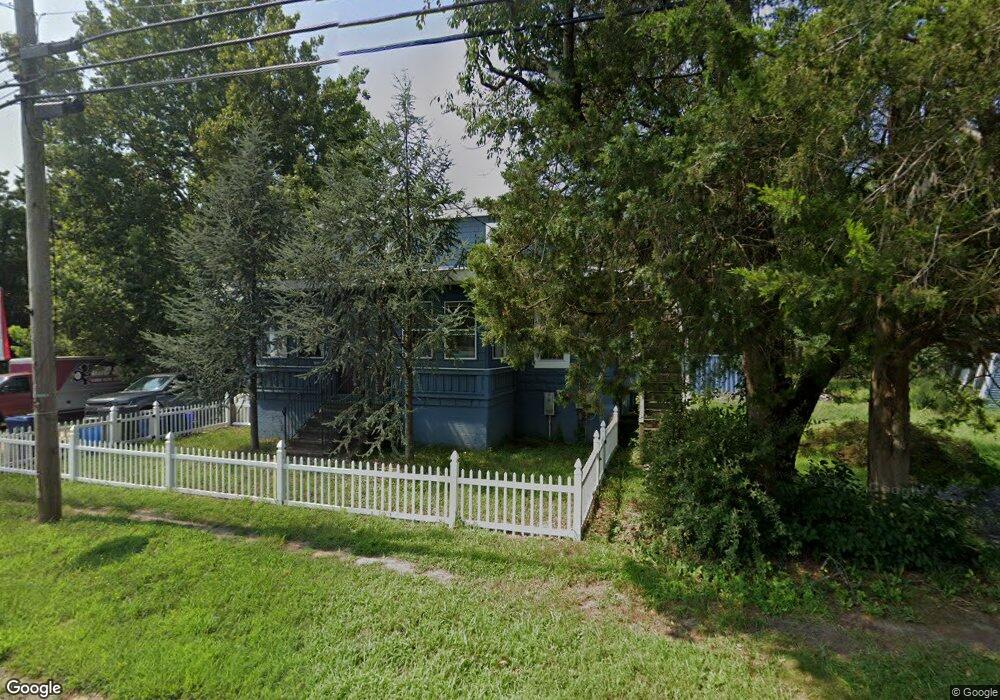
6650 Weymouth Rd Mays Landing, NJ 08330
Estimated Value: $179,000 - $550,000
--
Bed
--
Bath
2,304
Sq Ft
$162/Sq Ft
Est. Value
About This Home
This home is located at 6650 Weymouth Rd, Mays Landing, NJ 08330 and is currently estimated at $374,177, approximately $162 per square foot. 6650 Weymouth Rd is a home located in Atlantic County with nearby schools including Joseph Shaner School, George L. Hess Educational Complex, and William Davies Middle School.
Ownership History
Date
Name
Owned For
Owner Type
Purchase Details
Closed on
Aug 11, 2022
Sold by
Hermann Ann M and Connor Linda
Bought by
Grant Ronald
Current Estimated Value
Home Financials for this Owner
Home Financials are based on the most recent Mortgage that was taken out on this home.
Original Mortgage
$170,000
Interest Rate
6.29%
Mortgage Type
New Conventional
Purchase Details
Closed on
May 22, 2006
Sold by
Kasson Reo Llc
Bought by
Michael Kelly
Create a Home Valuation Report for This Property
The Home Valuation Report is an in-depth analysis detailing your home's value as well as a comparison with similar homes in the area
Home Values in the Area
Average Home Value in this Area
Purchase History
| Date | Buyer | Sale Price | Title Company |
|---|---|---|---|
| Grant Ronald | $103,972 | None Listed On Document | |
| Michael Kelly | $100,000 | -- |
Source: Public Records
Mortgage History
| Date | Status | Borrower | Loan Amount |
|---|---|---|---|
| Previous Owner | Grant Ronald | $170,000 |
Source: Public Records
Tax History Compared to Growth
Tax History
| Year | Tax Paid | Tax Assessment Tax Assessment Total Assessment is a certain percentage of the fair market value that is determined by local assessors to be the total taxable value of land and additions on the property. | Land | Improvement |
|---|---|---|---|---|
| 2025 | $5,960 | $173,700 | $60,000 | $113,700 |
| 2024 | $5,960 | $173,700 | $60,000 | $113,700 |
| 2023 | $5,604 | $173,700 | $60,000 | $113,700 |
| 2022 | $5,307 | $164,500 | $60,000 | $104,500 |
| 2021 | $5,295 | $164,500 | $60,000 | $104,500 |
| 2020 | $5,295 | $164,500 | $60,000 | $104,500 |
| 2019 | $5,308 | $164,500 | $60,000 | $104,500 |
| 2018 | $5,123 | $164,500 | $60,000 | $104,500 |
| 2017 | $5,042 | $164,500 | $60,000 | $104,500 |
| 2016 | $4,900 | $164,500 | $60,000 | $104,500 |
| 2015 | $4,734 | $164,500 | $60,000 | $104,500 |
| 2014 | $4,847 | $184,500 | $70,500 | $114,000 |
Source: Public Records
Map
Nearby Homes
- 850 Morningside Dr
- Rt 50 and Old Mays Landing Rd
- 6301 Knight Ave
- 6310 Phillips Ave
- 0 Railroad Blvd
- 6314 Lance Ave
- 6302 Palmer Ave
- 0 South Ave
- 6206 Roberts Ave
- 6251 Old Harding Hwy
- 6752 Harding Hwy
- 1st First Ave
- Lot:11.02-12.02 Estelle Ave
- B:534 L:11.01 Estelle Ave
- B:534 L:12.02 Estelle Ave
- B:534 L:11.02 Estelle Ave
- 0 Harding Hwy Unit 597638
- 0 Harding Hwy Unit NJAC2019438
- 565 Park Rd
- Bl 531 Lot 8&9 Adams Ave
- 6705 Weymouth Rd
- 6644 Weymouth Rd
- 6711 Weymouth Rd
- 6703 Weymouth Rd
- 6656 Weymouth Rd
- 6700 Weymouth Rd
- 6693 Weymouth Rd
- 6723 Weymouth Rd
- 6702 Weymouth Rd
- 6704 Weymouth Rd
- 6706 Weymouth Rd
- 6645 Weymouth Rd
- 6716 Weymouth Rd
- 6629 Weymouth Rd
- 6728 Weymouth Rd
- 6615 Weymouth Rd
- 6734 Weymouth Rd
- 6701 Weymouth Rd
- 6611 Weymouth Rd
- 6675 Weymouth Rd