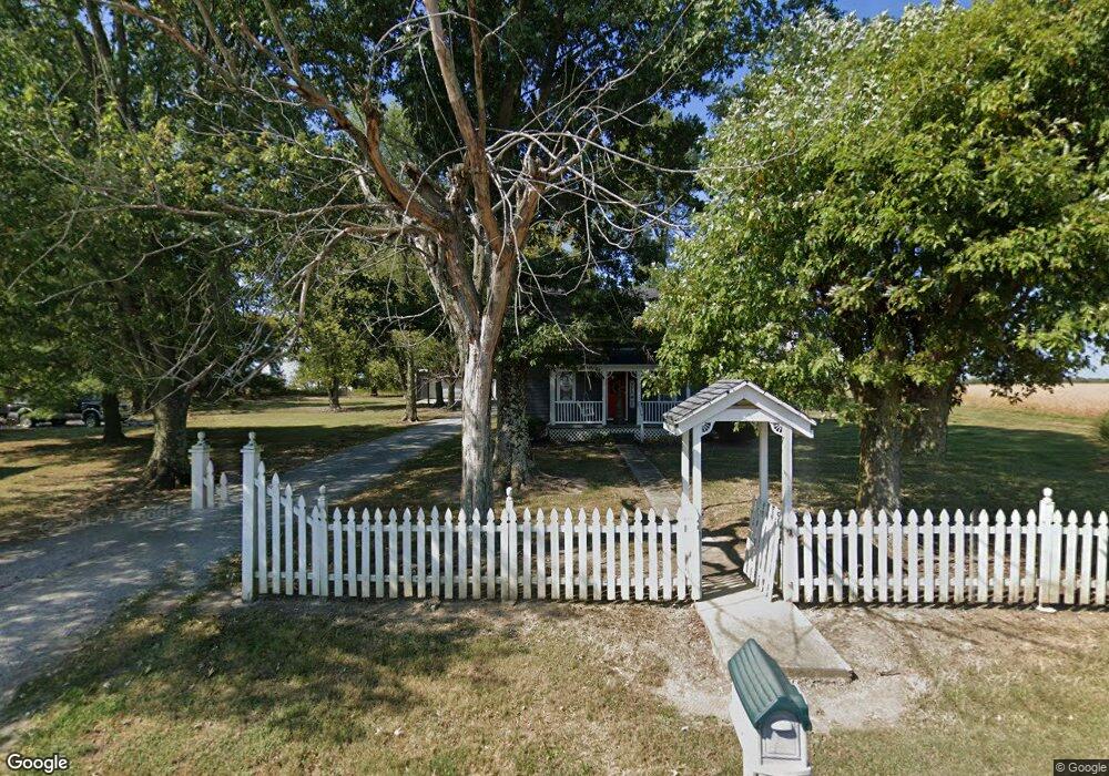
6651 Free Soil Rd Georgetown, OH 45121
Estimated Value: $208,000 - $332,000
2
Beds
1
Bath
1,472
Sq Ft
$177/Sq Ft
Est. Value
About This Home
This home is located at 6651 Free Soil Rd, Georgetown, OH 45121 and is currently estimated at $260,898, approximately $177 per square foot. 6651 Free Soil Rd is a home located in Brown County with nearby schools including Georgetown Elementary School and Georgetown Jr/Sr High School.
Ownership History
Date
Name
Owned For
Owner Type
Purchase Details
Closed on
Sep 11, 2012
Sold by
Carrington Christopher T
Bought by
Montgomery Kelly J
Current Estimated Value
Purchase Details
Closed on
Oct 23, 2000
Sold by
Watson David
Bought by
Carrington Christopher T and Carrington Kelly J
Home Financials for this Owner
Home Financials are based on the most recent Mortgage that was taken out on this home.
Original Mortgage
$91,453
Interest Rate
7.96%
Mortgage Type
FHA
Create a Home Valuation Report for This Property
The Home Valuation Report is an in-depth analysis detailing your home's value as well as a comparison with similar homes in the area
Purchase History
| Date | Buyer | Sale Price | Title Company |
|---|---|---|---|
| Montgomery Kelly J | -- | Attorney | |
| Carrington Christopher T | $91,500 | -- |
Source: Public Records
Mortgage History
| Date | Status | Borrower | Loan Amount |
|---|---|---|---|
| Previous Owner | Carrington Christopher T | $91,453 |
Source: Public Records
Tax History
| Year | Tax Paid | Tax Assessment Tax Assessment Total Assessment is a certain percentage of the fair market value that is determined by local assessors to be the total taxable value of land and additions on the property. | Land | Improvement |
|---|---|---|---|---|
| 2024 | $1,381 | $45,090 | $10,300 | $34,790 |
| 2023 | $1,381 | $34,480 | $7,860 | $26,620 |
| 2022 | $1,118 | $34,480 | $7,860 | $26,620 |
| 2021 | $1,105 | $34,480 | $7,860 | $26,620 |
| 2020 | $993 | $29,980 | $6,830 | $23,150 |
| 2019 | $984 | $29,980 | $6,830 | $23,150 |
| 2018 | $976 | $29,980 | $6,830 | $23,150 |
| 2017 | $964 | $29,380 | $7,510 | $21,870 |
| 2016 | $964 | $29,380 | $7,510 | $21,870 |
| 2015 | $978 | $29,380 | $7,510 | $21,870 |
| 2014 | $978 | $28,700 | $6,830 | $21,870 |
| 2013 | $975 | $28,700 | $6,830 | $21,870 |
Source: Public Records
Map
Nearby Homes
- 7029 Free Soil Rd
- 3571 Shaw Rd
- 470 Free Soil Rd
- 7480 Old Us Highway 68
- 20 Heritage Hill Dr
- 38 Dell Acres Dr
- 155 Free Soil Rd
- 0 St Rt 221 & Footbridge Unit 1826509
- 3755 Old A & P Hwy
- 175 Douglas Cir
- 5173 Old A & P
- 25 Douglas Ln
- 505 S Water St
- 510 W State St
- 312 White Oak St
- 666 E State St
- 708 E State St
- 405 N Main St
- 406 E North St
- 2845 Mary Ingles Hwy E
- 6639 Free Soil Rd
- 6598 Free Soil Rd
- 3931 Loudon Rd
- 0 Loudon Rd Unit 1251141
- 0 Loudon Rd Unit 1287366
- 4000 Drake Marshall Rd
- 3878 Shaw Rd
- 3789 Loudon Rd
- 4088 Drake Marshall Rd
- 3743 Loudon Rd
- 4090 Drake Marshall Rd
- 3834 Shaw Rd
- 3794 Shaw Rd
- 6921 Free Soil Rd
- 6327 Free Soil Rd
- 6327 Free Soil Rd
- 4124 Graybill Rd
- 3731 Loudon Rd
- 12.230ac Shaw Rd
- 3699 Loudon Rd
Your Personal Tour Guide
Ask me questions while you tour the home.