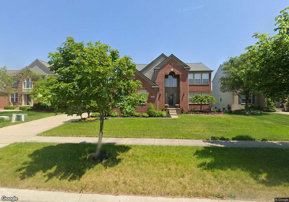
6651 Wing St Ypsilanti, MI 48197
Estimated Value: $422,000 - $497,000
4
Beds
3
Baths
2,454
Sq Ft
$189/Sq Ft
Est. Value
About This Home
This home is located at 6651 Wing St, Ypsilanti, MI 48197 and is currently estimated at $464,722, approximately $189 per square foot. 6651 Wing St is a home located in Washtenaw County with nearby schools including Lincoln Senior High School, East Arbor Charter Academy, and Arbor Preparatory High School.
Ownership History
Date
Name
Owned For
Owner Type
Purchase Details
Closed on
Nov 17, 2010
Sold by
Wright Karl and Wright Felicia
Bought by
Clayton Cassandra
Current Estimated Value
Purchase Details
Closed on
Nov 12, 2004
Sold by
Pulte Land Co Llc
Bought by
Wright Karl and Wright Felicia
Home Financials for this Owner
Home Financials are based on the most recent Mortgage that was taken out on this home.
Original Mortgage
$240,400
Interest Rate
6.75%
Mortgage Type
Unknown
Create a Home Valuation Report for This Property
The Home Valuation Report is an in-depth analysis detailing your home's value as well as a comparison with similar homes in the area
Home Values in the Area
Average Home Value in this Area
Purchase History
| Date | Buyer | Sale Price | Title Company |
|---|---|---|---|
| Clayton Cassandra | $180,000 | Liberty Title | |
| Wright Karl | $110,000 | Metropolitan Title Company |
Source: Public Records
Mortgage History
| Date | Status | Borrower | Loan Amount |
|---|---|---|---|
| Previous Owner | Wright Karl | $240,400 | |
| Closed | Wright Karl | $60,100 |
Source: Public Records
Tax History Compared to Growth
Tax History
| Year | Tax Paid | Tax Assessment Tax Assessment Total Assessment is a certain percentage of the fair market value that is determined by local assessors to be the total taxable value of land and additions on the property. | Land | Improvement |
|---|---|---|---|---|
| 2025 | -- | $216,000 | $0 | $0 |
| 2024 | -- | $195,500 | $0 | $0 |
| 2023 | -- | $176,400 | $0 | $0 |
| 2022 | $0 | $158,200 | $0 | $0 |
| 2021 | $4,789 | $152,700 | $0 | $0 |
| 2020 | $4,789 | $146,100 | $0 | $0 |
| 2019 | $4,789 | $133,700 | $133,700 | $0 |
| 2018 | $0 | $126,200 | $0 | $0 |
| 2017 | $4,802 | $124,000 | $0 | $0 |
| 2016 | $2,937 | $100,892 | $0 | $0 |
| 2015 | $4,549 | $100,591 | $0 | $0 |
| 2014 | $4,549 | $97,448 | $0 | $0 |
| 2013 | -- | $97,448 | $0 | $0 |
Source: Public Records
Map
Nearby Homes
- 6650 Wing St
- 9163 White Tail Ct
- 8933 Ringneck Dr
- 6755 Shula Vista
- 8770 Lilly Dr
- 6649 Maplelawn Dr
- 9480 White Tail Dr
- 6667 Maplelawn Dr
- 6081 S Miami St
- 6167 Colony Park Dr Unit 33
- 9081 Creekway Dr
- 8982 Creekway Dr
- 9050 Textile Rd
- 7010 Bunton Rd
- 7140 Maplelawn Dr
- 9551 Falmouth Dr
- 9491 Lakeside Dr
- 5934 E Island Dr Unit 32
- 9556 Nature View Ln
- 9563 Lakeside Dr Unit 84