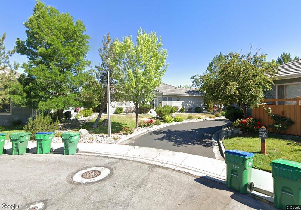
6656 Aston Cir Unit 18 Sparks, NV 89436
Wingfield Springs NeighborhoodEstimated Value: $449,000 - $532,000
3
Beds
3
Baths
1,736
Sq Ft
$275/Sq Ft
Est. Value
About This Home
This home is located at 6656 Aston Cir Unit 18, Sparks, NV 89436 and is currently estimated at $477,175, approximately $274 per square foot. 6656 Aston Cir Unit 18 is a home located in Washoe County with nearby schools including Van Gorder Elementary School, Sky Ranch Middle School, and Spanish Springs High School.
Ownership History
Date
Name
Owned For
Owner Type
Purchase Details
Closed on
Jul 3, 2002
Sold by
Tavo Valera Associates Llc
Bought by
Jacobs Robert H and Jacobs Judy A
Current Estimated Value
Home Financials for this Owner
Home Financials are based on the most recent Mortgage that was taken out on this home.
Original Mortgage
$124,500
Outstanding Balance
$48,617
Interest Rate
6%
Mortgage Type
Unknown
Estimated Equity
$428,558
Create a Home Valuation Report for This Property
The Home Valuation Report is an in-depth analysis detailing your home's value as well as a comparison with similar homes in the area
Home Values in the Area
Average Home Value in this Area
Purchase History
| Date | Buyer | Sale Price | Title Company |
|---|---|---|---|
| Jacobs Robert H | $227,826 | First American Title |
Source: Public Records
Mortgage History
| Date | Status | Borrower | Loan Amount |
|---|---|---|---|
| Open | Jacobs Robert H | $124,500 |
Source: Public Records
Tax History Compared to Growth
Tax History
| Year | Tax Paid | Tax Assessment Tax Assessment Total Assessment is a certain percentage of the fair market value that is determined by local assessors to be the total taxable value of land and additions on the property. | Land | Improvement |
|---|---|---|---|---|
| 2026 | $1,702 | $123,818 | $32,445 | $91,373 |
| 2025 | $2,209 | $124,068 | $32,445 | $91,623 |
| 2024 | $2,209 | $122,746 | $27,790 | $94,956 |
| 2023 | $2,146 | $114,398 | $30,590 | $83,808 |
| 2022 | $2,089 | $100,245 | $27,825 | $72,420 |
| 2021 | $2,031 | $94,968 | $22,400 | $72,568 |
| 2020 | $1,967 | $94,668 | $21,595 | $73,073 |
| 2019 | $1,910 | $92,503 | $21,455 | $71,048 |
| 2018 | $1,855 | $83,827 | $14,315 | $69,512 |
| 2017 | $1,801 | $79,720 | $14,210 | $65,510 |
| 2016 | $1,754 | $76,039 | $12,985 | $63,054 |
| 2015 | $1,752 | $76,085 | $13,055 | $63,030 |
| 2014 | $1,700 | $59,015 | $9,380 | $49,635 |
| 2013 | -- | $48,011 | $7,665 | $40,346 |
Source: Public Records
Map
Nearby Homes
- 6638 Aston Cir Unit 18
- 2691 Sutter Butte Ct
- 7302 Little Easy St
- 6375 N Ginger Quill Ct
- 2880 Friar Rock Ct
- 6658 Abbotswood Dr
- 2850 Billie Dove Ct
- 7315 Silver King Dr
- 2073 Marcus Way
- 2073 Marcus Way Unit Homesite 2
- 2069 Marcus Way Unit Homesite 1
- 6726 Runnymede Dr
- 2064 Marcus Way Unit Homesite 11
- 2024 Forest Grove Ln
- 2003 Forest Grove Ln
- 6302 Cokenee Ct
- 7090 Lemur Landing Way
- 2045 Elk Falls Way Unit Homesite 26
- 2230 Long Island Ct
- 2041 Elk Falls Way Unit Homesite 25
- 6658 Aston Cir
- 6652 Aston Cir Unit 18
- 6650 Aston Cir
- 6664 Aston Cir
- 6662 Aston Cir
- 6672 Aston Cir
- 6636 Aston Cir
- 6640 Aston Cir
- 6642 Aston Cir
- 6646 Aston Cir Unit 1844
- 6646 Aston Cir Unit 18
- 6648 Aston Cir Unit 18
- 6678 Aston Cir
- 6630 Aston Cir
- 6680 Aston Cir
- 6628 Aston Cir Unit 18
- 7018 Poco Bueno Cir
- 6696 Aston Cir
- 6637 Aston Cir Unit 1828
- 6637 Aston Cir