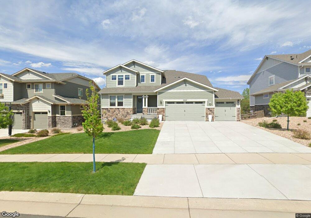
6657 S Robertsdale Way Aurora, CO 80016
Southeast Aurora NeighborhoodEstimated Value: $801,221 - $882,000
4
Beds
4
Baths
2,982
Sq Ft
$284/Sq Ft
Est. Value
About This Home
This home is located at 6657 S Robertsdale Way, Aurora, CO 80016 and is currently estimated at $847,305, approximately $284 per square foot. 6657 S Robertsdale Way is a home located in Arapahoe County with nearby schools including Altitude Elementary School, Fox Ridge Middle School, and Cherokee Trail High School.
Ownership History
Date
Name
Owned For
Owner Type
Purchase Details
Closed on
Aug 29, 2022
Sold by
Zachary Den Daas
Bought by
Den Daas Family Revocable Living Trust
Current Estimated Value
Purchase Details
Closed on
Sep 24, 2021
Sold by
Mineweaser John Michael and Mineweaser Noelle Kathleen
Bought by
Daas Zachary Den and Daas Maggie Den
Home Financials for this Owner
Home Financials are based on the most recent Mortgage that was taken out on this home.
Original Mortgage
$596,850
Interest Rate
2.8%
Mortgage Type
New Conventional
Purchase Details
Closed on
Jul 23, 2018
Sold by
William Lyon Homes Inc
Bought by
Mineweaser John Michael and Mineweaser Noelle Kathleen
Home Financials for this Owner
Home Financials are based on the most recent Mortgage that was taken out on this home.
Original Mortgage
$474,800
Interest Rate
4.5%
Mortgage Type
New Conventional
Create a Home Valuation Report for This Property
The Home Valuation Report is an in-depth analysis detailing your home's value as well as a comparison with similar homes in the area
Home Values in the Area
Average Home Value in this Area
Purchase History
| Date | Buyer | Sale Price | Title Company |
|---|---|---|---|
| Den Daas Family Revocable Living Trust | -- | -- | |
| Daas Zachary Den | $761,000 | None Available | |
| Mineweaser John Michael | $593,500 | Land Title Guarantee Co |
Source: Public Records
Mortgage History
| Date | Status | Borrower | Loan Amount |
|---|---|---|---|
| Previous Owner | Daas Zachary Den | $596,850 | |
| Previous Owner | Mineweaser John Michael | $474,800 |
Source: Public Records
Tax History Compared to Growth
Tax History
| Year | Tax Paid | Tax Assessment Tax Assessment Total Assessment is a certain percentage of the fair market value that is determined by local assessors to be the total taxable value of land and additions on the property. | Land | Improvement |
|---|---|---|---|---|
| 2024 | $7,353 | $53,085 | -- | -- |
| 2023 | $7,353 | $53,165 | $0 | $0 |
| 2022 | $5,707 | $43,216 | $0 | $0 |
| 2021 | $5,328 | $43,216 | $0 | $0 |
| 2020 | $5,336 | $0 | $0 | $0 |
| 2019 | $5,232 | $41,142 | $0 | $0 |
| 2018 | $2,132 | $16,243 | $0 | $0 |
| 2017 | $2,235 | $17,160 | $0 | $0 |
| 2016 | $570 | $4,400 | $0 | $0 |
| 2015 | $554 | $4,400 | $0 | $0 |
| 2014 | -- | $5,203 | $0 | $0 |
| 2013 | -- | $4,470 | $0 | $0 |
Source: Public Records
Map
Nearby Homes
- 6758 S Riverwood Way
- 26591 E Calhoun Place
- 6915 S Titus St
- 6450 S Riverwood Ct
- 7270 S Vandriver Way
- 6946 S Titus St
- 27553 E Euclid Dr
- 6689 S Vandriver Way
- 26683 E Peakview Place
- 27460 E Lakeview Dr
- 26656 E Peakview Dr
- 6843 S Vandriver Ct
- 6980 S Uriah St
- 26903 E Easter Place
- 26881 E Roxbury Place
- 6353 S Queensburg Ct
- 6360 S Patsburg Ct
- 27705 E Davies Dr
- 26473 E Caley Dr
- 7163 S Shady Grove Ct
- 6655 S Robertsdale Way
- 6659 S Robertsdale Way
- 6675 S Robertsdale Way
- 6652 S Robertsdale Way
- 6650 S Robertsdale Way
- 6670 S Robertsdale Way
- 6677 S Robertsdale Way
- 6672 S Robertsdale Way
- 27135 E Arapahoe Place
- 27010 E Lakeview Dr
- 27183 E Ontario Place
- 27173 E Ontario Place
- 27163 E Ontario Place
- 26951 E Briarwood Cir
- 6679 S Robertsdale Way
- 26961 E Briarwood Cir
- 27155 E Arapahoe Place
- 27030 E Lakeview Dr
- 27153 E Ontario Place
- 26941 E Briarwood Cir