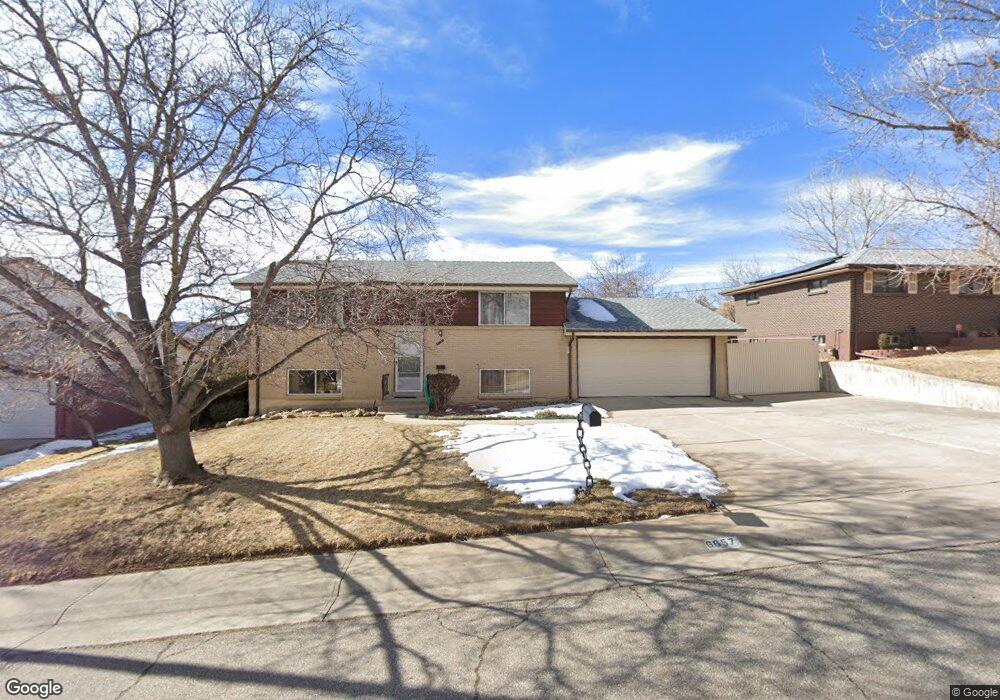
6657 Vivian St Arvada, CO 80004
Northwest Arvada NeighborhoodEstimated Value: $512,852 - $569,000
3
Beds
3
Baths
936
Sq Ft
$577/Sq Ft
Est. Value
About This Home
This home is located at 6657 Vivian St, Arvada, CO 80004 and is currently estimated at $540,463, approximately $577 per square foot. 6657 Vivian St is a home located in Jefferson County with nearby schools including Fremont Elementary School, Oberon Middle School, and Arvada West High School.
Create a Home Valuation Report for This Property
The Home Valuation Report is an in-depth analysis detailing your home's value as well as a comparison with similar homes in the area
Home Values in the Area
Average Home Value in this Area
Tax History Compared to Growth
Tax History
| Year | Tax Paid | Tax Assessment Tax Assessment Total Assessment is a certain percentage of the fair market value that is determined by local assessors to be the total taxable value of land and additions on the property. | Land | Improvement |
|---|---|---|---|---|
| 2024 | $2,343 | $30,851 | $14,410 | $16,441 |
| 2023 | $2,343 | $30,851 | $14,410 | $16,441 |
| 2022 | $1,837 | $25,704 | $11,695 | $14,009 |
| 2021 | $1,867 | $26,443 | $12,031 | $14,412 |
| 2020 | $1,793 | $25,735 | $11,278 | $14,457 |
| 2019 | $1,769 | $25,735 | $11,278 | $14,457 |
| 2018 | $1,489 | $22,409 | $5,806 | $16,603 |
| 2017 | $1,363 | $22,409 | $5,806 | $16,603 |
| 2016 | $1,042 | $18,908 | $5,527 | $13,381 |
| 2015 | $792 | $18,908 | $5,527 | $13,381 |
| 2014 | $792 | $15,639 | $4,384 | $11,255 |
Source: Public Records
Map
Nearby Homes
- 11925 W 66th Place Unit B
- 11820 W 66th Place Unit A
- 6440 Wright St
- 6616 Zang Cir
- 7049 Van Gordon Ct
- 6640 Simms St
- 12924 W 64th Dr Unit B
- 6470 Simms St Unit C
- 11443 W 67th Ave
- 11640 W 62nd Place Unit 203
- 11626 W 62nd Place Unit 103
- 6416 Zang Ct
- 13155 W 63rd Place
- 7154 Welch Ct
- 6766 Quail St
- 13245 W 63rd Cir
- 6762 Beech Dr
- 7080 Simms St Unit 204
- 13432 W 65th Place
- 13168 W 62nd Dr