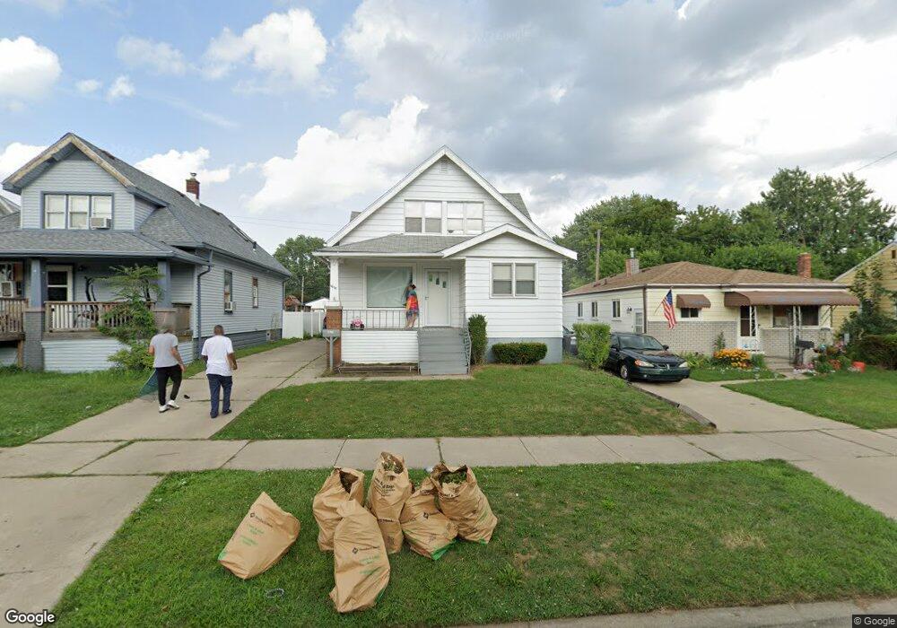
6657 Westpoint St Unit Bldg-Unit Taylor, MI 48180
Estimated Value: $178,128 - $191,000
--
Bed
2
Baths
1,356
Sq Ft
$135/Sq Ft
Est. Value
About This Home
This home is located at 6657 Westpoint St Unit Bldg-Unit, Taylor, MI 48180 and is currently estimated at $182,782, approximately $134 per square foot. 6657 Westpoint St Unit Bldg-Unit is a home located in Wayne County with nearby schools including Clarence Randall Elementary School, Hoover Middle School, and Quest Charter Academy.
Ownership History
Date
Name
Owned For
Owner Type
Purchase Details
Closed on
Jun 17, 2020
Sold by
Singh Properties Usa Llc
Bought by
Jackson James and Camp Melissa
Current Estimated Value
Purchase Details
Closed on
Jun 16, 2014
Sold by
Griffith James E and The Estate Of Wilgus Griffith
Bought by
Singh Properties Usa Llc
Purchase Details
Closed on
Jun 19, 2002
Sold by
Downriver Catholic Feder
Bought by
Griffith Wilgus
Create a Home Valuation Report for This Property
The Home Valuation Report is an in-depth analysis detailing your home's value as well as a comparison with similar homes in the area
Home Values in the Area
Average Home Value in this Area
Purchase History
| Date | Buyer | Sale Price | Title Company |
|---|---|---|---|
| Jackson James | $116,600 | Reputation First Ttl Agcy Ll | |
| Singh Properties Usa Llc | $57,500 | Michigan Title Insurance Age | |
| Griffith Wilgus | -- | -- |
Source: Public Records
Tax History Compared to Growth
Tax History
| Year | Tax Paid | Tax Assessment Tax Assessment Total Assessment is a certain percentage of the fair market value that is determined by local assessors to be the total taxable value of land and additions on the property. | Land | Improvement |
|---|---|---|---|---|
| 2025 | $2,836 | $78,400 | $0 | $0 |
| 2024 | $2,836 | $70,400 | $0 | $0 |
| 2023 | $4,374 | $66,900 | $0 | $0 |
| 2022 | $2,706 | $64,500 | $0 | $0 |
| 2021 | $3,257 | $57,400 | $0 | $0 |
| 2020 | $2,401 | $46,800 | $0 | $0 |
| 2019 | $388,453 | $42,800 | $0 | $0 |
| 2018 | $1,998 | $40,800 | $0 | $0 |
| 2017 | $2,191 | $36,400 | $0 | $0 |
| 2016 | $3,528 | $35,300 | $0 | $0 |
| 2015 | $3,170 | $31,700 | $0 | $0 |
| 2013 | $3,170 | $33,200 | $0 | $0 |
| 2012 | $1,224 | $32,500 | $4,800 | $27,700 |
Source: Public Records
Map
Nearby Homes
- 6657 Westpoint St
- 6647 Westpoint St
- 6665 Westpoint St
- 6641 Westpoint St
- 6677 Westpoint St
- 6633 Westpoint St
- 6648 Cornell St
- 6709 Westpoint St
- 6640 Cornell St
- 6625 W Point St
- 6717 Westpoint St
- 6658 Westpoint St
- 6664 Westpoint St
- 6648 Westpoint St
- 6640 Westpoint St Unit Bldg-Unit
- 6640 Westpoint St
- 6674 Westpoint St
- 6624 Cornell St
- 6617 Westpoint St
- 6716 Cornell St