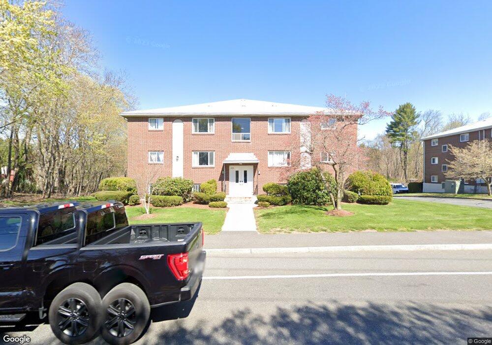
666 Farm Rd Unit 10 Marlborough, MA 01752
Estimated Value: $250,574 - $283,000
2
Beds
1
Bath
760
Sq Ft
$356/Sq Ft
Est. Value
About This Home
This home is located at 666 Farm Rd Unit 10, Marlborough, MA 01752 and is currently estimated at $270,644, approximately $356 per square foot. 666 Farm Rd Unit 10 is a home located in Middlesex County with nearby schools including Marlborough High School, New Covenant Christian School, and Glenhaven Academy - JRI School.
Ownership History
Date
Name
Owned For
Owner Type
Purchase Details
Closed on
Nov 28, 2003
Sold by
Orangio Mary Linda
Bought by
Ribeiro Bruno M
Current Estimated Value
Home Financials for this Owner
Home Financials are based on the most recent Mortgage that was taken out on this home.
Original Mortgage
$140,600
Outstanding Balance
$66,106
Interest Rate
6.09%
Mortgage Type
Purchase Money Mortgage
Estimated Equity
$204,538
Purchase Details
Closed on
Dec 2, 1999
Sold by
Kwatcher Tali
Bought by
Orangio Mary L
Home Financials for this Owner
Home Financials are based on the most recent Mortgage that was taken out on this home.
Original Mortgage
$63,000
Interest Rate
7.86%
Mortgage Type
Purchase Money Mortgage
Purchase Details
Closed on
Feb 20, 1991
Sold by
Quirk Tali and Quirk Paul A
Bought by
Quirk Tali
Create a Home Valuation Report for This Property
The Home Valuation Report is an in-depth analysis detailing your home's value as well as a comparison with similar homes in the area
Home Values in the Area
Average Home Value in this Area
Purchase History
| Date | Buyer | Sale Price | Title Company |
|---|---|---|---|
| Ribeiro Bruno M | $148,000 | -- | |
| Orangio Mary L | $70,000 | -- | |
| Quirk Tali | $12,000 | -- |
Source: Public Records
Mortgage History
| Date | Status | Borrower | Loan Amount |
|---|---|---|---|
| Open | Ribeiro Bruno M | $140,600 | |
| Previous Owner | Quirk Tali | $63,000 |
Source: Public Records
Tax History Compared to Growth
Tax History
| Year | Tax Paid | Tax Assessment Tax Assessment Total Assessment is a certain percentage of the fair market value that is determined by local assessors to be the total taxable value of land and additions on the property. | Land | Improvement |
|---|---|---|---|---|
| 2025 | $1,928 | $195,500 | $0 | $195,500 |
| 2024 | $1,740 | $169,900 | $0 | $169,900 |
| 2023 | $1,668 | $144,500 | $0 | $144,500 |
| 2022 | $1,559 | $118,800 | $0 | $118,800 |
| 2021 | $1,648 | $119,400 | $0 | $119,400 |
| 2020 | $1,577 | $111,200 | $0 | $111,200 |
| 2019 | $1,555 | $110,500 | $0 | $110,500 |
| 2018 | $1,624 | $111,000 | $0 | $111,000 |
| 2017 | $1,520 | $99,200 | $0 | $99,200 |
| 2016 | $1,384 | $90,200 | $0 | $90,200 |
| 2015 | $1,492 | $94,700 | $0 | $94,700 |
Source: Public Records
Map
Nearby Homes
- 552 Farm Rd
- 29 Eldorado Dr
- 10 Eldorado Dr
- 32 Ethel
- 109 Westminster Dr Unit 109
- 23 Victoria Ln
- 34 Muir Way
- 16 Holly Hill Ln
- 20 Virginia Ave
- 271 Boston Post Rd E Unit 4
- 53 Wagon Hill Rd
- 23 Shelly Ln
- 261 Boston Post Rd E Unit 1
- 608 Boston Post Rd E Unit 11
- 596 Boston Post Rd E Unit 13
- 596 Boston Post Rd E
- 624 Boston Post Rd E Unit 7
- 100 Phelps St Unit 7
- 70 Phelps St
- 392 Farm Rd
- 666 Farm Rd Unit 9
- 666 Farm Rd Unit 8
- 666 Farm Rd Unit 7
- 666 Farm Rd Unit 6
- 666 Farm Rd Unit 5
- 666 Farm Rd Unit 4
- 666 Farm Rd Unit 3
- 666 Farm Rd Unit 2
- 666 Farm Rd Unit 12
- 666 Farm Rd Unit 11
- 666 Farm Rd Unit 1
- 666 Farm Rd Unit 8- 666
- 666 Farm Rd Unit 2,666
- 676 Farm Rd Unit 9
- 676 Farm Rd Unit 8
- 676 Farm Rd Unit 7
- 676 Farm Rd Unit 6
- 676 Farm Rd Unit 5
- 676 Farm Rd Unit 4
- 676 Farm Rd Unit 3