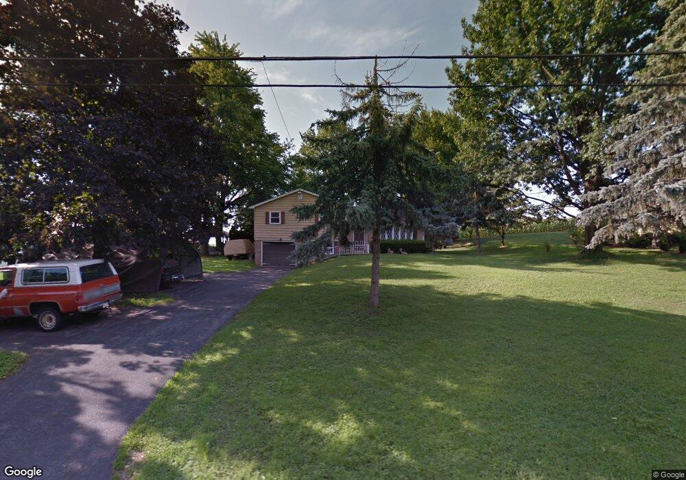
666 Shultz Rd Washington Boro, PA 17582
Manor NeighborhoodEstimated Value: $397,316 - $420,000
3
Beds
3
Baths
1,380
Sq Ft
$295/Sq Ft
Est. Value
About This Home
This home is located at 666 Shultz Rd, Washington Boro, PA 17582 and is currently estimated at $407,329, approximately $295 per square foot. 666 Shultz Rd is a home located in Lancaster County with nearby schools including Central Manor Elementary School, Manor Middle School, and Penn Manor High School.
Ownership History
Date
Name
Owned For
Owner Type
Purchase Details
Closed on
Jun 18, 2025
Sold by
Fhg 92 Llc
Bought by
Harelson Scott
Current Estimated Value
Home Financials for this Owner
Home Financials are based on the most recent Mortgage that was taken out on this home.
Original Mortgage
$366,300
Outstanding Balance
$365,350
Interest Rate
6.76%
Mortgage Type
New Conventional
Estimated Equity
$41,979
Purchase Details
Closed on
Oct 11, 2024
Sold by
Dernmy Christopher M
Bought by
Fhg 92 Llc
Home Financials for this Owner
Home Financials are based on the most recent Mortgage that was taken out on this home.
Original Mortgage
$280,000
Interest Rate
6.35%
Mortgage Type
New Conventional
Create a Home Valuation Report for This Property
The Home Valuation Report is an in-depth analysis detailing your home's value as well as a comparison with similar homes in the area
Home Values in the Area
Average Home Value in this Area
Purchase History
| Date | Buyer | Sale Price | Title Company |
|---|---|---|---|
| Harelson Scott | $407,000 | None Listed On Document | |
| Fhg 92 Llc | $259,000 | None Listed On Document |
Source: Public Records
Mortgage History
| Date | Status | Borrower | Loan Amount |
|---|---|---|---|
| Open | Harelson Scott | $366,300 | |
| Previous Owner | Fhg 92 Llc | $280,000 |
Source: Public Records
Tax History
| Year | Tax Paid | Tax Assessment Tax Assessment Total Assessment is a certain percentage of the fair market value that is determined by local assessors to be the total taxable value of land and additions on the property. | Land | Improvement |
|---|---|---|---|---|
| 2025 | $3,245 | $148,600 | $52,400 | $96,200 |
| 2024 | $3,245 | $148,600 | $52,400 | $96,200 |
| 2023 | $3,245 | $148,600 | $52,400 | $96,200 |
| 2022 | $3,184 | $148,600 | $52,400 | $96,200 |
| 2021 | $3,103 | $148,600 | $52,400 | $96,200 |
| 2020 | $3,103 | $148,600 | $52,400 | $96,200 |
| 2019 | $3,017 | $148,600 | $52,400 | $96,200 |
| 2018 | $2,317 | $148,600 | $52,400 | $96,200 |
| 2017 | $2,997 | $123,500 | $32,100 | $91,400 |
| 2016 | $2,997 | $123,500 | $32,100 | $91,400 |
| 2015 | $617 | $123,500 | $32,100 | $91,400 |
| 2014 | $2,056 | $123,500 | $32,100 | $91,400 |
Source: Public Records
Map
Nearby Homes
- 108 Hempfield St
- 3954 Laurel Run
- 1758 Quarry Dr
- 3948 Laurel Run
- 1211 Central Ave
- 645 Fairview Ave
- 1126 Lancaster Ave
- 522 S 10th St
- 714 Plane St
- 601 Manor St
- 495 Manor St
- 855 Lancaster Ave
- 290 S 5th St
- 852 Blunston St
- 267 S 4th St
- 543 Concord Ln
- 832 Houston St
- 230 Lawrence St
- 691 Cherry St
- 145 S 8th St
- 660 Shultz Rd
- 670 Shultz Rd
- 654 Shultz Rd
- 655 Shultz Rd
- 674 Shultz Rd
- 669 Shultz Rd
- 2006 Franklin Rd
- 2005 Franklin Rd
- 634 Shultz Rd
- 2009 Franklin Rd
- 2010 Franklin Rd
- 2013 Franklin Rd
- 624 Shultz Rd
- 2017 Franklin Rd
- 2026 Franklin Rd
- 2025 Franklin Rd
- 2030 Franklin Rd
- 618 Shultz Rd
- 564 Shultz Rd
- 2029 Franklin Rd
Your Personal Tour Guide
Ask me questions while you tour the home.