Estimated Value: $1,424,384 - $1,861,000
4
Beds
3
Baths
3,720
Sq Ft
$433/Sq Ft
Est. Value
About This Home
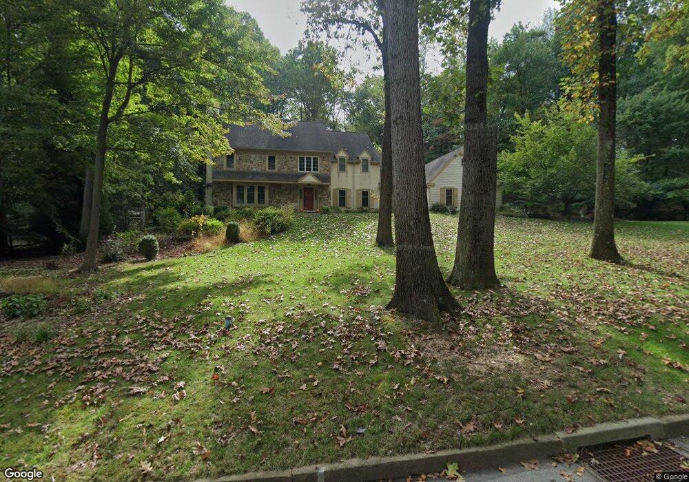
This home is located at 666 Strafford Cir, Wayne, PA 19087 and is currently estimated at $1,609,846, approximately $432 per square foot. 666 Strafford Cir is a home located in Chester County with nearby schools including New Eagle Elementary School, Valley Forge Middle School, and Conestoga Senior High School.
Ownership History
Date
Name
Owned For
Owner Type
Purchase Details
Closed on
May 10, 2017
Sold by
Chesney Janice B and Chesney John
Bought by
Benner Dokas Michael J and Benner Dokas Gabriela
Current Estimated Value
Purchase Details
Closed on
Jun 26, 1998
Sold by
Lieberman Anne and Lieberman Donald H
Bought by
Chesney Janice B and Chesney John
Home Financials for this Owner
Home Financials are based on the most recent Mortgage that was taken out on this home.
Original Mortgage
$468,000
Interest Rate
7.02%
Mortgage Type
Purchase Money Mortgage
Create a Home Valuation Report for This Property
The Home Valuation Report is an in-depth analysis detailing your home's value as well as a comparison with similar homes in the area
Home Values in the Area
Average Home Value in this Area
Purchase History
| Date | Buyer | Sale Price | Title Company |
|---|---|---|---|
| Benner Dokas Michael J | $900,000 | T A Of The Main Line | |
| Chesney Janice B | $585,000 | -- |
Source: Public Records
Mortgage History
| Date | Status | Borrower | Loan Amount |
|---|---|---|---|
| Previous Owner | Chesney Janice B | $468,000 |
Source: Public Records
Tax History
| Year | Tax Paid | Tax Assessment Tax Assessment Total Assessment is a certain percentage of the fair market value that is determined by local assessors to be the total taxable value of land and additions on the property. | Land | Improvement |
|---|---|---|---|---|
| 2025 | $16,802 | $477,000 | $131,300 | $345,700 |
| 2024 | $16,802 | $477,000 | $131,300 | $345,700 |
| 2023 | $15,782 | $477,000 | $131,300 | $345,700 |
| 2022 | $15,375 | $477,000 | $131,300 | $345,700 |
| 2021 | $15,083 | $477,000 | $131,300 | $345,700 |
| 2020 | $14,667 | $477,000 | $131,300 | $345,700 |
| 2019 | $14,204 | $477,000 | $131,300 | $345,700 |
| 2018 | $13,922 | $477,000 | $131,300 | $345,700 |
| 2017 | $14,657 | $514,450 | $131,300 | $383,150 |
| 2016 | -- | $514,450 | $131,300 | $383,150 |
| 2015 | -- | $514,450 | $131,300 | $383,150 |
| 2014 | -- | $514,450 | $131,300 | $383,150 |
Source: Public Records
Map
Nearby Homes
- 642 Pugh Rd
- 575 W Valley Rd
- 825 Springbank Ln
- 457 School House Ln
- 93 Hillside Rd
- 1129 Brians Way
- 443 Homestead Rd
- 211 Deepdale Rd
- 278 Old Forge Crossing Unit 278
- 92 Old Forge Crossing Unit 92
- 575 S Goddard Blvd Unit 502
- 575 S Goddard Blvd Unit 504
- 575 S Goddard Blvd Unit 406
- 605 Lakeview Ct Unit 19 LOWER
- 301 Eagle Rd
- 356 King of Prussia Rd
- 908 Laurens Aly
- 910 Laurens Aly
- 1008 Morton Aly
- 419 Drummers Ln Unit 419
- 668 Strafford Cir
- 665 Strafford Cir
- 674 Strafford Cir
- 681 Strafford Cir
- 650 Strafford Cir
- 645 Harwick Rd
- 602 Old Eagle School Rd
- 649 Strafford Cir
- 697 Strafford Cir
- 626 Pugh Rd
- 682 Strafford Cir
- 657 Harwick Rd
- 698 Strafford Cir
- 705 Harwick Rd
- 693 Harwick Rd
- 690 Strafford Cir
- 630 Harwick Rd
- 606 Pugh Rd
- 648 Harwick Rd
- 675 Harwick Rd
Your Personal Tour Guide
Ask me questions while you tour the home.