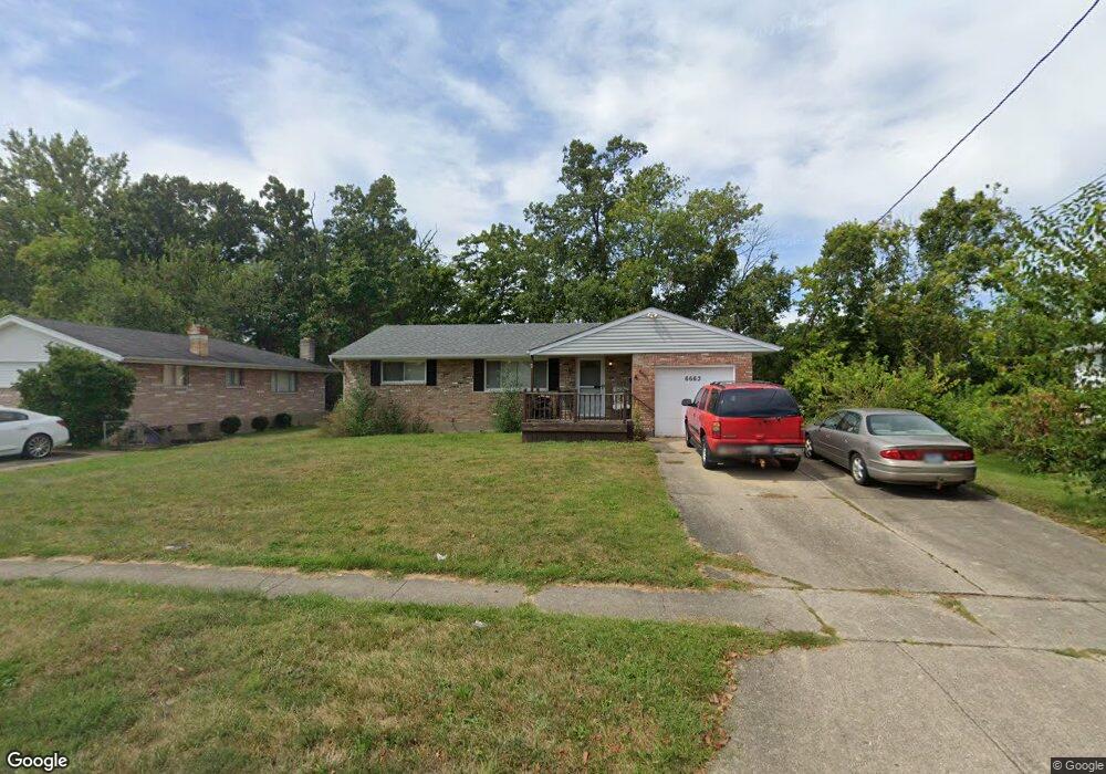
6663 Memory Ln Cincinnati, OH 45239
Estimated Value: $208,381 - $224,000
3
Beds
2
Baths
1,229
Sq Ft
$179/Sq Ft
Est. Value
About This Home
This home is located at 6663 Memory Ln, Cincinnati, OH 45239 and is currently estimated at $219,595, approximately $178 per square foot. 6663 Memory Ln is a home located in Hamilton County with nearby schools including White Oak Middle School, Colerain High School, and Cincinnati Achievement Academy.
Ownership History
Date
Name
Owned For
Owner Type
Purchase Details
Closed on
May 27, 1999
Sold by
Hempel Thomas J and Hempel Carrie A
Bought by
Olson Lon D and Olson Cathy F
Current Estimated Value
Home Financials for this Owner
Home Financials are based on the most recent Mortgage that was taken out on this home.
Original Mortgage
$95,000
Outstanding Balance
$22,969
Interest Rate
6.99%
Estimated Equity
$196,626
Purchase Details
Closed on
Mar 24, 1997
Sold by
Holt Deborah Rena
Bought by
Hempel Thomas J
Home Financials for this Owner
Home Financials are based on the most recent Mortgage that was taken out on this home.
Original Mortgage
$66,000
Interest Rate
7.82%
Create a Home Valuation Report for This Property
The Home Valuation Report is an in-depth analysis detailing your home's value as well as a comparison with similar homes in the area
Home Values in the Area
Average Home Value in this Area
Purchase History
| Date | Buyer | Sale Price | Title Company |
|---|---|---|---|
| Olson Lon D | $100,000 | -- | |
| Hempel Thomas J | -- | -- |
Source: Public Records
Mortgage History
| Date | Status | Borrower | Loan Amount |
|---|---|---|---|
| Open | Olson Lon D | $95,000 | |
| Previous Owner | Hempel Thomas J | $66,000 |
Source: Public Records
Tax History
| Year | Tax Paid | Tax Assessment Tax Assessment Total Assessment is a certain percentage of the fair market value that is determined by local assessors to be the total taxable value of land and additions on the property. | Land | Improvement |
|---|---|---|---|---|
| 2025 | $3,271 | $56,714 | $10,262 | $46,452 |
| 2024 | $3,033 | $56,714 | $10,262 | $46,452 |
| 2023 | $3,051 | $56,714 | $10,262 | $46,452 |
| 2022 | $2,073 | $31,367 | $8,015 | $23,352 |
| 2021 | $2,056 | $31,367 | $8,015 | $23,352 |
| 2020 | $2,077 | $31,367 | $8,015 | $23,352 |
| 2019 | $1,886 | $26,583 | $6,794 | $19,789 |
| 2018 | $1,693 | $26,583 | $6,794 | $19,789 |
| 2017 | $1,604 | $26,583 | $6,794 | $19,789 |
| 2016 | $1,897 | $31,067 | $9,370 | $21,697 |
| 2015 | $1,915 | $31,067 | $9,370 | $21,697 |
| 2014 | $1,919 | $31,067 | $9,370 | $21,697 |
| 2013 | $1,984 | $33,768 | $10,185 | $23,583 |
Source: Public Records
Map
Nearby Homes
- 6751 Rutherford Ct
- 2806 Breezy Way
- 2427 Crosley Meadow
- 2528 Flanigan Ct
- 2757 Banning Rd
- 2801 Byrneside Dr
- 2424 Banning Rd
- 2391 Deblin Dr
- 5970 Colerain Ave
- 2836 Banning Rd
- 2342 Banning Rd
- 2603 Kipling Ave
- 7560 Pippin Rd
- 3131 Preserve Ln
- 2564 Altura Dr
- 6381 Golfway Dr
- 2937 Blue Rock Rd
- 3191 Preserve Ln
- 3181 Preserve Ln
- 3181 Preserve Ln Unit 1C
- 6635 Memory Ln
- 6691 Memory Ln
- 6609 Memory Ln
- 6721 Memory Ln
- 6690 Memory Ln
- 2598 Highwood Ln
- 6710 Rutherford Ct
- 6720 Rutherford Ct
- 6720 Memory Ln
- 6581 Memory Ln
- 6749 Memory Ln
- 2660 Geraldine Dr
- 6748 Memory Ln
- 6594 Memory Ln
- 6711 Rutherford Ct
- 6731 Grange Ct
- 2590 Highwood Ln
- 6553 Memory Ln
- 6750 Rutherford Ct
- 6779 Memory Ln
Your Personal Tour Guide
Ask me questions while you tour the home.