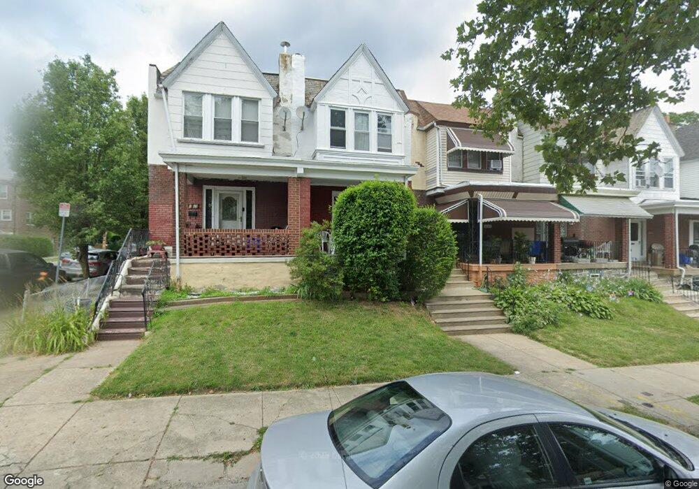
6667 Cornelius St Philadelphia, PA 19138
West Oak Lane NeighborhoodEstimated Value: $192,000 - $233,000
3
Beds
1
Bath
1,064
Sq Ft
$194/Sq Ft
Est. Value
About This Home
This home is located at 6667 Cornelius St, Philadelphia, PA 19138 and is currently estimated at $206,935, approximately $194 per square foot. 6667 Cornelius St is a home located in Philadelphia County with nearby schools including Anna B. Day School, Martin Luther King High School, and West Oak Lane Charter School.
Ownership History
Date
Name
Owned For
Owner Type
Purchase Details
Closed on
Jun 16, 2009
Sold by
Speaks Leonard
Bought by
Carlisle Kelvin J
Current Estimated Value
Home Financials for this Owner
Home Financials are based on the most recent Mortgage that was taken out on this home.
Original Mortgage
$108,007
Outstanding Balance
$68,754
Interest Rate
4.91%
Mortgage Type
FHA
Estimated Equity
$138,181
Purchase Details
Closed on
Mar 11, 1994
Sold by
Robinson James A
Bought by
Speaks Leonard
Create a Home Valuation Report for This Property
The Home Valuation Report is an in-depth analysis detailing your home's value as well as a comparison with similar homes in the area
Home Values in the Area
Average Home Value in this Area
Purchase History
| Date | Buyer | Sale Price | Title Company |
|---|---|---|---|
| Carlisle Kelvin J | $110,000 | None Available | |
| Speaks Leonard | $1,000 | -- |
Source: Public Records
Mortgage History
| Date | Status | Borrower | Loan Amount |
|---|---|---|---|
| Open | Carlisle Kelvin J | $108,007 |
Source: Public Records
Tax History Compared to Growth
Tax History
| Year | Tax Paid | Tax Assessment Tax Assessment Total Assessment is a certain percentage of the fair market value that is determined by local assessors to be the total taxable value of land and additions on the property. | Land | Improvement |
|---|---|---|---|---|
| 2025 | $2,093 | $185,300 | $37,060 | $148,240 |
| 2024 | $2,093 | $185,300 | $37,060 | $148,240 |
| 2023 | $2,093 | $149,500 | $29,900 | $119,600 |
| 2022 | $1,562 | $149,500 | $29,900 | $119,600 |
| 2021 | $1,562 | $0 | $0 | $0 |
| 2020 | $1,562 | $0 | $0 | $0 |
| 2019 | $1,631 | $0 | $0 | $0 |
| 2018 | $1,457 | $0 | $0 | $0 |
| 2017 | $1,457 | $0 | $0 | $0 |
| 2016 | $1,457 | $0 | $0 | $0 |
| 2015 | $1,395 | $0 | $0 | $0 |
| 2014 | -- | $104,100 | $9,504 | $94,596 |
| 2012 | -- | $10,912 | $1,847 | $9,065 |
Source: Public Records
Map
Nearby Homes
- 6661 Cornelius St
- 6635 Hollis St
- 1505 Beverly Rd
- 6620 Cornelius St
- 1521 E Walnut Ln
- 1537 Beverly Rd
- 1544 Beverly Rd
- 6332 E Wister St
- 7243 Mansfield Ave
- 7258 Mansfield Ave
- 1559 E Pastorius St
- 1416-20 E Tulpehocken St
- 1344 Narragansett St
- 6824 Rodney St
- 1544 E Tulpehocken St
- 5843 Crittenden St
- 5839 Crittenden St
- 2152 Stenton Ave
- 5831 Crittenden St
- 5829 Crittenden St
- 6669 Cornelius St
- 6665 Cornelius St
- 6663 Cornelius St
- 6701 Cornelius St
- 6659 Cornelius St
- 6703 Cornelius St
- 6657 Cornelius St
- 6644 Hollis St
- 6644 Hollis St Unit STUDIO
- 6642 Hollis St
- 6705 Cornelius St
- 6640 Hollis St
- 6655 Cornelius St
- 6638 Hollis St
- 6707 Cornelius St
- 6700 Hollis St
- 6636 Hollis St
- 6653 Cornelius St
- 6672 Cornelius St
- 6670 Cornelius St