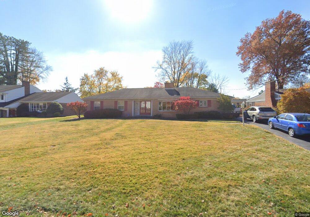
6667 Michael Dr Cincinnati, OH 45243
Estimated Value: $479,000 - $539,000
3
Beds
2
Baths
1,696
Sq Ft
$299/Sq Ft
Est. Value
About This Home
This home is located at 6667 Michael Dr, Cincinnati, OH 45243 and is currently estimated at $507,580, approximately $299 per square foot. 6667 Michael Dr is a home located in Hamilton County with nearby schools including Indian Hill Primary School, Indian Hill Elementary School, and Indian Hill Middle School.
Ownership History
Date
Name
Owned For
Owner Type
Purchase Details
Closed on
Mar 30, 2007
Sold by
Liang Shijiang and Zhao Bin
Bought by
Taylor Thomas E
Current Estimated Value
Home Financials for this Owner
Home Financials are based on the most recent Mortgage that was taken out on this home.
Original Mortgage
$148,000
Interest Rate
6.2%
Mortgage Type
Unknown
Purchase Details
Closed on
Feb 28, 2002
Sold by
Kitchen Everitt A Tr
Bought by
Liang Shijiang and Zhao Bin
Home Financials for this Owner
Home Financials are based on the most recent Mortgage that was taken out on this home.
Original Mortgage
$180,000
Interest Rate
7.03%
Create a Home Valuation Report for This Property
The Home Valuation Report is an in-depth analysis detailing your home's value as well as a comparison with similar homes in the area
Home Values in the Area
Average Home Value in this Area
Purchase History
| Date | Buyer | Sale Price | Title Company |
|---|---|---|---|
| Taylor Thomas E | $248,385 | Advanced Land Title Agency | |
| Liang Shijiang | $225,000 | -- |
Source: Public Records
Mortgage History
| Date | Status | Borrower | Loan Amount |
|---|---|---|---|
| Previous Owner | Taylor Thomas E | $148,000 | |
| Previous Owner | Liang Shijiang | $180,000 |
Source: Public Records
Tax History Compared to Growth
Tax History
| Year | Tax Paid | Tax Assessment Tax Assessment Total Assessment is a certain percentage of the fair market value that is determined by local assessors to be the total taxable value of land and additions on the property. | Land | Improvement |
|---|---|---|---|---|
| 2024 | $4,991 | $127,551 | $31,836 | $95,715 |
| 2023 | $5,021 | $127,551 | $31,836 | $95,715 |
| 2022 | $4,778 | $99,324 | $21,774 | $77,550 |
| 2021 | $4,655 | $99,324 | $21,774 | $77,550 |
| 2020 | $4,153 | $99,324 | $21,774 | $77,550 |
| 2019 | $3,908 | $87,126 | $19,100 | $68,026 |
| 2018 | $3,916 | $87,126 | $19,100 | $68,026 |
| 2017 | $3,734 | $87,126 | $19,100 | $68,026 |
| 2016 | $3,349 | $77,410 | $17,385 | $60,025 |
| 2015 | $3,373 | $77,410 | $17,385 | $60,025 |
| 2014 | $3,352 | $77,410 | $17,385 | $60,025 |
| 2013 | $3,309 | $73,721 | $16,555 | $57,166 |
Source: Public Records
Map
Nearby Homes