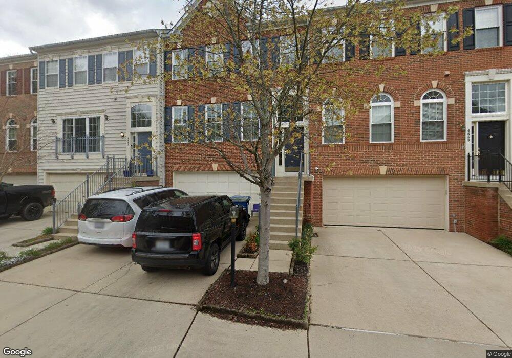
6667 Ordsall St Alexandria, VA 22315
Rose Hill NeighborhoodEstimated Value: $805,720 - $835,000
3
Beds
4
Baths
2,160
Sq Ft
$380/Sq Ft
Est. Value
About This Home
This home is located at 6667 Ordsall St, Alexandria, VA 22315 and is currently estimated at $820,360, approximately $379 per square foot. 6667 Ordsall St is a home located in Fairfax County with nearby schools including Lane Elementary School, Twain Middle School, and Edison High School.
Ownership History
Date
Name
Owned For
Owner Type
Purchase Details
Closed on
Mar 30, 1998
Sold by
The Ryland Group Inc
Bought by
Macfarlane Dirk N and Macfarlane Heidi W
Current Estimated Value
Home Financials for this Owner
Home Financials are based on the most recent Mortgage that was taken out on this home.
Original Mortgage
$203,200
Outstanding Balance
$38,102
Interest Rate
6.96%
Mortgage Type
New Conventional
Estimated Equity
$782,258
Purchase Details
Closed on
Jan 6, 1998
Sold by
Kingstowne Section 45 Llc
Bought by
Ryland Group Inc
Create a Home Valuation Report for This Property
The Home Valuation Report is an in-depth analysis detailing your home's value as well as a comparison with similar homes in the area
Home Values in the Area
Average Home Value in this Area
Purchase History
| Date | Buyer | Sale Price | Title Company |
|---|---|---|---|
| Macfarlane Dirk N | $254,030 | -- | |
| Ryland Group Inc | $831,470 | -- |
Source: Public Records
Mortgage History
| Date | Status | Borrower | Loan Amount |
|---|---|---|---|
| Open | Ryland Group Inc | $203,200 |
Source: Public Records
Tax History Compared to Growth
Tax History
| Year | Tax Paid | Tax Assessment Tax Assessment Total Assessment is a certain percentage of the fair market value that is determined by local assessors to be the total taxable value of land and additions on the property. | Land | Improvement |
|---|---|---|---|---|
| 2025 | $8,218 | $764,000 | $225,000 | $539,000 |
| 2024 | $8,218 | $709,340 | $225,000 | $484,340 |
| 2023 | $8,047 | $713,100 | $225,000 | $488,100 |
| 2022 | $7,841 | $685,670 | $205,000 | $480,670 |
| 2021 | $7,285 | $620,820 | $175,000 | $445,820 |
| 2020 | $7,146 | $603,780 | $175,000 | $428,780 |
| 2019 | $6,808 | $575,280 | $165,000 | $410,280 |
| 2018 | $6,546 | $569,220 | $163,000 | $406,220 |
| 2017 | $6,481 | $558,250 | $160,000 | $398,250 |
| 2016 | $6,467 | $558,250 | $160,000 | $398,250 |
| 2015 | $6,230 | $558,250 | $160,000 | $398,250 |
| 2014 | $6,216 | $558,250 | $160,000 | $398,250 |
Source: Public Records
Map
Nearby Homes
- 6607 Castle Bar Ct
- 6428 Warren Point Ct
- 6339 Dunman Way
- 5510 Jowett Ct
- 5241 Saint Genevieve Place
- 6624 Telegraph Rd
- 6485 Waterfield Rd
- 6547 Grange Ln Unit 104
- 6307 Cottonwood Dr
- 7137 Lake Cove Dr
- 7057 Kings Manor Dr
- 5606 Brookland Ct
- 7039 Kings Manor Dr
- 6631 Dunwich Way
- 6100 Leewood Dr
- 6420 Willowood Ln
- 6408 Maryview St
- 6044 Masondale Rd
- 6831 Vantage Dr
- 5405 Dunsmore Rd
- 6665 Ordsall St
- 6663 Ordsall St
- 6669 Ordsall St
- 6671 Ordsall St
- 6673 Ordsall St
- 6664 Ordsall St
- 6662 Ordsall St
- 6666 Ordsall St
- 6660 Ordsall St
- 5280 Sandyford St
- 5282 Sandyford St
- 6681 Ordsall St
- 5284 Sandyford St
- 5286 Sandyford St
- 5288 Sandyford St
- 6685 Ordsall St
- 6663 Scottswood St
- 5281 Sandyford St
- 6661 Scottswood St
- 6657 Scottswood St