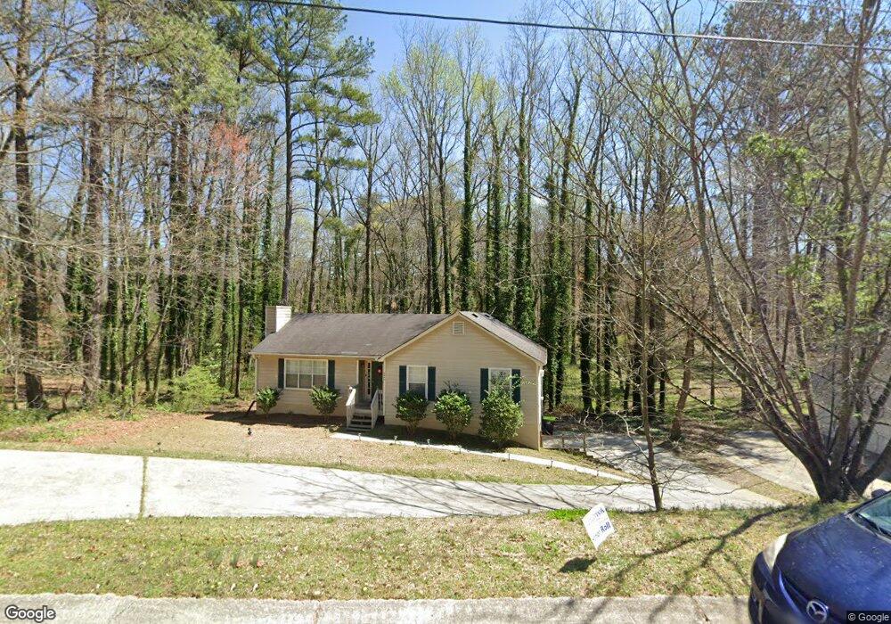
6669 Emily Ln Unit 2 Austell, GA 30168
Estimated Value: $229,000 - $341,000
3
Beds
2
Baths
1,384
Sq Ft
$205/Sq Ft
Est. Value
About This Home
This home is located at 6669 Emily Ln Unit 2, Austell, GA 30168 and is currently estimated at $283,042, approximately $204 per square foot. 6669 Emily Ln Unit 2 is a home located in Cobb County with nearby schools including Bryant Elementary School, Lindley Middle School, and Pebblebrook High School.
Ownership History
Date
Name
Owned For
Owner Type
Purchase Details
Closed on
Oct 31, 2022
Sold by
Second Avenue Sfr Holdings I Llc
Bought by
Second Avenue Sfr Holdings Iii Llc
Current Estimated Value
Purchase Details
Closed on
Dec 22, 2021
Sold by
Zillow Homes Property Trust
Bought by
Second Avenue Sfr Holdings I Llc
Purchase Details
Closed on
Nov 24, 2021
Sold by
Johnson Carl B
Bought by
Zillow Homes Property Trust
Purchase Details
Closed on
Feb 13, 2011
Sold by
Hsbc Bk Usa Na Ser 2005-2
Bought by
Johnson Carl B
Purchase Details
Closed on
May 4, 2010
Sold by
Brookins Jesse
Bought by
Hsbc Bk Usa
Purchase Details
Closed on
May 25, 2001
Sold by
Ellis W M
Bought by
Brookins Jesse
Home Financials for this Owner
Home Financials are based on the most recent Mortgage that was taken out on this home.
Original Mortgage
$118,047
Interest Rate
7.05%
Mortgage Type
FHA
Create a Home Valuation Report for This Property
The Home Valuation Report is an in-depth analysis detailing your home's value as well as a comparison with similar homes in the area
Home Values in the Area
Average Home Value in this Area
Purchase History
| Date | Buyer | Sale Price | Title Company |
|---|---|---|---|
| Second Avenue Sfr Holdings Iii Llc | -- | -- | |
| Second Avenue Sfr Holdings I Llc | $232,800 | Mcmanamy Mcleod Heller Llc | |
| Zillow Homes Property Trust | $259,000 | Mcmanamy Mcleod Heller Llc | |
| Johnson Carl B | $23,100 | -- | |
| Hsbc Bk Usa | $54,000 | -- | |
| Brookins Jesse | $119,900 | -- |
Source: Public Records
Mortgage History
| Date | Status | Borrower | Loan Amount |
|---|---|---|---|
| Previous Owner | Brookins Jesse | $118,047 |
Source: Public Records
Tax History Compared to Growth
Tax History
| Year | Tax Paid | Tax Assessment Tax Assessment Total Assessment is a certain percentage of the fair market value that is determined by local assessors to be the total taxable value of land and additions on the property. | Land | Improvement |
|---|---|---|---|---|
| 2025 | $3,787 | $125,700 | $20,000 | $105,700 |
| 2024 | $3,790 | $125,700 | $20,000 | $105,700 |
| 2023 | $3,790 | $125,700 | $20,000 | $105,700 |
| 2022 | $2,421 | $79,768 | $14,000 | $65,768 |
| 2021 | $2,421 | $79,768 | $14,000 | $65,768 |
| 2020 | $2,142 | $70,576 | $12,000 | $58,576 |
| 2019 | $1,853 | $61,052 | $8,000 | $53,052 |
| 2018 | $1,853 | $61,052 | $8,000 | $53,052 |
| 2017 | $1,282 | $44,588 | $4,800 | $39,788 |
| 2016 | $1,282 | $44,588 | $4,800 | $39,788 |
| 2015 | $581 | $19,716 | $4,800 | $14,916 |
| 2014 | $274 | $9,208 | $0 | $0 |
Source: Public Records
Map
Nearby Homes
- 6609 Crossing Creek Point
- 840 Revena Dr
- 817 Revena Dr
- 1142 Hembree Ln
- 00 Hembree Ln
- 0 Hembree Ln Unit 10633605
- 1086 S Gordon Rd
- 6675 S Dillon Rd
- 1202 Pisgah Rd SW
- 6736 Ivy Log Dr
- 6651 Malvin Dr
- 1507 Locust Log Way
- 1211 Ling Way
- 1243 Blairs Pointe Dr Unit 3
- 7098 Pleasant Dr
- 1395 Ling Dr Unit 2
- 1310 Dillon Rd
- 1576 S Gordon Rd
- 6669 Emily Ln
- 6671 Emily Ln
- 6667 Emily Ln
- 6673 Emily Ln Unit 2
- 6668 Emily Ln Unit 2
- 6670 Emily Ln
- 6665 Emily Ln
- 1351 Emily Ct
- 0 Emily Ln Unit 7502387
- 0 Emily Ln Unit 8269878
- 6676 Emily Ln Unit 2
- 6675 Emily Ln Unit 2
- 6663 Emily Ln
- 6677 Emily Ln Unit 2
- 1353 Emily Ct
- 6666 Emily Ln Unit 1
- 6678 Emily Ln
- 6661 Emily Ln
- 6679 Emily Ln
- 0 Emily Ct Unit 8184254