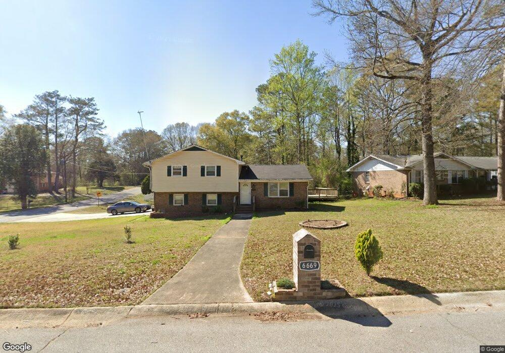
6669 Londonderry Dr Morrow, GA 30260
Estimated Value: $249,940 - $290,000
3
Beds
2
Baths
1,971
Sq Ft
$135/Sq Ft
Est. Value
About This Home
This home is located at 6669 Londonderry Dr, Morrow, GA 30260 and is currently estimated at $265,735, approximately $134 per square foot. 6669 Londonderry Dr is a home located in Clayton County with nearby schools including William M. Mcgarrah Elementary School, Rex Mill Middle School, and Mount Zion High School.
Ownership History
Date
Name
Owned For
Owner Type
Purchase Details
Closed on
Mar 9, 2007
Sold by
Nunez Nelson A
Bought by
Alas Rosa
Current Estimated Value
Home Financials for this Owner
Home Financials are based on the most recent Mortgage that was taken out on this home.
Original Mortgage
$120,000
Outstanding Balance
$72,793
Interest Rate
6.3%
Mortgage Type
New Conventional
Estimated Equity
$192,942
Purchase Details
Closed on
Jan 19, 2001
Sold by
Hud
Bought by
Nunez Nelson A
Home Financials for this Owner
Home Financials are based on the most recent Mortgage that was taken out on this home.
Original Mortgage
$82,400
Interest Rate
7.03%
Mortgage Type
New Conventional
Purchase Details
Closed on
Nov 3, 1998
Sold by
Lyle Gregory S and Lyle Tonya L
Bought by
Regions Mtg
Create a Home Valuation Report for This Property
The Home Valuation Report is an in-depth analysis detailing your home's value as well as a comparison with similar homes in the area
Home Values in the Area
Average Home Value in this Area
Purchase History
| Date | Buyer | Sale Price | Title Company |
|---|---|---|---|
| Alas Rosa | $120,000 | -- | |
| Nunez Nelson A | -- | -- | |
| Regions Mtg | $87,312 | -- |
Source: Public Records
Mortgage History
| Date | Status | Borrower | Loan Amount |
|---|---|---|---|
| Open | Alas Rosa | $120,000 | |
| Previous Owner | Nunez Nelson A | $82,400 |
Source: Public Records
Tax History Compared to Growth
Tax History
| Year | Tax Paid | Tax Assessment Tax Assessment Total Assessment is a certain percentage of the fair market value that is determined by local assessors to be the total taxable value of land and additions on the property. | Land | Improvement |
|---|---|---|---|---|
| 2024 | $3,828 | $108,120 | $7,200 | $100,920 |
| 2023 | $3,947 | $109,320 | $7,200 | $102,120 |
| 2022 | $3,143 | $90,080 | $7,200 | $82,880 |
| 2021 | $1,986 | $60,280 | $7,200 | $53,080 |
| 2020 | $1,757 | $53,928 | $7,200 | $46,728 |
| 2019 | $1,196 | $39,464 | $5,600 | $33,864 |
| 2018 | $1,037 | $35,548 | $5,600 | $29,948 |
| 2017 | $1,227 | $30,152 | $5,600 | $24,552 |
| 2016 | $1,065 | $26,172 | $5,600 | $20,572 |
| 2015 | $883 | $0 | $0 | $0 |
| 2014 | $897 | $22,560 | $6,400 | $16,160 |
Source: Public Records
Map
Nearby Homes
- 2756 Brook Dr
- 2845 Heritage Ln
- 2688 Heritage Ln
- 2681 Heritage Ln
- 2705 Heritage Ln
- 2783 Mill Lake Way
- 6584 Sleepy Hollow Ln
- 2613 Stratford Ln Unit 3
- 2617 Terrace Pkwy
- 2881 Panther Ct
- 6852 Silver Maple Dr
- 2933 Bretton Dr
- 6848 Silver Maple Dr
- 6844 Silver Maple Dr
- 6486 Aquila Dr
- 2577 Castile Dr
- 6397 E Meyer Dr
- 6485 Bobolink Ct
- 2649 Lake Harbin Rd
- 6659 Londonderry Dr
- 2746 Starr Rd
- 6687 Londonderry Dr Unit 1
- 6649 Londonderry Dr
- 6668 Londonderry Dr
- 6676 Londonderry Dr
- 2707 Brook Dr
- 6660 Londonderry Dr
- 2738 Starr Rd
- 6684 Londonderry Dr
- 6652 Londonderry Dr Unit 1
- 6641 Londonderry Dr
- 2730 Starr Rd
- 6692 Londonderry Dr Unit 1
- 6701 Londonderry Dr
- 6646 Londonderry Dr
- 2795 Starr Rd
- 6702 Londonderry Dr
- 2793 Starr Rd
- 2793 Starr Rd