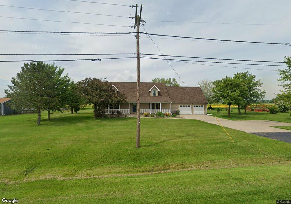
6669 W Harbor Rd Port Clinton, OH 43452
Estimated Value: $253,000 - $354,000
3
Beds
3
Baths
1,882
Sq Ft
$163/Sq Ft
Est. Value
About This Home
This home is located at 6669 W Harbor Rd, Port Clinton, OH 43452 and is currently estimated at $307,551, approximately $163 per square foot. 6669 W Harbor Rd is a home located in Ottawa County with nearby schools including Bataan Memorial Primary School, Bataan Memorial Intermediate School, and Port Clinton Middle School.
Ownership History
Date
Name
Owned For
Owner Type
Purchase Details
Closed on
Jan 5, 2024
Sold by
Courtney Dave J and Courtney Pamela J
Bought by
Courtney Dave J and Courtney Pamela J
Current Estimated Value
Purchase Details
Closed on
Aug 20, 2011
Sold by
Courtney Pamela J and Courtney David J
Bought by
Courtney David J
Home Financials for this Owner
Home Financials are based on the most recent Mortgage that was taken out on this home.
Original Mortgage
$139,500
Interest Rate
4.55%
Mortgage Type
New Conventional
Purchase Details
Closed on
Jun 30, 2004
Sold by
Blevins Brett and Blevins Joanne
Bought by
Courtney Et Al Dave J
Home Financials for this Owner
Home Financials are based on the most recent Mortgage that was taken out on this home.
Original Mortgage
$151,050
Interest Rate
6.37%
Mortgage Type
Purchase Money Mortgage
Create a Home Valuation Report for This Property
The Home Valuation Report is an in-depth analysis detailing your home's value as well as a comparison with similar homes in the area
Home Values in the Area
Average Home Value in this Area
Purchase History
| Date | Buyer | Sale Price | Title Company |
|---|---|---|---|
| Courtney Dave J | -- | None Listed On Document | |
| Courtney Dave J | -- | None Listed On Document | |
| Courtney David J | -- | Attorney | |
| Courtney Et Al Dave J | $159,000 | -- | |
| Courtney David J | $159,000 | -- |
Source: Public Records
Mortgage History
| Date | Status | Borrower | Loan Amount |
|---|---|---|---|
| Previous Owner | Courtney David J | $139,500 | |
| Previous Owner | Courtney David J | $151,050 |
Source: Public Records
Tax History Compared to Growth
Tax History
| Year | Tax Paid | Tax Assessment Tax Assessment Total Assessment is a certain percentage of the fair market value that is determined by local assessors to be the total taxable value of land and additions on the property. | Land | Improvement |
|---|---|---|---|---|
| 2024 | $2,579 | $78,894 | $8,327 | $70,567 |
| 2023 | $2,579 | $61,761 | $5,943 | $55,818 |
| 2022 | $2,240 | $61,761 | $5,943 | $55,818 |
| 2021 | $2,237 | $61,760 | $5,940 | $55,820 |
| 2020 | $2,057 | $54,480 | $5,120 | $49,360 |
| 2019 | $2,037 | $54,480 | $5,120 | $49,360 |
| 2018 | $2,033 | $54,480 | $5,120 | $49,360 |
| 2017 | $1,907 | $50,270 | $4,980 | $45,290 |
| 2016 | $1,912 | $50,270 | $4,980 | $45,290 |
| 2015 | $1,818 | $50,270 | $4,980 | $45,290 |
| 2014 | $1,810 | $48,010 | $4,980 | $43,030 |
| 2013 | $1,814 | $48,010 | $4,980 | $43,030 |
Source: Public Records
Map
Nearby Homes
- 141 N Wexford Dr E
- 295 Meachem Rd
- 265 S Meachem Rd
- 265 S Meachem Rd Unit 62
- 265 S Meachem Rd Unit 24
- 265 S Meachem Rd Unit 41
- 265 S Meachem Rd Unit 39
- 9238 W State Route 163
- 5225 W Lakeshore Dr
- 7723 W Little Portage Rd E
- 3800 W Lakeshore Dr
- 162 Oak Ridge Dr
- 2020 S Mud Creek Rd
- 2915 W Rising Sun Rd
- 2915 W Risingsun Rd
- 2860 W Rising Sun Rd
- 328 E Water St
- 2738 W Columbus St
- 147 E Water St
- 14328 W State Route 163
- 6669 West Harbor Rd
- 6669 West Harbor Rd
- 6659 West Harbor Rd
- 6711 West Harbor Rd
- 6711 W Harbor Rd
- 6598 W Harbor Rd
- 6761 West Harbor Rd
- 6862 West Harbor Rd
- 6831 West Harbor Rd
- 6863 West Harbor Rd
- 6862 W Harbor Rd
- 100 N Rymers Rd
- 6893 West Harbor Rd
- 6440 West Harbor Rd
- 6410 W Harbor Rd
- 6410 West Harbor Rd
- 185 N Rymers Rd
- 6929 West Harbor Rd
- 6929 W Harbor Rd
- 6390 West Harbor Rd