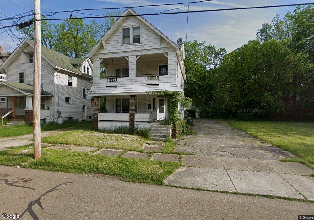
667 Dorothy Ave Akron, OH 44307
Sherbondy Hill NeighborhoodEstimated Value: $79,000 - $122,000
--
Bed
3
Baths
--
Sq Ft
4,530
Sq Ft Lot
About This Home
This home is located at 667 Dorothy Ave, Akron, OH 44307 and is currently estimated at $92,109. 667 Dorothy Ave is a home located in Summit County with nearby schools including St. Bernard-St. Mary Elementary School.
Ownership History
Date
Name
Owned For
Owner Type
Purchase Details
Closed on
Jun 28, 2021
Sold by
Alon Llc
Bought by
New Corp Immo Invest Llc
Current Estimated Value
Purchase Details
Closed on
Jul 10, 2019
Sold by
True Pair Llc
Bought by
Alon Llc
Purchase Details
Closed on
Mar 27, 2002
Sold by
Price William T
Bought by
Price William T and Price Marianne
Home Financials for this Owner
Home Financials are based on the most recent Mortgage that was taken out on this home.
Original Mortgage
$26,500
Interest Rate
6.93%
Purchase Details
Closed on
Jun 25, 1996
Sold by
United Companies Lending
Bought by
Price William T
Home Financials for this Owner
Home Financials are based on the most recent Mortgage that was taken out on this home.
Original Mortgage
$29,900
Interest Rate
8.29%
Mortgage Type
New Conventional
Purchase Details
Closed on
May 21, 1996
Sold by
Shrf Ardie B Whiting Pr
Bought by
United Companies Lending Corp
Home Financials for this Owner
Home Financials are based on the most recent Mortgage that was taken out on this home.
Original Mortgage
$29,900
Interest Rate
8.29%
Mortgage Type
New Conventional
Create a Home Valuation Report for This Property
The Home Valuation Report is an in-depth analysis detailing your home's value as well as a comparison with similar homes in the area
Home Values in the Area
Average Home Value in this Area
Purchase History
| Date | Buyer | Sale Price | Title Company |
|---|---|---|---|
| New Corp Immo Invest Llc | $63,000 | None Available | |
| Alon Llc | $5,400 | None Available | |
| True Pair Llc | $32,000 | None Available | |
| Price William T | -- | Tower City Title Agency Inc | |
| Price William T | $30,000 | -- | |
| United Companies Lending Corp | $30,000 | -- |
Source: Public Records
Mortgage History
| Date | Status | Borrower | Loan Amount |
|---|---|---|---|
| Previous Owner | Price William T | $26,500 | |
| Previous Owner | Price William T | $29,900 |
Source: Public Records
Tax History Compared to Growth
Tax History
| Year | Tax Paid | Tax Assessment Tax Assessment Total Assessment is a certain percentage of the fair market value that is determined by local assessors to be the total taxable value of land and additions on the property. | Land | Improvement |
|---|---|---|---|---|
| 2025 | $8,761 | $16,720 | $3,612 | $13,108 |
| 2024 | $6,375 | $16,720 | $3,612 | $13,108 |
| 2023 | $8,761 | $16,720 | $3,612 | $13,108 |
| 2022 | $922 | $10,196 | $2,125 | $8,071 |
| 2021 | $823 | $10,196 | $2,125 | $8,071 |
| 2020 | $912 | $10,200 | $2,130 | $8,070 |
| 2019 | $1,023 | $10,780 | $2,490 | $8,290 |
| 2018 | $843 | $10,780 | $2,490 | $8,290 |
| 2017 | $870 | $10,780 | $2,490 | $8,290 |
| 2016 | $871 | $10,970 | $2,490 | $8,480 |
| 2015 | $870 | $10,970 | $2,490 | $8,480 |
| 2014 | $863 | $10,970 | $2,490 | $8,480 |
| 2013 | $847 | $10,970 | $2,490 | $8,480 |
Source: Public Records
Map
Nearby Homes
- 639 Bellevue Ave
- 650 Easter Ave
- 670 Euclid Ave
- 677 Vernon Odom Blvd
- 737 Vernon Odom Blvd
- 817 Raymond St
- 776 Krause Ct
- 985 Diana Ave
- 1132 Bristol Terrace
- 853 Fried St
- 385 Campbell St
- 861 Glenn St
- 949 Raymond St
- 881 Stoner St
- 577 Rhodes Ave
- 614 East Ave
- 644 Diagonal Rd
- 1206 Diagonal Rd
- VL Mercer Ave
- 605 East Ave
- 671 Dorothy Ave
- 675 Dorothy Ave
- 670 Bellevue Ave
- 655 Dorothy Ave
- 674 Bellevue Ave
- 778 Ruth Ave
- 678 Bellevue Ave
- 907 East Ave
- 919 East Ave
- 651 Dorothy Ave
- 676 Dorothy Ave
- 656 Bellevue Ave
- 672 Dorothy Ave
- 782 Ruth Ave
- 680 Dorothy Ave
- 647 Dorothy Ave
- 652 Bellevue Ave
- 0 Bellevue Ave Unit 3118658
- 786 Ruth Ave
- 777 Ruth Ave