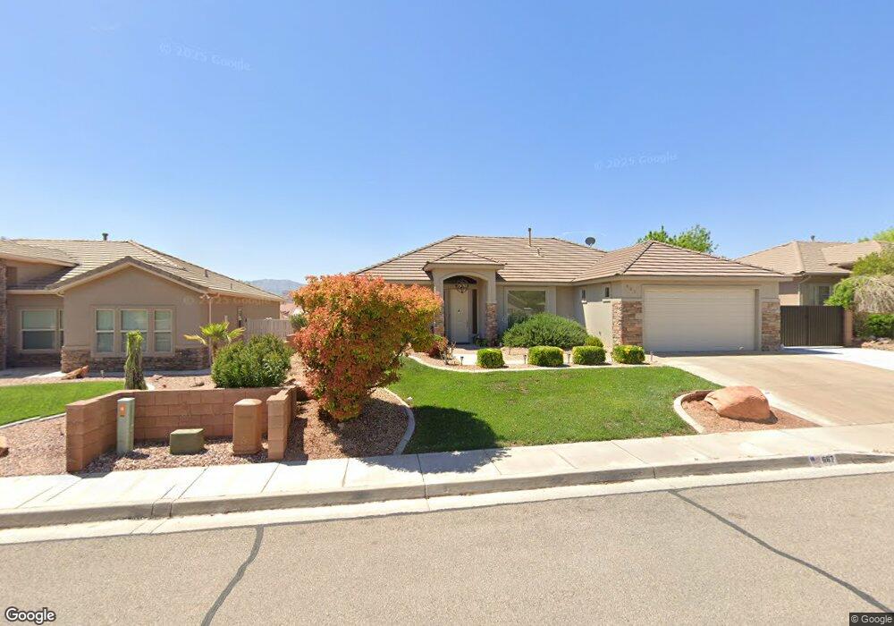
667 N 1620 W St. George, UT 84770
Estimated Value: $450,313 - $461,000
3
Beds
2
Baths
1,618
Sq Ft
$280/Sq Ft
Est. Value
About This Home
This home is located at 667 N 1620 W, St. George, UT 84770 and is currently estimated at $453,828, approximately $280 per square foot. 667 N 1620 W is a home located in Washington County with nearby schools including Sunset School, Snow Canyon Middle School, and Lava Ridge Intermediate School.
Ownership History
Date
Name
Owned For
Owner Type
Purchase Details
Closed on
Oct 6, 2020
Sold by
Dumble Brandon Michael and Dumble Michelle Rose
Bought by
Gallegos Kerissa and Gallegos Christopher Lewis
Current Estimated Value
Home Financials for this Owner
Home Financials are based on the most recent Mortgage that was taken out on this home.
Original Mortgage
$338,151
Outstanding Balance
$300,767
Interest Rate
2.9%
Mortgage Type
FHA
Estimated Equity
$153,061
Purchase Details
Closed on
Oct 4, 2005
Sold by
Graham Robert D
Bought by
Graham Robert D and Robert D Graham Family Trust
Purchase Details
Closed on
Jun 24, 2005
Sold by
Graham Robert D
Bought by
Graham Robert D and Graham Kimberly J
Home Financials for this Owner
Home Financials are based on the most recent Mortgage that was taken out on this home.
Original Mortgage
$176,000
Interest Rate
5.58%
Mortgage Type
Purchase Money Mortgage
Create a Home Valuation Report for This Property
The Home Valuation Report is an in-depth analysis detailing your home's value as well as a comparison with similar homes in the area
Home Values in the Area
Average Home Value in this Area
Purchase History
| Date | Buyer | Sale Price | Title Company |
|---|---|---|---|
| Gallegos Kerissa | -- | Eagle Gate Ttl Ins Agcy Inc | |
| Graham Robert D | -- | None Available | |
| Graham Robert D | -- | None Available | |
| Graham Robert D | -- | Valley Title Co | |
| Graham Robert D | -- | None Available |
Source: Public Records
Mortgage History
| Date | Status | Borrower | Loan Amount |
|---|---|---|---|
| Open | Gallegos Kerissa | $338,151 | |
| Previous Owner | Graham Robert D | $176,000 |
Source: Public Records
Tax History Compared to Growth
Tax History
| Year | Tax Paid | Tax Assessment Tax Assessment Total Assessment is a certain percentage of the fair market value that is determined by local assessors to be the total taxable value of land and additions on the property. | Land | Improvement |
|---|---|---|---|---|
| 2025 | $1,605 | $245,245 | $46,750 | $198,495 |
| 2023 | $1,702 | $254,320 | $35,750 | $218,570 |
| 2022 | $1,784 | $250,690 | $35,750 | $214,940 |
| 2021 | $1,603 | $335,900 | $45,000 | $290,900 |
| 2020 | $1,426 | $281,500 | $45,000 | $236,500 |
| 2019 | $1,407 | $271,200 | $50,000 | $221,200 |
| 2018 | $1,303 | $129,690 | $0 | $0 |
| 2017 | $1,213 | $117,260 | $0 | $0 |
| 2016 | $1,263 | $112,915 | $0 | $0 |
| 2015 | $1,204 | $103,235 | $0 | $0 |
| 2014 | $1,292 | $111,485 | $0 | $0 |
Source: Public Records
Map
Nearby Homes
- 1732 N 540 W Unit 120
- 1385 W 625 N
- 1385 W 625 North St
- 1732 W 540 N Unit 120
- 1732 W 540 N Unit 13
- 1732 W 540 N Unit 68
- 1732 W 540 N Unit 17
- 1732 W 540 N Unit 92
- 1735 W 540 N Unit 2302
- 1735 W 540 N Unit 2302
- 1735 W 540 N Unit 1202
- 954 N 1725 W Unit 32
- 727 N 1275 W
- 1708 W 1020 N Unit 146
- 695 N Daybreak Dr
- 1782 W 1020 N Unit 133
- 1075 N 1400 W Unit 32
- 1070 1400 St W
- 1840 W 1100 N Unit 28
- 1840 W 1100 N Unit 17
- 667 N 1620 West Cir
- 681 N 1620 W
- 681 N 1620 West Cir
- 653 N 1620 West Cir
- 0 1620 St W
- 0 1620 St W
- 0 1620 St W
- 668 N 1620 West Cir
- 668 N 1620 Cir W
- 695 N 1620 West Cir
- 682 N 1620 West Cir
- 641 N 1620 W
- 682 N 1620 W
- 641 N 1620 West Cir
- 695 N 1620 Cir W
- 696 N 1620 W
- 696 N 1620 West Cir
- 1611 W 650 N
- 709 N 1620 Cir W
- 709 N 1620 West Cir