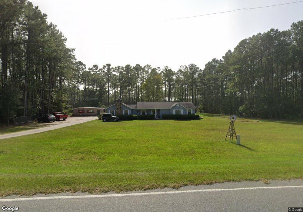
667 Nine Run Rd Screven, GA 31560
Estimated Value: $225,891 - $265,000
--
Bed
2
Baths
1,899
Sq Ft
$129/Sq Ft
Est. Value
About This Home
This home is located at 667 Nine Run Rd, Screven, GA 31560 and is currently estimated at $245,223, approximately $129 per square foot. 667 Nine Run Rd is a home located in Wayne County with nearby schools including Screven Elementary School, Arthur Williams Middle School, and Wayne County High School.
Ownership History
Date
Name
Owned For
Owner Type
Purchase Details
Closed on
Oct 31, 2007
Sold by
Copeland Hugh S
Bought by
Copeland Sarah D
Current Estimated Value
Purchase Details
Closed on
Jan 1, 1996
Purchase Details
Closed on
May 1, 1993
Purchase Details
Closed on
Mar 1, 1993
Purchase Details
Closed on
Jun 1, 1977
Purchase Details
Closed on
Aug 1, 1976
Create a Home Valuation Report for This Property
The Home Valuation Report is an in-depth analysis detailing your home's value as well as a comparison with similar homes in the area
Home Values in the Area
Average Home Value in this Area
Purchase History
| Date | Buyer | Sale Price | Title Company |
|---|---|---|---|
| Copeland Sarah D | $25,000 | -- | |
| -- | $63,000 | -- | |
| -- | -- | -- | |
| -- | $3,000 | -- | |
| -- | -- | -- | |
| -- | -- | -- |
Source: Public Records
Tax History Compared to Growth
Tax History
| Year | Tax Paid | Tax Assessment Tax Assessment Total Assessment is a certain percentage of the fair market value that is determined by local assessors to be the total taxable value of land and additions on the property. | Land | Improvement |
|---|---|---|---|---|
| 2024 | $2,059 | $82,721 | $1,214 | $81,507 |
| 2023 | $2,202 | $73,384 | $1,214 | $72,170 |
| 2022 | $1,741 | $60,313 | $1,214 | $59,099 |
| 2021 | $1,677 | $54,720 | $1,214 | $53,506 |
| 2020 | $1,824 | $57,274 | $3,768 | $53,506 |
| 2019 | $1,878 | $57,274 | $3,768 | $53,506 |
| 2018 | $1,878 | $57,274 | $3,768 | $53,506 |
| 2017 | $1,616 | $57,274 | $3,768 | $53,506 |
Source: Public Records
Map
Nearby Homes
- 301 Whitaker Dr
- 406 Cw Collins St
- 109 Joyner St
- 102 Highsmith Ave
- 868 Broadhurst Rd W
- 0 S Forks Rd
- 391 S Forks Rd
- 0 Dale Mill Rd
- 59 Enoch Moody Rd
- 9009 Waycross Hwy
- 362 Crosby Ln
- 88 Minnesota Rd
- 7132 Waycross Hwy
- 7114 Waycross Hwy
- 7014 Waycross Hwy
- 6005 Chancey Rd
- 2460 Thornton Rd
- 1435 E Lake Dr
- 301 Broadhurst Rd
- 675 Foxwood Cir
- 269 Sandy Hill Rd
- 613 Cw Collins St
- 605 Cw Collins St
- 618 Cw Collins St
- 622 Cw Collins St
- 303 School St
- 609 Cw Collins St
- 612 Cw Collins St
- 577 Nine Run Rd
- 610 Cw Collins St
- 628 Nine Run Rd
- 133 Sycamore St
- 607 Cw Collins St
- 608 Cw Collins St
- 125 Sycamore St
- 606 Cw Collins St
- 603 Cw Collins St
- Trk B South Forks
- 201 Whitaker Dr
- 119 Sycamore St