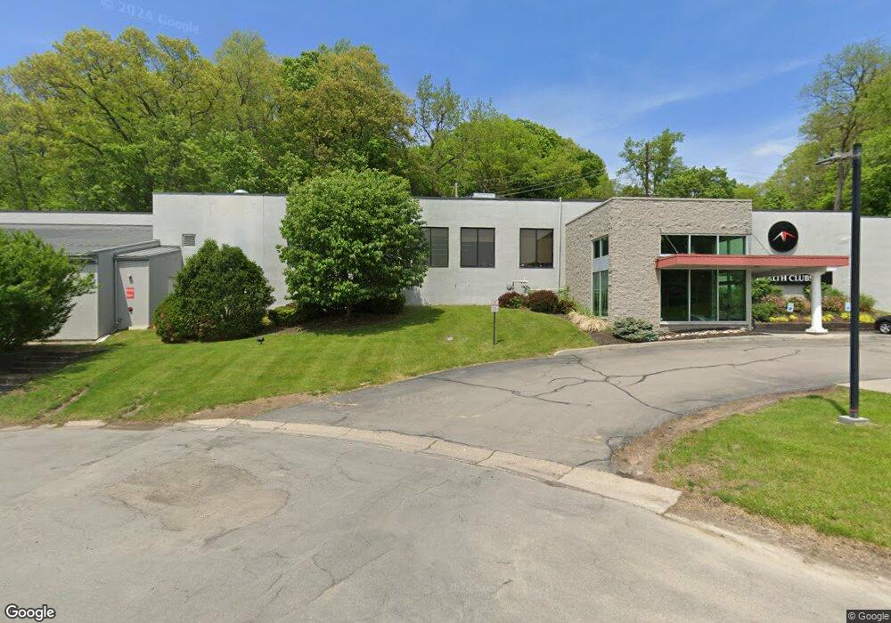
667 Panorama Trail W Rochester, NY 14625
Estimated Value: $3,666,129
--
Bed
--
Bath
39,523
Sq Ft
$93/Sq Ft
Est. Value
About This Home
This home is located at 667 Panorama Trail W, Rochester, NY 14625 and is currently estimated at $3,666,129, approximately $92 per square foot. 667 Panorama Trail W is a home located in Monroe County with nearby schools including Bay Trail Middle School, Penfield Senior High School, and Charles Finney School (The).
Ownership History
Date
Name
Owned For
Owner Type
Purchase Details
Closed on
Feb 20, 2023
Sold by
Hanford Health Llc
Bought by
Dgna Real Estate Holdings Llc
Current Estimated Value
Home Financials for this Owner
Home Financials are based on the most recent Mortgage that was taken out on this home.
Original Mortgage
$1,400,000
Outstanding Balance
$1,354,464
Interest Rate
6.13%
Mortgage Type
New Conventional
Estimated Equity
$2,278,862
Purchase Details
Closed on
Jul 1, 2015
Sold by
Penfield Racquet Club Inc
Bought by
Hanford Health Llc
Home Financials for this Owner
Home Financials are based on the most recent Mortgage that was taken out on this home.
Original Mortgage
$200,671
Interest Rate
3.87%
Mortgage Type
Commercial
Create a Home Valuation Report for This Property
The Home Valuation Report is an in-depth analysis detailing your home's value as well as a comparison with similar homes in the area
Home Values in the Area
Average Home Value in this Area
Purchase History
| Date | Buyer | Sale Price | Title Company |
|---|---|---|---|
| Dgna Real Estate Holdings Llc | $2,600,000 | -- | |
| Hanford Health Llc | $966,328 | None Available |
Source: Public Records
Mortgage History
| Date | Status | Borrower | Loan Amount |
|---|---|---|---|
| Open | Dgna Real Estate Holdings Llc | $1,400,000 | |
| Previous Owner | Hanford Health Llc | $200,671 |
Source: Public Records
Tax History Compared to Growth
Tax History
| Year | Tax Paid | Tax Assessment Tax Assessment Total Assessment is a certain percentage of the fair market value that is determined by local assessors to be the total taxable value of land and additions on the property. | Land | Improvement |
|---|---|---|---|---|
| 2024 | $2,614 | $2,808,600 | $417,000 | $2,391,600 |
| 2023 | $54,703 | $1,807,000 | $417,000 | $1,390,000 |
| 2022 | $78,687 | $1,807,000 | $417,000 | $1,390,000 |
| 2021 | $48,477 | $1,112,000 | $410,000 | $702,000 |
| 2020 | $50,203 | $1,112,000 | $410,000 | $702,000 |
| 2019 | $49,686 | $1,112,000 | $410,000 | $702,000 |
| 2018 | $48,762 | $1,112,000 | $410,000 | $702,000 |
| 2017 | $49,781 | $1,112,000 | $410,000 | $702,000 |
| 2016 | $49,686 | $1,112,000 | $410,000 | $702,000 |
| 2015 | -- | $1,112,000 | $410,000 | $702,000 |
| 2014 | -- | $1,112,000 | $410,000 | $702,000 |
Source: Public Records
Map
Nearby Homes
- 37 Penn Ln
- 59 Waterview Cir
- 121 Gebhardt Rd
- 7 Sky Ridge Dr
- 41 Burrows Hills Dr
- 26 Fondiller Dr
- 1986 Five Mile Line Rd
- 6 Devonshire Dr
- 25 Patio Dr
- 36 Patio Dr
- 40 Norhill Dr
- 69 Alta Vista Dr
- 8 Harway Dr
- 31 Ewald Dr
- 26 Ewald Dr
- 127 Collingsworth Dr
- 124 Milrace Dr
- 340 N Washington St
- 10 Peachtree Rd
- 7 Skyway Dr
- 30 Lost Mountain Trail Unit 5F
- 28 Lost Mountain Trail
- 26 Lost Mountain Trail
- 29 Lost Mountain Trail
- 27 Lost Mountain Trail
- 25 Lost Mountain Trail Unit 5A
- 22 Lost Mountain Trail
- 24 Lost Mountain Trail
- 20 Lost Mountain Trail Unit 4B
- 23 Lost Mountain Trail
- 21 Lost Mountain Trail
- 19 Lost Mountain Trail
- 35 Lost Mountain Trail
- 33 Lost Mountain Trail
- 31 Lost Mountain Trail
- 32 Lost Mountain Trail
- 36 Lost Mountain Trail
- 34 Lost Mountain Trail Unit 6D
- 18 Lost Mountain Trail
- 16 Lost Mountain Trail