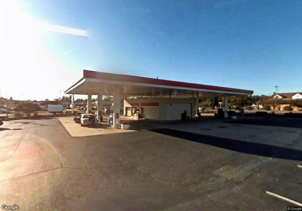
6670 Crain Hwy La Plata, MD 20646
Estimated Value: $1,534,115
--
Bed
--
Bath
1,104
Sq Ft
$1,390/Sq Ft
Est. Value
About This Home
This home is located at 6670 Crain Hwy, La Plata, MD 20646 and is currently estimated at $1,534,115, approximately $1,389 per square foot. 6670 Crain Hwy is a home located in Charles County with nearby schools including Mary Matula Elementary School, Milton M. Somers Middle School, and La Plata High School.
Ownership History
Date
Name
Owned For
Owner Type
Purchase Details
Closed on
Dec 14, 2011
Sold by
Southside Oil Llc
Bought by
Dash In Food Stores Inc
Current Estimated Value
Purchase Details
Closed on
Jun 23, 2010
Sold by
Exxon Corporation
Bought by
Southside Oil Llc
Purchase Details
Closed on
Aug 21, 1996
Sold by
Calomiris William J Coopersmith
Bought by
Calomiris William
Purchase Details
Closed on
Apr 16, 1991
Sold by
Calomiris William and Calomiris Coopersmith J
Bought by
Exxon Corporation
Create a Home Valuation Report for This Property
The Home Valuation Report is an in-depth analysis detailing your home's value as well as a comparison with similar homes in the area
Home Values in the Area
Average Home Value in this Area
Purchase History
| Date | Buyer | Sale Price | Title Company |
|---|---|---|---|
| Dash In Food Stores Inc | $770,000 | None Available | |
| Southside Oil Llc | $3,578,627 | -- | |
| Calomiris William | $103,000 | -- | |
| Exxon Corporation | $575,000 | -- |
Source: Public Records
Tax History Compared to Growth
Tax History
| Year | Tax Paid | Tax Assessment Tax Assessment Total Assessment is a certain percentage of the fair market value that is determined by local assessors to be the total taxable value of land and additions on the property. | Land | Improvement |
|---|---|---|---|---|
| 2025 | -- | $1,160,500 | $457,900 | $702,600 |
| 2024 | $17,858 | $1,160,500 | $457,900 | $702,600 |
| 2023 | $20,297 | $1,160,500 | $457,900 | $702,600 |
| 2022 | $15,638 | $1,044,433 | $0 | $0 |
| 2021 | $12,215 | $928,367 | $0 | $0 |
| 2020 | $12,215 | $812,300 | $438,400 | $373,900 |
| 2019 | $12,260 | $812,300 | $438,400 | $373,900 |
| 2018 | $12,208 | $812,300 | $438,400 | $373,900 |
| 2017 | $12,505 | $827,500 | $0 | $0 |
| 2016 | -- | $827,500 | $0 | $0 |
| 2015 | $15,113 | $827,500 | $0 | $0 |
| 2014 | $15,113 | $1,041,000 | $0 | $0 |
Source: Public Records
Map
Nearby Homes
- 107 Howard St
- Lot 241 Washington
- 45 Hibiscus Ct
- The Adelina Plan at Fischer's Grant
- The Westminster Plan at Fischer's Grant
- The Brentwood Plan at Fischer's Grant
- The Lancaster Plan at Fischer's Grant
- The Winchester Plan at Fischer's Grant
- The Willow Plan at Fischer's Grant
- The Oxford Plan at Fischer's Grant
- The Fairfax Plan at Fischer's Grant
- The Belmont Plan at Fischer's Grant
- The Glenwood Plan at Fischer's Grant
- The Hampton Plan at Fischer's Grant
- The Somerset Plan at Fischer's Grant
- The Ashland Plan at Fischer's Grant
- 6 Gramby Ct
- 214B Washington Ave
- 9 Gramby Ct
- 72 Camden Cir
- 104 E Charles St
- 6660 Crain Hwy
- 101 SUITE 302 E Charles St
- 101 E Charles St
- 101 E Charles St Unit 206
- 101 E Charles St Unit 300
- 101 E Charles St Unit 200
- 101 E Charles St Unit 208
- 101 E Charles St Unit 202
- 101 E Charles St Unit 214
- 101 E Charles St Unit 106
- 101 E Charles St Unit 104
- 101 E Charles St Unit 312
- 101 E Charles St Unit 204
- 101 E Charles St Unit 212
- 101 E Charles St Unit 210
- 0 Charles St Unit 1007925108
- 0 Charles St Unit 1000178523
- 0 Charles St Unit CH6695779
- 0 Charles St Unit 1000076321