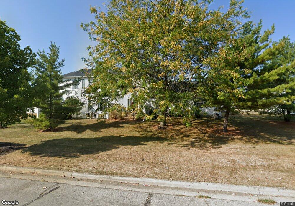
6671 Lagrange Dr Unit 45B Canal Winchester, OH 43110
East Columbus-White Ash NeighborhoodEstimated Value: $161,000 - $198,003
2
Beds
2
Baths
1,280
Sq Ft
$143/Sq Ft
Est. Value
About This Home
This home is located at 6671 Lagrange Dr Unit 45B, Canal Winchester, OH 43110 and is currently estimated at $182,501, approximately $142 per square foot. 6671 Lagrange Dr Unit 45B is a home located in Franklin County with nearby schools including Liberty Elementary School, Yorktown Middle School, and Independence High School.
Ownership History
Date
Name
Owned For
Owner Type
Purchase Details
Closed on
Jun 29, 2011
Sold by
Mckitrick David J and Mckitrick Martha
Bought by
Evans Stephanie L
Current Estimated Value
Home Financials for this Owner
Home Financials are based on the most recent Mortgage that was taken out on this home.
Original Mortgage
$54,900
Outstanding Balance
$37,983
Interest Rate
4.63%
Mortgage Type
New Conventional
Estimated Equity
$144,518
Purchase Details
Closed on
May 18, 2000
Sold by
Qualstan Corp
Bought by
Mckitrick David J
Home Financials for this Owner
Home Financials are based on the most recent Mortgage that was taken out on this home.
Original Mortgage
$95,493
Interest Rate
8.21%
Mortgage Type
FHA
Create a Home Valuation Report for This Property
The Home Valuation Report is an in-depth analysis detailing your home's value as well as a comparison with similar homes in the area
Home Values in the Area
Average Home Value in this Area
Purchase History
| Date | Buyer | Sale Price | Title Company |
|---|---|---|---|
| Evans Stephanie L | $54,900 | Talon Group | |
| Mckitrick David J | $97,700 | Transohio Title |
Source: Public Records
Mortgage History
| Date | Status | Borrower | Loan Amount |
|---|---|---|---|
| Open | Evans Stephanie L | $54,900 | |
| Previous Owner | Mckitrick David J | $95,493 |
Source: Public Records
Tax History Compared to Growth
Tax History
| Year | Tax Paid | Tax Assessment Tax Assessment Total Assessment is a certain percentage of the fair market value that is determined by local assessors to be the total taxable value of land and additions on the property. | Land | Improvement |
|---|---|---|---|---|
| 2024 | $2,438 | $54,320 | $12,250 | $42,070 |
| 2023 | $2,407 | $54,320 | $12,250 | $42,070 |
| 2022 | $1,737 | $33,500 | $4,170 | $29,330 |
| 2021 | $1,741 | $33,500 | $4,170 | $29,330 |
| 2020 | $1,743 | $33,500 | $4,170 | $29,330 |
| 2019 | $1,625 | $26,780 | $3,330 | $23,450 |
| 2018 | $1,419 | $26,780 | $3,330 | $23,450 |
| 2017 | $1,482 | $26,780 | $3,330 | $23,450 |
| 2016 | $1,340 | $20,230 | $3,570 | $16,660 |
| 2015 | $1,217 | $20,230 | $3,570 | $16,660 |
| 2014 | $1,219 | $20,230 | $3,570 | $16,660 |
| 2013 | $708 | $23,800 | $4,200 | $19,600 |
Source: Public Records
Map
Nearby Homes
- 6757 Lagrange Dr Unit 57A
- 6755 Axtel Dr Unit 14C
- 6772 Hamler Dr Unit 25B
- 6297 Marengo St
- Fairton Plan at Brookview
- Sienna Plan at Brookview
- Pendleton Plan at Brookview
- Bellamy Plan at Brookview
- Henley Plan at Brookview
- Harmony Plan at Brookview
- Chatham Plan at Brookview
- Juniper Plan at Brookview
- 6832 Axtel Dr Unit 23D
- 6830 Axtel Dr Unit 23C
- 6828 Axtel Dr Unit 23B
- 5195 Mantua Dr Unit 62D
- 6289 Tarklin St
- 5012 Gore St
- 5200 Mantua Dr Unit 63C
- 6977 Remsen Dr Unit 77D
- 6669 Lagrange Dr Unit 45C
- 6673 Lagrange Dr Unit 45A
- 6667 Lagrange Dr Unit 45D
- 6665 Lagrange Dr Unit 45E
- 6677 Lagrange Dr Unit 47E
- 6674 Lagrange Dr Unit 46D
- 6668 Lagrange Dr Unit 46A
- 6670 Lagrange Dr Unit 46B
- 6672 Lagrange Dr Unit 46C
- 6679 Lagrange Dr Unit 47D
- 6676 Lagrange Dr Unit 46E
- 6661 Lagrange Dr Unit 44A
- 6681 Lagrange Dr Unit 47C
- 6683 Lagrange Dr Unit 47B
- 6659 Lagrange Dr Unit 44B
- 6659 Lagrange Dr Unit 44B
- 6657 Lagrange Dr Unit 44C
- 6680 Lagrange Dr Unit 48A
- 6685 Lagrange Dr Unit 47A
- 6652 Lagrange Dr Unit 43B