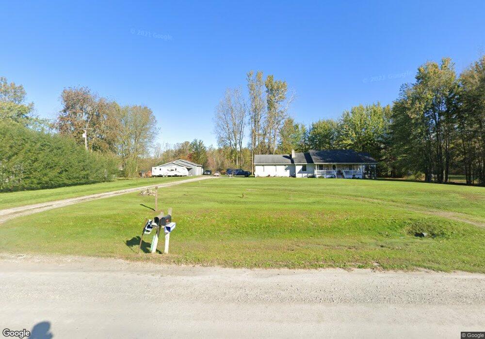
6672 Ravenswood Rd Kimball, MI 48074
Estimated Value: $351,000 - $495,485
3
Beds
2
Baths
1,643
Sq Ft
$260/Sq Ft
Est. Value
About This Home
This home is located at 6672 Ravenswood Rd, Kimball, MI 48074 and is currently estimated at $426,871, approximately $259 per square foot. 6672 Ravenswood Rd is a home located in St. Clair County with nearby schools including Marysville High School.
Ownership History
Date
Name
Owned For
Owner Type
Purchase Details
Closed on
Jun 23, 2014
Sold by
Duckworth Robert George and Duckworth Kathlee Joy
Bought by
Moore Glenn E and Moore Michelle L
Current Estimated Value
Home Financials for this Owner
Home Financials are based on the most recent Mortgage that was taken out on this home.
Original Mortgage
$169,387
Outstanding Balance
$128,839
Interest Rate
4.2%
Mortgage Type
New Conventional
Estimated Equity
$298,032
Purchase Details
Closed on
Oct 5, 2005
Sold by
Bank One Na
Bought by
Duckworth Robert and Duckworth Kathleen J
Home Financials for this Owner
Home Financials are based on the most recent Mortgage that was taken out on this home.
Original Mortgage
$50,000
Interest Rate
6.04%
Mortgage Type
New Conventional
Create a Home Valuation Report for This Property
The Home Valuation Report is an in-depth analysis detailing your home's value as well as a comparison with similar homes in the area
Home Values in the Area
Average Home Value in this Area
Purchase History
| Date | Buyer | Sale Price | Title Company |
|---|---|---|---|
| Moore Glenn E | $166,000 | None Available | |
| Duckworth Robert | $28,000 | None Available |
Source: Public Records
Mortgage History
| Date | Status | Borrower | Loan Amount |
|---|---|---|---|
| Open | Moore Glenn E | $169,387 | |
| Previous Owner | Duckworth Robert | $50,000 |
Source: Public Records
Tax History Compared to Growth
Tax History
| Year | Tax Paid | Tax Assessment Tax Assessment Total Assessment is a certain percentage of the fair market value that is determined by local assessors to be the total taxable value of land and additions on the property. | Land | Improvement |
|---|---|---|---|---|
| 2025 | $4,912 | $241,500 | $0 | $0 |
| 2024 | $1,802 | $227,700 | $0 | $0 |
| 2023 | $1,716 | $209,800 | $0 | $0 |
| 2022 | $4,458 | $185,700 | $0 | $0 |
| 2021 | $3,917 | $167,100 | $0 | $0 |
| 2020 | $3,917 | $165,000 | $47,600 | $117,400 |
| 2019 | $3,844 | $156,400 | $0 | $0 |
| 2018 | $3,754 | $129,800 | $0 | $0 |
| 2017 | $3,677 | $127,000 | $0 | $0 |
| 2016 | $1,453 | $127,000 | $0 | $0 |
| 2015 | -- | $127,700 | $37,700 | $90,000 |
| 2014 | -- | $147,900 | $37,700 | $110,200 |
| 2013 | -- | $126,600 | $0 | $0 |
Source: Public Records
Map
Nearby Homes
- 1261 Sturdevant Rd
- 1371 Sturdevant Rd
- 6417 Dove Rd
- 6928 Smiths Creek Rd
- 1533 Richman Rd
- 1688 Sturdevant Rd
- 355 Henry St
- 1671 Ditty Rd
- 1900 Burns Rd
- VL Lambs Rd
- 00 Griswold Rd
- 0 Sparling Rd Unit 2210034403
- 1876 Morningstar Ave
- 2019 Edward Ln E
- 8067 Lambs Rd
- 8237 Lambs Rd
- 7710 Sparling Rd
- 1091 Allen Rd
- 5035 Burma Rd
- 0 Sparling Unit 20230091288
- 6750 Ravenswood Rd
- 6750 Ravenswood Rd
- 6770 Ravenswood Rd
- 6669 Ravenswood Rd
- 6677 Ravenswood Rd
- 6664 Ravenswood Rd
- 6671 Ravenswood Rd
- 6665 Ravenswood Rd
- 6771 Ravenswood Rd
- 6647 Ravenswood Rd
- 6598 Ravenswood Rd
- 6782 Ravenswood Rd
- 6776 Ravenswood Rd
- 6594 Ravenswood Rd
- 6781 Ravenswood Rd
- 6631 Ravenswood Rd
- 6783 Ravenswood Rd
- 6572 Ravenswood Rd
- 6654 Ravenswood Rd
- 6787 Ravenswood Rd