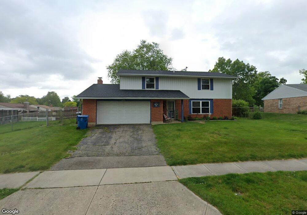
6675 Dial Dr Dayton, OH 45424
Estimated Value: $243,000 - $283,000
4
Beds
3
Baths
2,226
Sq Ft
$119/Sq Ft
Est. Value
About This Home
This home is located at 6675 Dial Dr, Dayton, OH 45424 and is currently estimated at $264,350, approximately $118 per square foot. 6675 Dial Dr is a home located in Montgomery County with nearby schools including Wayne High School and Huber Heights Christian Academy.
Ownership History
Date
Name
Owned For
Owner Type
Purchase Details
Closed on
Mar 31, 2006
Sold by
Lock Robert L and Lock Lesa
Bought by
Curry Ahmed H and Curry Mollie R
Current Estimated Value
Home Financials for this Owner
Home Financials are based on the most recent Mortgage that was taken out on this home.
Original Mortgage
$118,350
Outstanding Balance
$67,509
Interest Rate
6.62%
Mortgage Type
Fannie Mae Freddie Mac
Estimated Equity
$196,841
Purchase Details
Closed on
Jun 15, 1998
Sold by
Wells Richard L and Wells Cynthia J
Bought by
Lock Ii Robert L
Home Financials for this Owner
Home Financials are based on the most recent Mortgage that was taken out on this home.
Original Mortgage
$105,200
Interest Rate
7.15%
Create a Home Valuation Report for This Property
The Home Valuation Report is an in-depth analysis detailing your home's value as well as a comparison with similar homes in the area
Home Values in the Area
Average Home Value in this Area
Purchase History
| Date | Buyer | Sale Price | Title Company |
|---|---|---|---|
| Curry Ahmed H | $131,500 | None Available | |
| Lock Ii Robert L | $116,900 | -- | |
| Lock Ii Robert L | $116,900 | -- |
Source: Public Records
Mortgage History
| Date | Status | Borrower | Loan Amount |
|---|---|---|---|
| Open | Curry Ahmed H | $118,350 | |
| Closed | Lock Ii Robert L | $105,200 |
Source: Public Records
Tax History
| Year | Tax Paid | Tax Assessment Tax Assessment Total Assessment is a certain percentage of the fair market value that is determined by local assessors to be the total taxable value of land and additions on the property. | Land | Improvement |
|---|---|---|---|---|
| 2025 | $3,897 | $73,260 | $12,340 | $60,920 |
| 2024 | $3,763 | $73,260 | $12,340 | $60,920 |
| 2023 | $3,763 | $73,260 | $12,340 | $60,920 |
| 2022 | $3,390 | $51,990 | $8,750 | $43,240 |
| 2021 | $3,434 | $51,990 | $8,750 | $43,240 |
| 2020 | $3,437 | $51,990 | $8,750 | $43,240 |
| 2019 | $3,228 | $43,150 | $8,750 | $34,400 |
| 2018 | $3,239 | $43,150 | $8,750 | $34,400 |
| 2017 | $3,217 | $43,150 | $8,750 | $34,400 |
| 2016 | $3,144 | $41,090 | $8,750 | $32,340 |
| 2015 | $3,103 | $41,090 | $8,750 | $32,340 |
| 2014 | $3,103 | $41,090 | $8,750 | $32,340 |
| 2012 | -- | $44,470 | $8,750 | $35,720 |
Source: Public Records
Map
Nearby Homes
- 5260 Beechview Dr
- 2254 Kiel St
- 2245 Kiel St
- 2260 Kiel St
- 2251 Kiel St
- 5667 Troy Villa Blvd Unit 20081
- 4942 Birchview Ct
- 6388 Stoney Creek Dr
- 6686 Oakwood Ln
- 5873 Troy Villa Blvd Unit 20174
- 5812 Troy Villa Blvd Unit 20005
- 6724 Willow Creek Dr
- 5934 Troy Villa Blvd Unit 20066
- 7173 Caledonian Ave
- 7167 Caledonian Ave
- 6745 Oakwood Ln
- 6750 Tiger Dr
- 5907 Beech Ct
- 7259 Charnwood Dr
- 5917 Longford Rd
- 6685 Dial Dr
- 5121 Lincrest Place
- 6620 Teakwood Ct
- 5111 Lincrest Place
- 6691 Dial Dr
- 6670 Dial Dr
- 6684 Dial Dr
- 5101 Lincrest Place
- 6656 Dial Dr
- 6630 Teakwood Ct
- 6700 Locustview Dr
- 6695 Dial Dr
- 6542 Wrenview Ct
- 5120 Lincrest Place
- 6642 Dial Dr
- 5110 Lincrest Place
- 6532 Wrenview Ct
- 6710 Locustview Dr
- 6621 Teakwood Ct
- 6631 Teakwood Ct
Your Personal Tour Guide
Ask me questions while you tour the home.