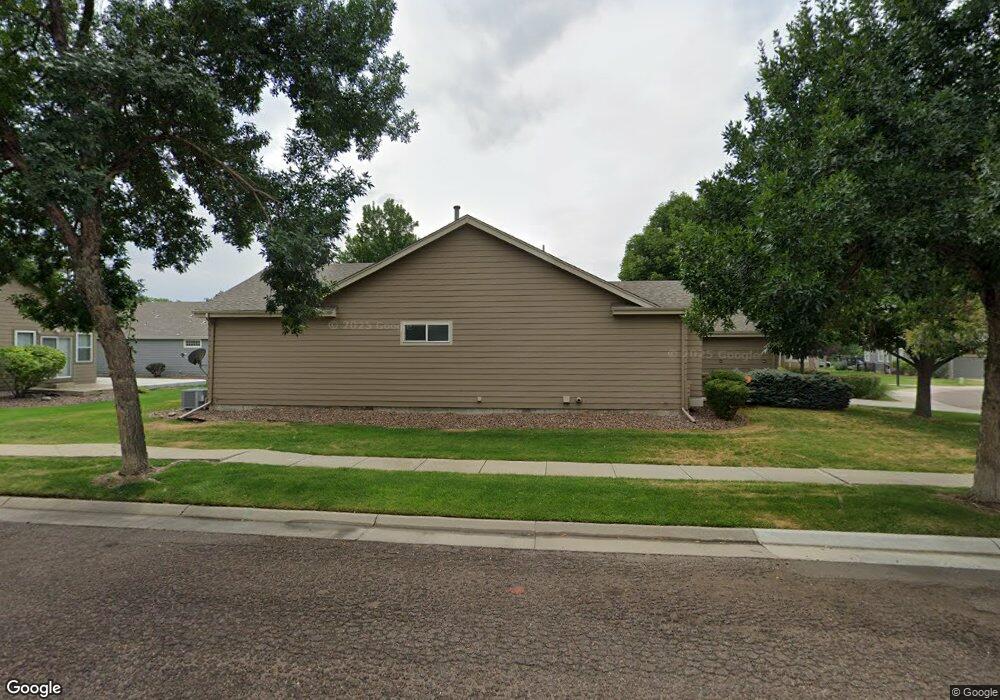
6675 Kendrick Dr Arvada, CO 80007
Ralston Valley NeighborhoodEstimated Value: $655,000 - $773,000
2
Beds
3
Baths
1,608
Sq Ft
$431/Sq Ft
Est. Value
About This Home
This home is located at 6675 Kendrick Dr, Arvada, CO 80007 and is currently estimated at $693,603, approximately $431 per square foot. 6675 Kendrick Dr is a home located in Jefferson County with nearby schools including West Woods Elementary School, Drake Junior High School, and Ralston Valley Senior High School.
Ownership History
Date
Name
Owned For
Owner Type
Purchase Details
Closed on
Dec 9, 1997
Sold by
Forest Spring Ltd Liability Co
Bought by
Evans Darlene A
Current Estimated Value
Home Financials for this Owner
Home Financials are based on the most recent Mortgage that was taken out on this home.
Original Mortgage
$127,000
Outstanding Balance
$21,429
Interest Rate
7.2%
Estimated Equity
$672,174
Purchase Details
Closed on
Jul 14, 1997
Sold by
Ochsner Development Corp
Bought by
Forest Spring Ltd Liability Co
Create a Home Valuation Report for This Property
The Home Valuation Report is an in-depth analysis detailing your home's value as well as a comparison with similar homes in the area
Home Values in the Area
Average Home Value in this Area
Purchase History
| Date | Buyer | Sale Price | Title Company |
|---|---|---|---|
| Evans Darlene A | $204,804 | -- | |
| Forest Spring Ltd Liability Co | $60,000 | -- |
Source: Public Records
Mortgage History
| Date | Status | Borrower | Loan Amount |
|---|---|---|---|
| Open | Evans Darlene A | $127,000 |
Source: Public Records
Tax History Compared to Growth
Tax History
| Year | Tax Paid | Tax Assessment Tax Assessment Total Assessment is a certain percentage of the fair market value that is determined by local assessors to be the total taxable value of land and additions on the property. | Land | Improvement |
|---|---|---|---|---|
| 2024 | $3,159 | $39,264 | $8,829 | $30,435 |
| 2023 | $3,159 | $39,264 | $8,829 | $30,435 |
| 2022 | $2,458 | $32,053 | $8,424 | $23,629 |
| 2021 | $2,499 | $32,975 | $8,667 | $24,308 |
| 2020 | $2,403 | $32,054 | $11,233 | $20,821 |
| 2019 | $2,371 | $32,054 | $11,233 | $20,821 |
| 2018 | $2,043 | $28,061 | $9,044 | $19,017 |
| 2017 | $1,870 | $28,061 | $9,044 | $19,017 |
| 2016 | $1,749 | $26,345 | $8,714 | $17,631 |
| 2015 | $1,473 | $26,345 | $8,714 | $17,631 |
| 2014 | $1,473 | $22,513 | $6,927 | $15,586 |
Source: Public Records
Map
Nearby Homes
- 15296 W 66th Dr Unit G
- 15516 W 66th Dr Unit A
- 15496 W 66th Dr Unit C
- 15233 W 65th Ave Unit C
- 15492 W 65th Ave Unit C
- 15290 W 68th Place
- 15316 W 69th Dr
- 15312 W 69th Place
- 15345 W 69th Dr
- 15325 W 69th Dr
- 15313 W 69th Ave
- Urban Paired Plan at Geos - Paired Homes
- Reihenhaus Plan at Geos - Townhomes
- Sonnenvilla Plan at Geos - Single Family Homes
- Solstice Plan at Geos - Townhomes
- 15338 W 68th Ave
- 15336 W 68th Ave
- 15152 W 69th Place
- 15328 W 68th Ave
- 15336 68th Loop
- 6679 Kendrick Dr
- 15241 W 66th Place
- 6683 Kendrick Dr
- 15261 W 66th Place
- 15281 W 66th Place
- 6670 Kendrick Dr
- 6674 Kendrick Dr
- 6681 Kendrick Dr
- 6668 Kendrick Dr
- 6685 Kendrick Dr
- 6678 Kendrick Dr
- 15233 W 66th Place Unit E
- 15233 W 66th Place Unit D
- 15233 W 66th Place Unit 23D
- 15233 W 66th Place Unit 23E
- 15321 W 66th Place
- 6664 Kendrick Dr
- 6680 Kendrick Dr
- 6688 Kendrick Dr
- 6692 Kendrick Dr