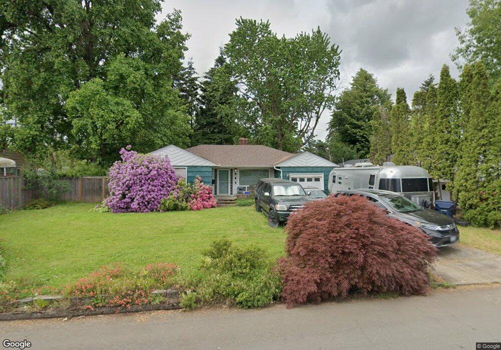
668 Baxter St Eugene, OR 97402
Bethel NeighborhoodEstimated Value: $352,000 - $394,000
2
Beds
1
Bath
1,411
Sq Ft
$260/Sq Ft
Est. Value
About This Home
This home is located at 668 Baxter St, Eugene, OR 97402 and is currently estimated at $366,877, approximately $260 per square foot. 668 Baxter St is a home located in Lane County with nearby schools including Fairfield Elementary School, Cascade Middle School, and Willamette High School.
Ownership History
Date
Name
Owned For
Owner Type
Purchase Details
Closed on
Mar 3, 2026
Sold by
Stout Gregory J
Bought by
Stout Gregory J and Stout Lisa M
Current Estimated Value
Purchase Details
Closed on
Dec 14, 1999
Sold by
Huffman Dixie
Bought by
Stout Gregory J
Home Financials for this Owner
Home Financials are based on the most recent Mortgage that was taken out on this home.
Original Mortgage
$108,827
Interest Rate
7.82%
Mortgage Type
FHA
Purchase Details
Closed on
May 27, 1998
Sold by
Shirley Glover and Shirley Dixie Huffman
Bought by
Huffman Dixie
Home Financials for this Owner
Home Financials are based on the most recent Mortgage that was taken out on this home.
Original Mortgage
$50,000
Interest Rate
7.13%
Create a Home Valuation Report for This Property
The Home Valuation Report is an in-depth analysis detailing your home's value as well as a comparison with similar homes in the area
Home Values in the Area
Average Home Value in this Area
Purchase History
| Date | Buyer | Sale Price | Title Company |
|---|---|---|---|
| Stout Gregory J | -- | None Listed On Document | |
| Stout Gregory J | $110,000 | Cascade Title Co | |
| Huffman Dixie | -- | Evergreen Land Title Co |
Source: Public Records
Mortgage History
| Date | Status | Borrower | Loan Amount |
|---|---|---|---|
| Previous Owner | Stout Gregory J | $108,827 | |
| Previous Owner | Huffman Dixie | $50,000 |
Source: Public Records
Tax History
| Year | Tax Paid | Tax Assessment Tax Assessment Total Assessment is a certain percentage of the fair market value that is determined by local assessors to be the total taxable value of land and additions on the property. | Land | Improvement |
|---|---|---|---|---|
| 2025 | $3,056 | $175,701 | -- | -- |
| 2024 | $2,979 | $170,584 | -- | -- |
| 2023 | $2,979 | $165,616 | $0 | $0 |
| 2022 | $2,773 | $160,793 | $0 | $0 |
| 2021 | $2,715 | $156,110 | $0 | $0 |
| 2020 | $2,636 | $151,564 | $0 | $0 |
| 2019 | $2,506 | $147,150 | $0 | $0 |
| 2018 | $2,436 | $138,704 | $0 | $0 |
| 2017 | $2,328 | $138,704 | $0 | $0 |
| 2016 | $2,269 | $134,664 | $0 | $0 |
| 2015 | $2,224 | $130,742 | $0 | $0 |
| 2014 | $2,190 | $126,934 | $0 | $0 |
Source: Public Records
Map
Nearby Homes
- 0 Elmira Rd
- 3520 Elmira Rd
- 1047 Baxter St
- 280 Baxter St
- 338 Archie St
- 279 Lacasa St
- 465 Davis St
- 201 Lacasa St
- 3118 Richard Ave Unit 1
- 630 Gilbert St
- 647 Ellsworth St
- 1219 Waite St
- 1293 Highway 99 N
- 1281 Highway 99 N
- 3939 Cross St
- 3461 Concord St
- 4041 Bell Ave
- 1384 Jacobs Dr
- 3970 Marshall Ave
- 795 Red Cedar Ct
Your Personal Tour Guide
Ask me questions while you tour the home.