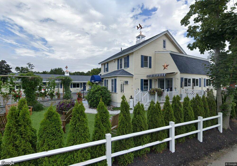
668 Main St Ogunquit, ME 03907
Ogunquit Neighborhood
Studio
--
Bath
8,727
Sq Ft
24,829
Sq Ft Lot
About This Home
This home is located at 668 Main St, Ogunquit, ME 03907. 668 Main St is a home located in York County with nearby schools including Wells Junior High School, Wells Elementary School, and Wells High School.
Ownership History
Date
Name
Owned For
Owner Type
Purchase Details
Closed on
Jan 5, 2018
Sold by
Russell Llc
Bought by
Kjm Investments Llc
Home Financials for this Owner
Home Financials are based on the most recent Mortgage that was taken out on this home.
Original Mortgage
$1,520,000
Outstanding Balance
$1,282,044
Interest Rate
3.92%
Mortgage Type
Purchase Money Mortgage
Purchase Details
Closed on
Jun 13, 2007
Sold by
Footbridge Realty Hldgs
Bought by
Russell Llc
Home Financials for this Owner
Home Financials are based on the most recent Mortgage that was taken out on this home.
Original Mortgage
$425,000
Interest Rate
6.14%
Mortgage Type
Commercial
Create a Home Valuation Report for This Property
The Home Valuation Report is an in-depth analysis detailing your home's value as well as a comparison with similar homes in the area
Home Values in the Area
Average Home Value in this Area
Purchase History
| Date | Buyer | Sale Price | Title Company |
|---|---|---|---|
| Kjm Investments Llc | -- | -- | |
| Russell Llc | -- | -- |
Source: Public Records
Mortgage History
| Date | Status | Borrower | Loan Amount |
|---|---|---|---|
| Open | Kjm Investments Llc | $1,520,000 | |
| Closed | Russell Llc | $425,000 |
Source: Public Records
Tax History
| Year | Tax Paid | Tax Assessment Tax Assessment Total Assessment is a certain percentage of the fair market value that is determined by local assessors to be the total taxable value of land and additions on the property. | Land | Improvement |
|---|---|---|---|---|
| 2024 | $11,377 | $1,761,100 | $1,067,400 | $693,700 |
| 2023 | $11,377 | $1,761,100 | $1,067,400 | $693,700 |
| 2022 | $11,130 | $1,761,100 | $1,067,400 | $693,700 |
| 2021 | $9,228 | $1,133,600 | $609,800 | $523,800 |
| 2020 | $9,069 | $1,133,600 | $609,800 | $523,800 |
| 2019 | $9,069 | $1,133,600 | $609,800 | $523,800 |
| 2018 | $8,967 | $1,133,600 | $609,800 | $523,800 |
| 2017 | $8,593 | $1,133,600 | $609,800 | $523,800 |
| 2016 | $7,622 | $942,100 | $457,400 | $484,700 |
| 2015 | $7,603 | $942,100 | $457,400 | $484,700 |
| 2014 | $7,311 | $942,100 | $457,400 | $484,700 |
Source: Public Records
Map
Nearby Homes
- 488 Main St Unit 7
- 31 Rebecca Rd
- 22 Adams Ln
- 76 Post Rd Unit 21M
- 9 Bourne Ave Unit B6
- 191 Tatnic Rd Unit 73
- 168 Ocean Ave
- 14 Valleybrook Rd Unit 14
- 25 Shore Rd Unit A
- 1 Old County Rd Unit 165
- 1 Old County Rd Unit 155
- 20 Shore Rd Unit 2A,B,C,D
- 69 Cottage St
- 47 Village Green Dr
- 412 Post Rd Unit 304
- 412 Post Rd Unit 145
- 55 Israel Head Rd Unit 203
- 200 Shore Rd
- 14 Maple St
- 310 Furbish Rd
- 19 Ocean St Unit 6
- 19 Ocean St Unit 5
- 19 Ocean St Unit 4
- 19 Ocean St Unit 3
- 17 Ocean St Unit 56
- 17 Ocean St Unit 55
- 17 Ocean St Unit 54
- 17 Ocean St Unit 53
- 42 Ocean St Unit 36
- 42 Ocean St Unit 35
- 42 Ocean St Unit 2
- 42 Ocean St Unit 1
- 10 Ocean St Unit 47
- 10 Ocean St Unit 46
- 46 Ocean Meadows N Unit 39
- 46 Ocean Meadows N Unit 38
- 46 Ocean Meadows N Unit 37
- 8 Ocean St Unit 30
- 110 Ocean St Unit 25
- 110 Ocean St Unit 24
Your Personal Tour Guide
Ask me questions while you tour the home.