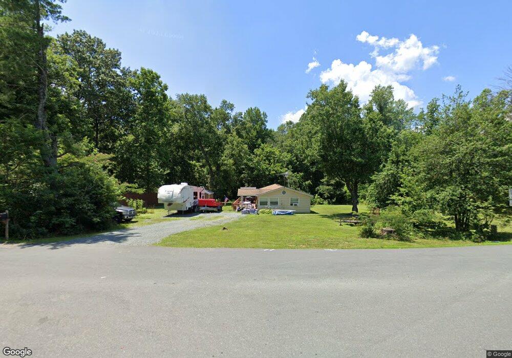
668 Maxfield Rd Keswick, VA 22947
Cismont NeighborhoodEstimated Value: $341,000 - $560,000
3
Beds
2
Baths
1,392
Sq Ft
$308/Sq Ft
Est. Value
About This Home
This home is located at 668 Maxfield Rd, Keswick, VA 22947 and is currently estimated at $429,199, approximately $308 per square foot. 668 Maxfield Rd is a home located in Albemarle County with nearby schools including Stone Robinson Elementary School, Jackson P. Burley Middle School, and Monticello High School.
Ownership History
Date
Name
Owned For
Owner Type
Purchase Details
Closed on
Sep 17, 2020
Sold by
Silman Deborah A and Steele Deborah Ann
Bought by
Silman Deborah A and Silman Richard P
Current Estimated Value
Home Financials for this Owner
Home Financials are based on the most recent Mortgage that was taken out on this home.
Original Mortgage
$144,318
Outstanding Balance
$115,660
Interest Rate
2.9%
Mortgage Type
New Conventional
Estimated Equity
$313,539
Purchase Details
Closed on
Apr 10, 2009
Sold by
Emc Mortgage Corp
Bought by
Oliveri Vincent and Oliveri Frank
Purchase Details
Closed on
Jul 25, 2006
Sold by
Proffit Helen Kirby and Kirby Frank
Bought by
Kirby Joseph D
Home Financials for this Owner
Home Financials are based on the most recent Mortgage that was taken out on this home.
Original Mortgage
$164,000
Interest Rate
6.67%
Mortgage Type
Credit Line Revolving
Create a Home Valuation Report for This Property
The Home Valuation Report is an in-depth analysis detailing your home's value as well as a comparison with similar homes in the area
Home Values in the Area
Average Home Value in this Area
Purchase History
| Date | Buyer | Sale Price | Title Company |
|---|---|---|---|
| Silman Deborah A | -- | None Available | |
| Oliveri Vincent | $115,000 | -- | |
| Kirby Joseph D | -- | -- |
Source: Public Records
Mortgage History
| Date | Status | Borrower | Loan Amount |
|---|---|---|---|
| Open | Silman Deborah A | $144,318 | |
| Previous Owner | Kirby Joseph D | $164,000 |
Source: Public Records
Tax History Compared to Growth
Tax History
| Year | Tax Paid | Tax Assessment Tax Assessment Total Assessment is a certain percentage of the fair market value that is determined by local assessors to be the total taxable value of land and additions on the property. | Land | Improvement |
|---|---|---|---|---|
| 2025 | $3,119 | $348,900 | $92,900 | $256,000 |
| 2024 | $2,590 | $303,300 | $93,500 | $209,800 |
| 2023 | $2,508 | $293,700 | $78,100 | $215,600 |
| 2022 | $1,785 | $209,000 | $61,400 | $147,600 |
| 2021 | $1,676 | $196,300 | $61,400 | $134,900 |
| 2020 | $1,568 | $183,600 | $55,800 | $127,800 |
| 2019 | $1,331 | $155,900 | $33,900 | $122,000 |
| 2018 | $1,277 | $150,200 | $33,900 | $116,300 |
| 2017 | $1,295 | $154,300 | $26,300 | $128,000 |
| 2016 | $1,206 | $143,800 | $35,400 | $108,400 |
| 2015 | $1,171 | $143,000 | $35,400 | $107,600 |
| 2014 | -- | $144,700 | $37,200 | $107,500 |
Source: Public Records
Map
Nearby Homes
- 5515 Gordonsville Rd
- 5484 Gordonsville Rd
- 240 Campbell Rd
- 465 Glenmore Lot 30 Ln
- 5515 - L Gordonsville Rd
- 6376 Louisa Rd
- 0 Louisa Rd Unit 646537
- SALEM Plan at Green Spring Estates
- HAYDEN Plan at Green Spring Estates
- HANOVER Plan at Green Spring Estates
- 347 Clarks Tract
- 0 Saint John Rd
- TBD Stony Point Pass
- TBD Stony Point Pass Unit 30
- 6497 Grove Hill Ct
- 405B Lazy Branch Ln
- 405A Lazy Branch Ln
- 405C Lazy Branch Ln
- 662 Maxfield Rd
- 5668 Louisa Rd
- 5621 Louisa Rd
- 5656 Louisa Rd
- 5705 Louisa Rd
- 650 Maxfield Rd
- 27 Campbell Rd
- 653 Maxfield Rd
- 5706 Louisa Rd
- 644 Maxfield Rd
- 5606 Louisa Rd
- 633 Maxfield Rd
- 9 Campbell Rd
- 5750 Louisa Rd
- 5592 Louisa Rd
- 615 Maxfield Rd
- 5793 Louisa Rd
- 612 Maxfield Rd
- 630 Maxfield Rd
- 40 Campbell Rd