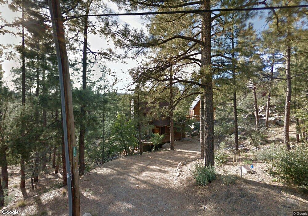
668 N Smoki Dr Prescott, AZ 86305
Estimated Value: $528,372 - $738,000
--
Bed
--
Bath
1,798
Sq Ft
$345/Sq Ft
Est. Value
About This Home
This home is located at 668 N Smoki Dr, Prescott, AZ 86305 and is currently estimated at $621,093, approximately $345 per square foot. 668 N Smoki Dr is a home located in Yavapai County with nearby schools including Granite Mountain Middle School, Lincoln Elementary School, and Prescott Mile High Middle School.
Ownership History
Date
Name
Owned For
Owner Type
Purchase Details
Closed on
Oct 19, 2017
Sold by
Bauer Richard J and Bauer Deborah
Bought by
Bauer Richard J and Bauer Deborah
Current Estimated Value
Purchase Details
Closed on
Jan 16, 1998
Sold by
Ferguson Fred E and Ferguson Patricia S
Bought by
Ferguson Fred E and Ferguson Patricia S
Purchase Details
Closed on
Oct 31, 1997
Sold by
Pfingstag John R and Pfingstag Sherry A
Bought by
Ferguson Fred E and Ferguson Patricia S
Home Financials for this Owner
Home Financials are based on the most recent Mortgage that was taken out on this home.
Original Mortgage
$73,700
Interest Rate
7.33%
Mortgage Type
New Conventional
Purchase Details
Closed on
May 12, 1995
Sold by
Chaney Doyle D and Chaney Kathryn G
Bought by
Bauer Richard J and Bauer Deborah
Purchase Details
Closed on
Jun 30, 1994
Sold by
Bradford Charles E and Bradford Dawn A
Bought by
Goodman Glen F and Goodman Barbara L
Create a Home Valuation Report for This Property
The Home Valuation Report is an in-depth analysis detailing your home's value as well as a comparison with similar homes in the area
Home Values in the Area
Average Home Value in this Area
Purchase History
| Date | Buyer | Sale Price | Title Company |
|---|---|---|---|
| Bauer Richard J | -- | None Available | |
| Ferguson Fred E | -- | -- | |
| Ferguson Fred E | $92,150 | First American Title Ins | |
| Bauer Richard J | $24,300 | Capital Title Agency | |
| Goodman Glen F | -- | Capital Title Agency |
Source: Public Records
Mortgage History
| Date | Status | Borrower | Loan Amount |
|---|---|---|---|
| Closed | Ferguson Fred E | $73,700 |
Source: Public Records
Tax History Compared to Growth
Tax History
| Year | Tax Paid | Tax Assessment Tax Assessment Total Assessment is a certain percentage of the fair market value that is determined by local assessors to be the total taxable value of land and additions on the property. | Land | Improvement |
|---|---|---|---|---|
| 2026 | $3,491 | $52,200 | -- | -- |
| 2024 | $3,365 | $49,340 | -- | -- |
| 2023 | $3,365 | $40,565 | $0 | $0 |
| 2022 | $3,239 | $34,703 | $3,692 | $31,011 |
| 2021 | $3,307 | $33,443 | $3,984 | $29,459 |
| 2020 | $3,241 | $0 | $0 | $0 |
| 2019 | $3,184 | $0 | $0 | $0 |
| 2018 | $2,388 | $0 | $0 | $0 |
| 2017 | $2,269 | $0 | $0 | $0 |
| 2016 | $1,971 | $0 | $0 | $0 |
| 2015 | -- | $0 | $0 | $0 |
| 2014 | -- | $0 | $0 | $0 |
Source: Public Records
Map
Nearby Homes
- 5240 Rock Cove
- 5240 Rock Cove Unit 28
- 5003 W Smoki Dr
- 4080 W Smoki Dr
- 5005 W Smoki Dr
- 932 Rock Haven Unit 1
- 835 Happy Valley Rd
- 1515 N Happy Valley Rd
- 1515 N Happy Valley Rd Unit 3&4
- 5592 W Mountain View Unit 27
- 5592 W Mountain View
- 5588 W Mountain View
- 5792 W Pine Cove
- 1251 Navajo Rd
- 5712 W Sunrise Dr
- 5500 W Lonesome Hawk Dr
- 757 N Valley View Dr
- 1044 N Turkey Run Rd
- 611 N Valley View Dr Unit 23
- 611 N Valley View Dr
- 5223 W Rock Cove
- 5259 W Rock Cove
- 675 N Smoki Dr
- 641 N Smoki Dr
- 691 N Smoki Dr
- 5224 W Rock Cove
- 5240 W Rock
- 5267 W Rock Cove
- 715 N Smoki Dr
- 715 N Smoki Dr
- 744 N Hillside Dr
- 735 N Smoki Dr
- 753 N Hillside Dr
- 4965 N Smoki Dr
- 751 N Smoki Dr
- 761 N Hillside Dr
- 497 Happy Valley Rd
- 752 N Hillside Dr
- 752 N Hillside Dr
- 5320 W Tombstone Trail