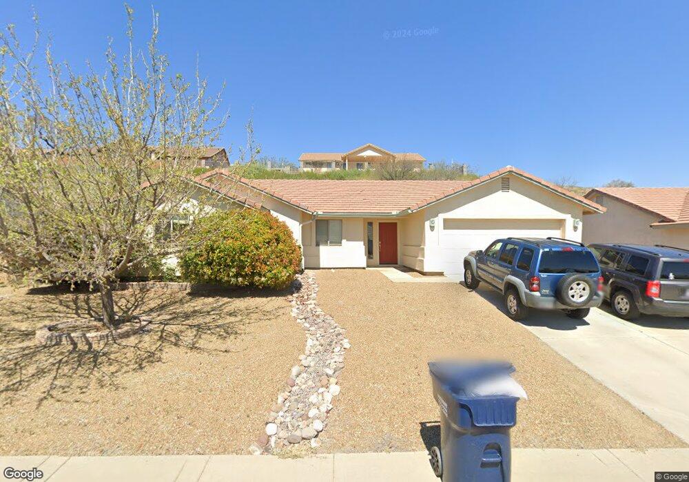
668 S Highline Ln Camp Verde, AZ 86322
Estimated Value: $356,000 - $409,000
4
Beds
--
Bath
1,694
Sq Ft
$220/Sq Ft
Est. Value
About This Home
This home is located at 668 S Highline Ln, Camp Verde, AZ 86322 and is currently estimated at $373,256, approximately $220 per square foot. 668 S Highline Ln is a home located in Yavapai County with nearby schools including Camp Verde Elementary School, Camp Verde Middle School, and Camp Verde High School.
Ownership History
Date
Name
Owned For
Owner Type
Purchase Details
Closed on
Jan 17, 2012
Sold by
Jerumbo Susan K
Bought by
Jerumbo Ronald P
Current Estimated Value
Purchase Details
Closed on
Dec 14, 2006
Sold by
Brown David L
Bought by
Brown Debra
Home Financials for this Owner
Home Financials are based on the most recent Mortgage that was taken out on this home.
Original Mortgage
$230,500
Interest Rate
9.45%
Mortgage Type
New Conventional
Purchase Details
Closed on
Nov 21, 2006
Sold by
Chartwell Homes Inc
Bought by
Young Robert and Young Deshannan
Home Financials for this Owner
Home Financials are based on the most recent Mortgage that was taken out on this home.
Original Mortgage
$230,500
Interest Rate
9.45%
Mortgage Type
New Conventional
Create a Home Valuation Report for This Property
The Home Valuation Report is an in-depth analysis detailing your home's value as well as a comparison with similar homes in the area
Home Values in the Area
Average Home Value in this Area
Purchase History
| Date | Buyer | Sale Price | Title Company |
|---|---|---|---|
| Jerumbo Ronald P | -- | Pioneer Title | |
| Jerumbo Ronald P | $87,500 | Pioneer Title | |
| Brown Debra | -- | Transnation Title | |
| Young Robert | $230,500 | Transnation Title | |
| Chartwell Homes Inc | -- | Transnation Title |
Source: Public Records
Mortgage History
| Date | Status | Borrower | Loan Amount |
|---|---|---|---|
| Previous Owner | Young Robert | $230,500 |
Source: Public Records
Tax History Compared to Growth
Tax History
| Year | Tax Paid | Tax Assessment Tax Assessment Total Assessment is a certain percentage of the fair market value that is determined by local assessors to be the total taxable value of land and additions on the property. | Land | Improvement |
|---|---|---|---|---|
| 2026 | $2,131 | $34,626 | -- | -- |
| 2024 | $2,106 | $35,031 | -- | -- |
| 2023 | $2,106 | $28,480 | $2,899 | $25,581 |
| 2022 | $2,031 | $23,310 | $1,933 | $21,377 |
| 2021 | $2,067 | $21,467 | $1,992 | $19,475 |
| 2020 | $2,020 | $0 | $0 | $0 |
| 2019 | $1,997 | $0 | $0 | $0 |
| 2018 | $1,912 | $0 | $0 | $0 |
| 2017 | $1,881 | $0 | $0 | $0 |
| 2016 | $1,830 | $0 | $0 | $0 |
| 2015 | -- | $0 | $0 | $0 |
| 2014 | -- | $0 | $0 | $0 |
Source: Public Records
Map
Nearby Homes
- 667 E Cliffs Pkwy
- 639 S Azure Dr
- 509 S Longhorn Dr
- 556 S Azure Dr
- 870 W Deep Gorge Rd
- 836 Arizona 260
- 660 S Dakota Dr
- 0000 W General Crook Trail
- 421 S Dakota Dr
- 477 Arizona 260
- 539 W Saddle Creek Dr
- 778 W Salt Mine Rd
- 595 S Park Cir
- 451 W Salt Mine Rd
- 2375 S San Dominique Rd
- 1053 W Wheeler Rd
- 12 Ranch Dr
- 1145 W Thorton Rd
- 1114 W Thorton Rd
- 360 W Finnie Flat Rd Unit 16