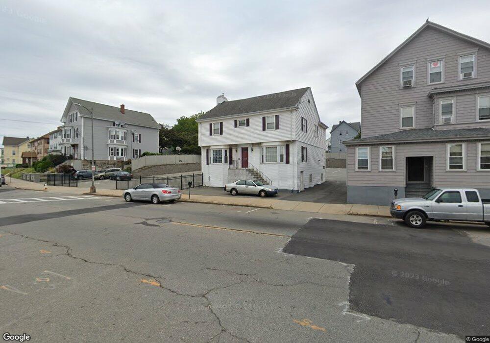
668 S Main St Fall River, MA 02721
Corky Row NeighborhoodEstimated Value: $478,000 - $631,000
4
Beds
3
Baths
3,421
Sq Ft
$170/Sq Ft
Est. Value
About This Home
This home is located at 668 S Main St, Fall River, MA 02721 and is currently estimated at $580,141, approximately $169 per square foot. 668 S Main St is a home located in Bristol County with nearby schools including Henry Lord Community School, B M C Durfee High School, and Argosy Collegiate Charter School.
Ownership History
Date
Name
Owned For
Owner Type
Purchase Details
Closed on
Feb 5, 2026
Sold by
Caa T T and Caa Auclair
Bought by
666-668 South Main St T and Auclair
Current Estimated Value
Purchase Details
Closed on
Nov 4, 2020
Sold by
666 S Main Street Llc
Bought by
Caa T
Purchase Details
Closed on
Mar 2, 2019
Sold by
Auclair Charles A
Bought by
666 S Main Street Llc
Purchase Details
Closed on
Jan 5, 2001
Sold by
Tavares Renato R
Bought by
Auclair Charles A
Home Financials for this Owner
Home Financials are based on the most recent Mortgage that was taken out on this home.
Original Mortgage
$138,400
Interest Rate
7.69%
Mortgage Type
Purchase Money Mortgage
Purchase Details
Closed on
Jun 30, 1995
Sold by
Tavares Renato R
Bought by
Samuel-Reback Andrea and Tavares Sharon Y
Home Financials for this Owner
Home Financials are based on the most recent Mortgage that was taken out on this home.
Original Mortgage
$160,000
Interest Rate
7.8%
Mortgage Type
Purchase Money Mortgage
Create a Home Valuation Report for This Property
The Home Valuation Report is an in-depth analysis detailing your home's value as well as a comparison with similar homes in the area
Home Values in the Area
Average Home Value in this Area
Purchase History
| Date | Buyer | Sale Price | Title Company |
|---|---|---|---|
| Caa T | -- | None Available | |
| 666 S Main Street Llc | -- | -- | |
| Auclair Charles A | $225,000 | -- | |
| Samuel-Reback Andrea | $140,000 | -- |
Source: Public Records
Mortgage History
| Date | Status | Borrower | Loan Amount |
|---|---|---|---|
| Previous Owner | Samuel-Reback Andrea | $138,400 | |
| Previous Owner | Samuel-Reback Andrea | $160,000 |
Source: Public Records
Tax History
| Year | Tax Paid | Tax Assessment Tax Assessment Total Assessment is a certain percentage of the fair market value that is determined by local assessors to be the total taxable value of land and additions on the property. | Land | Improvement |
|---|---|---|---|---|
| 2025 | $5,346 | $466,900 | $113,400 | $353,500 |
| 2024 | $4,434 | $385,900 | $109,300 | $276,600 |
| 2023 | $4,303 | $350,700 | $90,300 | $260,400 |
| 2022 | $4,372 | $346,400 | $86,000 | $260,400 |
| 2021 | $4,336 | $313,500 | $81,800 | $231,700 |
| 2020 | $4,026 | $278,600 | $80,600 | $198,000 |
| 2019 | $3,910 | $268,200 | $77,600 | $190,600 |
| 2018 | $3,868 | $264,600 | $84,100 | $180,500 |
| 2017 | $3,606 | $257,600 | $80,100 | $177,500 |
| 2016 | $3,447 | $252,900 | $85,300 | $167,600 |
| 2015 | $3,316 | $253,500 | $85,300 | $168,200 |
| 2014 | $3,156 | $250,900 | $82,700 | $168,200 |
Source: Public Records
Map
Nearby Homes
- 640 S Main St
- 165 Grant St
- 169 Grant St
- 105 Park St
- 111 Park St
- 150 Forest St
- 334 Fountain St
- 81 Hunter St
- 452 S Main St
- 48 Ridge St
- 75 Hunter St
- 77 Hunter St
- 271 Mulberry St
- 928 Middle St
- 621 Second St
- 403 Division St Unit 13
- 403 Division St Unit 5
- 403 Division St Unit 9
- 403 Division St Unit 11
- 403 Division St Unit 12
- 654 S Main St
- 640 S Main St Unit 2
- 640 S Main St Unit 1
- 651 S Main St
- 651 S Main St Unit 3
- 651 S Main St Unit 2
- 651 S Main St Unit 1
- 628 S Main St Unit 1
- 626 S Main St Unit 2 NORTH
- 626 S Main St Unit 3 SOUTH
- 626 S Main St Unit 3 NORTH
- 35 Forest St
- 25 Forest St
- 635 S Main St Unit 637
- 73 Forest St
- 73 Forest St Unit 2
- 45 Forest St
- 17 Forest St Unit 2
- 40 Park St
- 40 Park St Unit 2
Your Personal Tour Guide
Ask me questions while you tour the home.