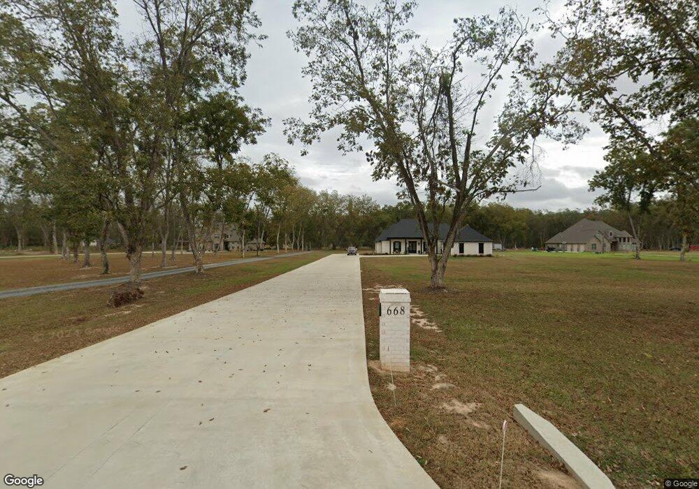
668 Stubbs Vinson Rd Monroe, LA 71203
Estimated Value: $371,000 - $461,000
4
Beds
2
Baths
2,252
Sq Ft
$184/Sq Ft
Est. Value
About This Home
This home is located at 668 Stubbs Vinson Rd, Monroe, LA 71203 and is currently estimated at $414,506, approximately $184 per square foot. 668 Stubbs Vinson Rd is a home with nearby schools including Swartz Lower Elementary School, Swartz Upper Elementary School, and Ouachita Junior High School.
Ownership History
Date
Name
Owned For
Owner Type
Purchase Details
Closed on
Jan 14, 2022
Sold by
Thomas Barham Wilson and Thomas Elizabeth Kathryn
Bought by
Cole Brian Jerome and Jones Kirsen K
Current Estimated Value
Home Financials for this Owner
Home Financials are based on the most recent Mortgage that was taken out on this home.
Original Mortgage
$44,550
Outstanding Balance
$40,686
Interest Rate
3.05%
Mortgage Type
New Conventional
Estimated Equity
$373,820
Purchase Details
Closed on
Jan 12, 2022
Sold by
Thomas Barham Wilson and Thomas Elizabeth Kathryn
Bought by
Turner Ronald Reagan and Turner Adrian D
Home Financials for this Owner
Home Financials are based on the most recent Mortgage that was taken out on this home.
Original Mortgage
$44,550
Outstanding Balance
$40,686
Interest Rate
3.05%
Mortgage Type
New Conventional
Estimated Equity
$373,820
Create a Home Valuation Report for This Property
The Home Valuation Report is an in-depth analysis detailing your home's value as well as a comparison with similar homes in the area
Purchase History
| Date | Buyer | Sale Price | Title Company |
|---|---|---|---|
| Cole Brian Jerome | $52,500 | None Listed On Document | |
| Turner Ronald Reagan | -- | Donald M Randall |
Source: Public Records
Mortgage History
| Date | Status | Borrower | Loan Amount |
|---|---|---|---|
| Open | Turner Ronald Reagan | $44,550 |
Source: Public Records
Tax History
| Year | Tax Paid | Tax Assessment Tax Assessment Total Assessment is a certain percentage of the fair market value that is determined by local assessors to be the total taxable value of land and additions on the property. | Land | Improvement |
|---|---|---|---|---|
| 2025 | $3,837 | $35,200 | $4,800 | $30,400 |
| 2024 | $3,837 | $35,200 | $4,800 | $30,400 |
| 2023 | $3,864 | $36,284 | $4,800 | $31,484 |
| 2022 | $15 | $106 | $106 | $0 |
| 2021 | $15 | $106 | $106 | $0 |
| 2020 | $15 | $106 | $106 | $0 |
| 2019 | $14 | $101 | $101 | $0 |
| 2018 | $13 | $101 | $101 | $0 |
Source: Public Records
Map
Nearby Homes
- 338 Bower Rd
- 374 Stubbs Vinson Rd
- 306 Taylor Dr
- 285 Stubbs Vinson Rd
- 1077 Stubbs Vinson Rd
- 228 Eisenhower Dr
- 158 Barbara Dr
- 142 Jesse Ln
- 1141 Rowland Rd
- 60 Nelson Rd
- 318 Monarch Dr
- 719 Ed Edelen Rd
- 2210 Highway 594
- 2238 Highway 594
- 0 Braebend Dr
- 300 Timber Way
- 364 Sonny Day Rd
- 03 Stubbs Vinson Rd
- 2080 Stubbs Vinson Rd
- 02 Stubbs Vinson Rd
- 648 Stubbs Vinson Rd
- 657 Stubbs Vinson Rd
- 688 Stubbs Vinson Rd
- 621 Stubbs Vinson Rd
- 693 Stubbs Vinson Rd
- 114 Kiowa St
- 116 Kiowa St
- 603 Stubbs Vinson Rd
- 110 Kiowa St
- 711 Stubbs Vinson Rd
- 118 Kiowa Ln
- 118 Kiowa St
- 614 Stubbs Vinson Rd
- 734 Stubbs Vinson Rd
- 729 Stubbs Vinson Rd
- 585 Stubbs Vinson Rd
- 120 Kiowa St
- 108 Kiowa St
- 122 Kiowa St
- 122 Kiowa Ln
Your Personal Tour Guide
Ask me questions while you tour the home.