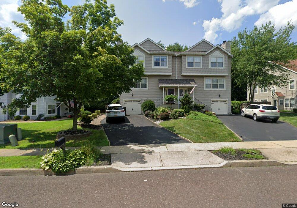
668 Woodspring Dr Warrington, PA 18976
Estimated Value: $548,000 - $758,951
4
Beds
3
Baths
2,727
Sq Ft
$225/Sq Ft
Est. Value
About This Home
This home is located at 668 Woodspring Dr, Warrington, PA 18976 and is currently estimated at $612,488, approximately $224 per square foot. 668 Woodspring Dr is a home located in Bucks County with nearby schools including Titus Elementary School, Tamanend Middle School, and Central Bucks High School - South.
Ownership History
Date
Name
Owned For
Owner Type
Purchase Details
Closed on
Mar 10, 2000
Sold by
Alisesky Mark D and Alisesky Cynthia L
Bought by
Robbins John J and Robbins Lorraine C
Current Estimated Value
Home Financials for this Owner
Home Financials are based on the most recent Mortgage that was taken out on this home.
Original Mortgage
$166,150
Outstanding Balance
$47,040
Interest Rate
6%
Estimated Equity
$565,448
Purchase Details
Closed on
Jun 17, 1996
Sold by
Racioppe Thomas W and Racioppe Elizabeth R
Bought by
Alisesky Mark D and Alisesky Cynthia L
Home Financials for this Owner
Home Financials are based on the most recent Mortgage that was taken out on this home.
Original Mortgage
$120,400
Interest Rate
8.06%
Create a Home Valuation Report for This Property
The Home Valuation Report is an in-depth analysis detailing your home's value as well as a comparison with similar homes in the area
Home Values in the Area
Average Home Value in this Area
Purchase History
| Date | Buyer | Sale Price | Title Company |
|---|---|---|---|
| Robbins John J | $174,900 | -- | |
| Alisesky Mark D | $150,500 | -- |
Source: Public Records
Mortgage History
| Date | Status | Borrower | Loan Amount |
|---|---|---|---|
| Open | Robbins John J | $166,150 | |
| Previous Owner | Alisesky Mark D | $120,400 |
Source: Public Records
Tax History Compared to Growth
Tax History
| Year | Tax Paid | Tax Assessment Tax Assessment Total Assessment is a certain percentage of the fair market value that is determined by local assessors to be the total taxable value of land and additions on the property. | Land | Improvement |
|---|---|---|---|---|
| 2025 | $6,498 | $35,200 | $3,920 | $31,280 |
| 2024 | $6,498 | $35,200 | $3,920 | $31,280 |
| 2023 | $6,016 | $35,200 | $3,920 | $31,280 |
| 2022 | $5,897 | $35,200 | $3,920 | $31,280 |
| 2021 | $5,832 | $35,200 | $3,920 | $31,280 |
| 2020 | $5,832 | $35,200 | $3,920 | $31,280 |
| 2019 | $5,796 | $35,200 | $3,920 | $31,280 |
| 2018 | $5,732 | $35,200 | $3,920 | $31,280 |
| 2017 | $5,655 | $35,200 | $3,920 | $31,280 |
| 2016 | $5,637 | $35,200 | $3,920 | $31,280 |
| 2015 | -- | $35,200 | $3,920 | $31,280 |
| 2014 | -- | $35,200 | $3,920 | $31,280 |
Source: Public Records
Map
Nearby Homes
- 858 Elbow Ln
- 2492 Greensward S
- 2402 Dogleg Dr Unit 42H
- 2756 Pickertown Rd
- 508 Fullerton Farm Court Lot#21
- 503
- 506 Fullerton Farm Court Lot #22
- 500
- 2463 Pine Cone Rd
- 528 Fullerton Farm Ct
- 506 McNaney Farm Dr Lot # 27
- 511 McNaney Farm Dr Lot #6
- 430 Homestead Cir
- 871 Coolidge Ct
- 2405 Cindy Ln
- 1602 Burnham Ct Unit 6
- 418 Homestead Cir
- 753 S Settlers Cir
- 535 Mockingbird Way
- 279 Folly Rd
- 666 Woodspring Dr
- 670 Woodspring Dr
- 664 Woodspring Dr
- 672 Woodspring Dr
- 662 Woodspring Dr
- 674 Woodspring Dr
- 660 Woodspring Dr
- 671 Woodspring Dr
- 669 Woodspring Dr
- 676 Woodspring Dr
- 667 Woodspring Dr
- 673 Woodspring Dr
- 665 Woodspring Dr
- 658 Woodspring Dr
- 675 Woodspring Dr
- 678 Woodspring Dr
- 656 Woodspring Dr
- 680 Woodspring Dr
- 677 Woodspring Dr
- 682 Woodspring Dr