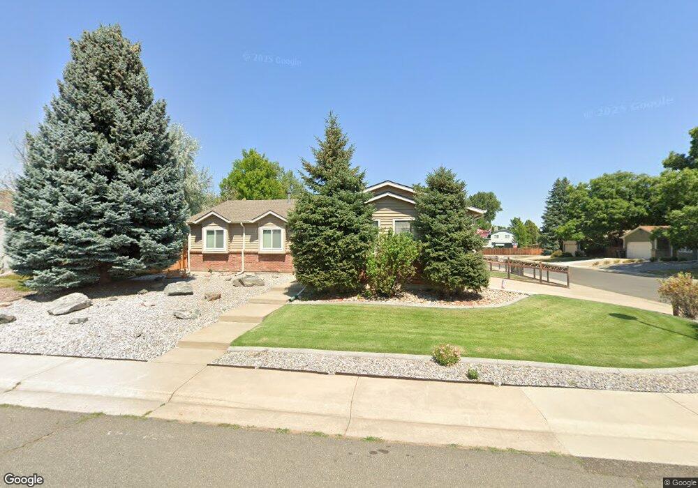
6682 Deframe Ct Arvada, CO 80004
Ralston Valley NeighborhoodEstimated Value: $601,588 - $635,000
3
Beds
3
Baths
1,312
Sq Ft
$472/Sq Ft
Est. Value
About This Home
This home is located at 6682 Deframe Ct, Arvada, CO 80004 and is currently estimated at $619,397, approximately $472 per square foot. 6682 Deframe Ct is a home located in Jefferson County with nearby schools including Stott Elementary School, Oberon Middle School, and Arvada West High School.
Ownership History
Date
Name
Owned For
Owner Type
Purchase Details
Closed on
Jun 19, 1999
Sold by
Benso Bruce A
Bought by
Benso Bruce A and Benso Rae Jean
Current Estimated Value
Purchase Details
Closed on
Apr 16, 1999
Sold by
Robbins William R and Robbins June C
Bought by
Benso Bruce A
Home Financials for this Owner
Home Financials are based on the most recent Mortgage that was taken out on this home.
Original Mortgage
$178,500
Outstanding Balance
$45,651
Interest Rate
7.16%
Mortgage Type
VA
Estimated Equity
$573,746
Purchase Details
Closed on
May 25, 1994
Sold by
Logan Donald D
Bought by
Robbins William R and Robbins June C
Create a Home Valuation Report for This Property
The Home Valuation Report is an in-depth analysis detailing your home's value as well as a comparison with similar homes in the area
Home Values in the Area
Average Home Value in this Area
Purchase History
| Date | Buyer | Sale Price | Title Company |
|---|---|---|---|
| Benso Bruce A | -- | -- | |
| Benso Bruce A | $175,000 | First American Heritage Titl | |
| Robbins William R | $133,500 | Land Title |
Source: Public Records
Mortgage History
| Date | Status | Borrower | Loan Amount |
|---|---|---|---|
| Open | Benso Bruce A | $178,500 |
Source: Public Records
Tax History
| Year | Tax Paid | Tax Assessment Tax Assessment Total Assessment is a certain percentage of the fair market value that is determined by local assessors to be the total taxable value of land and additions on the property. | Land | Improvement |
|---|---|---|---|---|
| 2024 | $2,800 | $35,565 | $15,326 | $20,239 |
| 2023 | $2,800 | $35,565 | $15,326 | $20,239 |
| 2022 | $2,310 | $30,541 | $11,901 | $18,640 |
| 2021 | $2,349 | $31,420 | $12,243 | $19,177 |
| 2020 | $2,122 | $29,143 | $11,614 | $17,529 |
| 2019 | $2,094 | $29,143 | $11,614 | $17,529 |
| 2018 | $2,562 | $26,163 | $7,751 | $18,412 |
| 2017 | $2,345 | $26,163 | $7,751 | $18,412 |
| 2016 | $2,268 | $23,840 | $5,803 | $18,037 |
| 2015 | $1,910 | $23,840 | $5,803 | $18,037 |
| 2014 | $1,910 | $18,866 | $4,872 | $13,994 |
Source: Public Records
Map
Nearby Homes
- 14050 W 68th Ave
- 13750 W 65th Ave
- 13812 W 64th Place
- 13294 W 65th Dr
- 6652 Zinnia St
- 13527 W 63rd Way
- 6888 Howell St
- 6304 Deframe Way
- 12869 W 68th Ave
- 6426 Zang Ct
- 13155 W 63rd Place
- 13115 W 63rd Place
- 13679 W 62nd Dr
- 6262 Braun Cir
- 7250 Devinney Ct Unit E
- 12730 W 67th Way
- 13436 W 62nd Dr
- 13970 W 72nd Place Unit C
- 12995 W 63rd Place Unit A
- 12670 W 66th Place
- 6684 Deframe Ct
- 13813 W 66th Dr
- 13831 W 66th Dr
- 13818 W 66th Dr
- 13824 W 66th Dr
- 13807 W 66th Dr
- 6686 Deframe Ct
- 13830 W 66th Dr
- 6683 Deframe Ct
- 13837 W 66th Dr
- 6685 Deframe Ct
- 13836 W 66th Dr
- 6687 Deframe Ct
- 6688 Deframe Ct
- 13817 W 66th Place
- 13823 W 66th Place
- 13811 W 66th Place
- 13843 W 66th Dr
- 6691 Deframe Ct
- 13829 W 66th Place
Your Personal Tour Guide
Ask me questions while you tour the home.