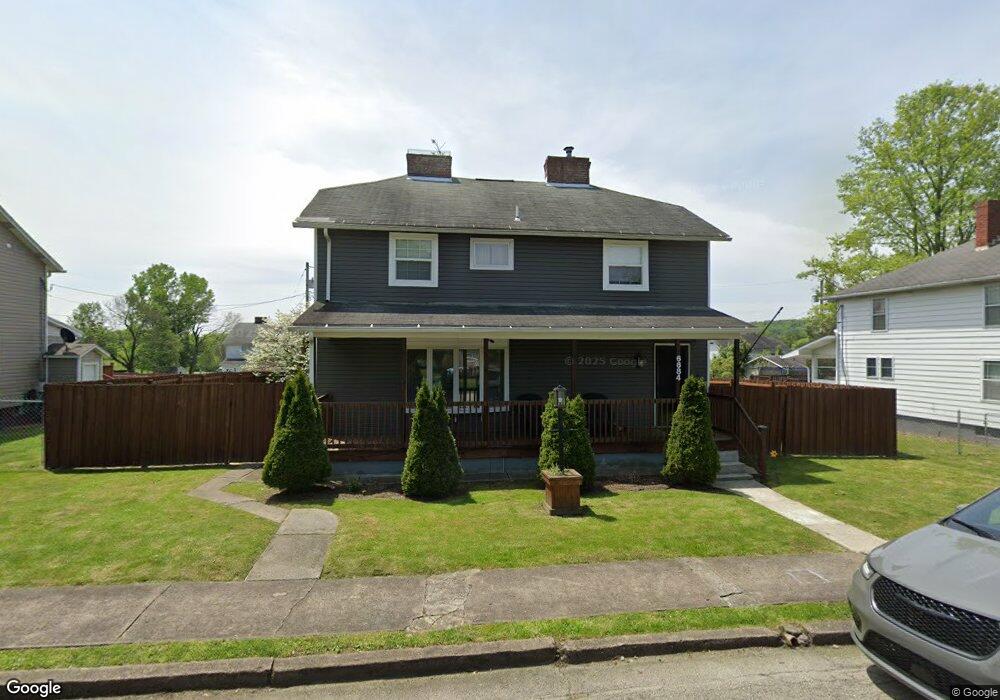
6684 6th St Grindstone, PA 15442
Estimated Value: $68,000 - $174,000
4
Beds
1
Bath
1,792
Sq Ft
$61/Sq Ft
Est. Value
About This Home
This home is located at 6684 6th St, Grindstone, PA 15442 and is currently estimated at $108,817, approximately $60 per square foot. 6684 6th St is a home located in Fayette County with nearby schools including Brownsville Area Elementary School, Brownsville Area Middle School, and Brownsville Area High School.
Ownership History
Date
Name
Owned For
Owner Type
Purchase Details
Closed on
Oct 19, 2023
Sold by
Locke Edward C and Locke Rebecca S
Bought by
Locke Edward C and Locke Rebecca S
Current Estimated Value
Purchase Details
Closed on
Apr 4, 2016
Sold by
Finfrock Charles W and Baker Gloria J
Bought by
Brown Lon R
Home Financials for this Owner
Home Financials are based on the most recent Mortgage that was taken out on this home.
Original Mortgage
$65,687
Interest Rate
4.62%
Mortgage Type
FHA
Create a Home Valuation Report for This Property
The Home Valuation Report is an in-depth analysis detailing your home's value as well as a comparison with similar homes in the area
Home Values in the Area
Average Home Value in this Area
Purchase History
| Date | Buyer | Sale Price | Title Company |
|---|---|---|---|
| Locke Edward C | -- | None Listed On Document | |
| Brown Lon R | $66,900 | None Available |
Source: Public Records
Mortgage History
| Date | Status | Borrower | Loan Amount |
|---|---|---|---|
| Previous Owner | Brown Lon R | $65,687 |
Source: Public Records
Tax History
| Year | Tax Paid | Tax Assessment Tax Assessment Total Assessment is a certain percentage of the fair market value that is determined by local assessors to be the total taxable value of land and additions on the property. | Land | Improvement |
|---|---|---|---|---|
| 2025 | $397 | $14,520 | $2,925 | $11,595 |
| 2024 | $424 | $15,490 | $2,925 | $12,565 |
| 2023 | $847 | $15,490 | $2,925 | $12,565 |
| 2022 | $847 | $15,490 | $2,925 | $12,565 |
| 2021 | $821 | $15,490 | $2,925 | $12,565 |
| 2020 | $820 | $15,490 | $2,925 | $12,565 |
| 2019 | $775 | $15,490 | $2,925 | $12,565 |
| 2018 | $775 | $15,490 | $2,925 | $12,565 |
| 2017 | $757 | $15,490 | $2,925 | $12,565 |
| 2016 | -- | $15,490 | $2,925 | $12,565 |
| 2015 | -- | $15,490 | $2,925 | $12,565 |
| 2014 | -- | $30,980 | $5,850 | $25,130 |
Source: Public Records
Map
Nearby Homes
- 116 New Hill Rd
- 377 Crabapple Rd
- 192 Colvin Run Rd
- 428 Grindstone Rd
- 0 Alpine Ln Unit 1706795
- 100 Bank St
- 0 Curfew Rd
- 242 2nd St Unit 1
- 160 Main St
- 218 Hatfield Rd
- 84 Union St
- 208 Woodward Ave
- 912 Keisterville Rd
- 626 Front St
- 115 6th Ave
- 406 Market St
- 201 Brown St
- 208 Brown St
- TR326 Simpson Rd
- 221 Matteo St
Your Personal Tour Guide
Ask me questions while you tour the home.