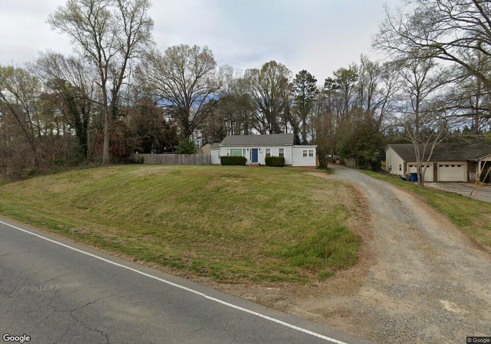
6685 Highway 73 E Mount Pleasant, NC 28124
Estimated Value: $127,000 - $264,000
2
Beds
1
Bath
987
Sq Ft
$202/Sq Ft
Est. Value
About This Home
This home is located at 6685 Highway 73 E, Mount Pleasant, NC 28124 and is currently estimated at $199,406, approximately $202 per square foot. 6685 Highway 73 E is a home located in Cabarrus County with nearby schools including Mount Pleasant Elementary School, Mount Pleasant Middle School, and Mount Pleasant High School.
Ownership History
Date
Name
Owned For
Owner Type
Purchase Details
Closed on
Sep 29, 2006
Sold by
Busbin Donald Eugene
Bought by
Talley David M
Current Estimated Value
Home Financials for this Owner
Home Financials are based on the most recent Mortgage that was taken out on this home.
Original Mortgage
$46,400
Outstanding Balance
$27,688
Interest Rate
6.46%
Mortgage Type
Purchase Money Mortgage
Estimated Equity
$171,718
Create a Home Valuation Report for This Property
The Home Valuation Report is an in-depth analysis detailing your home's value as well as a comparison with similar homes in the area
Home Values in the Area
Average Home Value in this Area
Purchase History
| Date | Buyer | Sale Price | Title Company |
|---|---|---|---|
| Talley David M | $46,500 | Statewide Title Inc |
Source: Public Records
Mortgage History
| Date | Status | Borrower | Loan Amount |
|---|---|---|---|
| Open | Talley David M | $46,400 |
Source: Public Records
Tax History
| Year | Tax Paid | Tax Assessment Tax Assessment Total Assessment is a certain percentage of the fair market value that is determined by local assessors to be the total taxable value of land and additions on the property. | Land | Improvement |
|---|---|---|---|---|
| 2025 | $894 | $130,350 | $35,630 | $94,720 |
| 2024 | $894 | $130,350 | $35,630 | $94,720 |
| 2023 | $679 | $79,150 | $23,440 | $55,710 |
| 2022 | $679 | $79,150 | $23,440 | $55,710 |
| 2021 | $679 | $79,150 | $23,440 | $55,710 |
| 2020 | $679 | $79,150 | $23,440 | $55,710 |
| 2019 | $575 | $67,010 | $19,690 | $47,320 |
| 2018 | $551 | $67,010 | $19,690 | $47,320 |
| 2017 | $538 | $67,010 | $19,690 | $47,320 |
| 2016 | $538 | $66,300 | $20,630 | $45,670 |
| 2015 | $519 | $66,300 | $20,630 | $45,670 |
| 2014 | $519 | $66,300 | $20,630 | $45,670 |
Source: Public Records
Map
Nearby Homes
- 6823 Glen Abbey Ln Unit Lot 3
- 6853 Glen Abbey Ln Unit 8
- 6853 Glen Abby Ln
- 622 Brennan St Unit 39
- 6907 Glen Abbey Ln Unit 9
- 470 S Moose Rd
- 6907 Glen Abby Ln
- 6910 State Highway 49
- 1151 Pine Cross Dr
- 1232 Long Farm Ln
- 1223 Walker Rd
- 7670 N Carolina 73
- 5411 Arnold Way
- 5423 Arnold Way
- 16 Wendall Ln
- 997 S Skyland Dr
- 24 Wendall Ln
- 13 Wendall Ln
- 21 Wendall Ln
- 755 Skyland Dr N
- 6685 Nc Hwy 73 E
- 6715 Highway 73 E
- 6665 Highway 73 E
- 6609 N Carolina 73
- 6631 Nc Hwy 73 E
- 6755 Highway 73 E
- 6796 Highway 73 E
- 6595 Highway 73 E
- 6600 Highway 73 E
- 6575 Highway 73 E
- 6530 Nc Hwy 73 E
- 6530 Highway 73 E
- 6523 Nc Hwy 73 E
- 6823 Glen Abbey Ln
- 6494 Highway 73 E
- 6911 Nc Hwy 73 None E
- 6911 Highway 73 E
- 6459 Nc Hwy 73 E
- 6470 Nc Hwy 73 E
- 6443 Nc Hwy 73 E
Your Personal Tour Guide
Ask me questions while you tour the home.