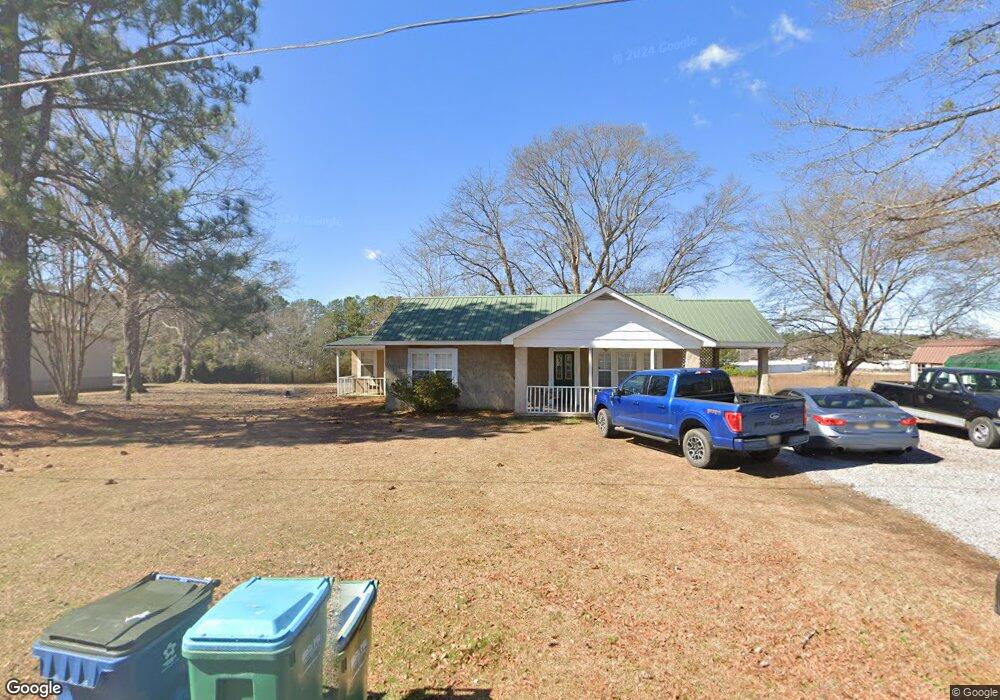
6685 Spunky Hollow Rd Locust Fork, AL 35097
Estimated Value: $127,157 - $206,000
3
Beds
1
Bath
1,342
Sq Ft
$137/Sq Ft
Est. Value
About This Home
This home is located at 6685 Spunky Hollow Rd, Locust Fork, AL 35097 and is currently estimated at $183,289, approximately $136 per square foot. 6685 Spunky Hollow Rd is a home located in Blount County with nearby schools including Locust Fork Elementary School and Locust Fork High School.
Ownership History
Date
Name
Owned For
Owner Type
Purchase Details
Closed on
Sep 21, 2018
Sold by
Quinn Mark R and Quinn Charlene
Bought by
Tucker Keith and Tucker Mona
Current Estimated Value
Purchase Details
Closed on
Jul 22, 2010
Sold by
Federal Home Loan Mortgage Corporation
Bought by
Quinn Mark R
Purchase Details
Closed on
Jun 29, 2007
Sold by
Daily Laura J and Daily Ronnie L
Bought by
Rylant Rodger and Rylant Cathy
Home Financials for this Owner
Home Financials are based on the most recent Mortgage that was taken out on this home.
Original Mortgage
$88,400
Interest Rate
6.37%
Mortgage Type
Purchase Money Mortgage
Create a Home Valuation Report for This Property
The Home Valuation Report is an in-depth analysis detailing your home's value as well as a comparison with similar homes in the area
Home Values in the Area
Average Home Value in this Area
Purchase History
| Date | Buyer | Sale Price | Title Company |
|---|---|---|---|
| Tucker Keith | -- | -- | |
| Quinn Mark R | -- | -- | |
| Rylant Rodger | $88,400 | -- |
Source: Public Records
Mortgage History
| Date | Status | Borrower | Loan Amount |
|---|---|---|---|
| Previous Owner | Rylant Rodger | $88,400 |
Source: Public Records
Tax History Compared to Growth
Tax History
| Year | Tax Paid | Tax Assessment Tax Assessment Total Assessment is a certain percentage of the fair market value that is determined by local assessors to be the total taxable value of land and additions on the property. | Land | Improvement |
|---|---|---|---|---|
| 2024 | $305 | $8,540 | $500 | $8,040 |
| 2023 | $309 | $7,940 | $500 | $7,440 |
| 2022 | $233 | $6,400 | $300 | $6,100 |
| 2021 | $193 | $5,340 | $320 | $5,020 |
| 2020 | $185 | $4,660 | $300 | $4,360 |
| 2019 | $168 | $4,660 | $300 | $4,360 |
| 2018 | $348 | $9,280 | $300 | $8,980 |
| 2017 | $320 | $8,540 | $0 | $0 |
| 2015 | -- | $8,540 | $0 | $0 |
| 2014 | -- | $8,540 | $0 | $0 |
| 2013 | -- | $5,880 | $0 | $0 |
Source: Public Records
Map
Nearby Homes
- 29542 Alabama 79
- 178 Jerry Marsh Rd
- 380 Jerry Marsh Rd
- 159 Ray Dr
- #0 Shady Point Rd
- 3251 County Highway 13
- 31730 Alabama 79
- 89 Pine Tree Dr
- 2898 County Highway 15
- 265 Riverview Dr
- 1129 Baty Rd
- 32510 Alabama 79
- 707 Saint Andrews Pkwy
- Lot 104 Muirfield Cir Unit 104
- 1065 Saint Andrews Pkwy
- 0 Bellerive Cir Unit 21390746
- 1166 Saint Andrews Pkwy Unit 76A, 76 & 77A
- 0 Center Hill Rd Unit 21411639
- 1410 Saint Andrews Pkwy Unit 80 & 81
- 496 Tawbush Rd
- 6700 Spunky Hollow Rd
- 6730 Spunky Hollow Rd
- 44 Turtle Dr
- 81 Turtle Dr
- 6727 Spunky Hollow Rd
- 6455 Spunky Hollow Rd
- 6640 Spunky Hollow Rd
- 6551 Spunky Hollow Rd
- 308 Wilder Rd
- 6560 Spunky Hollow Rd
- 157 Turtle Dr
- 6529 Spunky Hollow Rd
- 6520 Spunky Hollow Rd
- 6830 Spunky Hollow Rd
- 172 Turtle Dr
- 172 Turtle Dr
- 6509 Spunky Hollow Rd
- 6865 Spunky Hollow Rd
- 150 Wilder Rd
- 6495 Spunky Hollow Rd